Australian emergency services drone operators and mapping experts are helping recovery efforts after the recent disaster in Nepal.
A 15-person Australian Disaster Assistance Response Team (DART) has been put together from members of the Queensland Fire Department (QFD) and Fire and Rescue NSW (FRNSW) to assist rescue operations in Nepal.
FRNSW and QFD are the only two Australian emergency services with a UN International Search and Rescue Advisory Group (INSARAG) classification, enabling deployment by the Department of Foreign Affairs and Trade (DFAT) during overseas disasters.
Queensland is supplying 5 personnel and NSW is contributing 10.
The location of the disaster zone poses many challenges for authorities as they desperately continue to search for survivors and begin recovery operations. The region is extremely remote and difficult to reach.
The Australian team will use its equipment and experience to:
- Provide remotely piloted drone capabilities, supported by technical, planning and incident management specialists;
- Provide real-time imagery, geospatial information and mapping, impact assessments, route reconnaissance and targeted search support;
- Collect imagery to support the Government of Nepal’s technical search decisions, rescue planning and risk assessments;
- Support coordination between Nepali authorities and humanitarian partners by providing timely and accurate aerial intelligence;
- Conduct broad area imagery assessments; and
- Produce 3D mapping products for measuring debris and distances.
Emergency deployment to the disaster zone
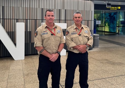
Two of the QFD’s specialist drone operators are among the state’s contribution to the DART.
Fire officers Dale McVeigh, based at Beenleigh Fire Station, and Matt Herbert, based at state headquarters, will use their drone technology to provide mapping, imaging and 3D modelling support for the Nepalese authorities.
“It’s an honour to go over and help, and considering it’s a newish capability, it’s good to put it to work in an overseas environment,” said Herbert.
FRNSW is deploying similar capabilities.
“FRNSW has extensive experience responding to natural disasters and humanitarian emergencies. We’re sending some of our best-qualified people, equipped with cutting-edge drone technology, to support the international effort,” said FRNSW Commissioner, Jeremy Fewtrell.
“They will play an important role, flying drones through areas deemed too dangerous for ground teams to search and providing critical information to guide search and rescue operations,” the Commissioner added.
“The team will be self-sufficient, carrying its own food, water, medicines and tents so it doesn’t place additional pressure on local supplies.”
FRNSW’s other overseas emergency deployments have included the Türkiye earthquake in 2023, the Tongan volcanic eruption in 2022, the Indonesian landslides in 2020 and the earthquakes in Christchurch and Japan in 2011.
Readers wishing to donate to the Nepal relief efforts can visit emergencyaction.org.au.