

Four US research organisations have been awarded a total of up to US$20 million in funding as part of the Geospatial Modeling Grant competition.
Each of the projects will comprise cooperative agreements with the National Oceanic and Atmospheric Administration’s (NOAA) National Geodetic Survey (NGS) for a five-year period, with each of the projects addressing key issues facing the geodetic community.
Oregon State University, Scripps Institution of Oceanography, Michigan State University and the Ohio State University have been awarded a total of approximately US$4 million in grant funding, with the potential for that to be raised to US$20 million.
The projects will research emerging problems in the field of geodesy and support a Geodesy Community of Practice to address a nationwide deficiency of geodesists, as well as developing tools and models to advance the modernisation of the US’ National Spatial Reference System (NSRS).
NGS is a program office within NOAA’s National Ocean Service (NOS) that provides the authoritative coordinate system for all geospatial and positioning activities in the US.
The four projects and their funding grants, are:
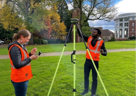
- Oregon State University (OSU): US$1,304,056 annually for a potential total of US$6,520,280 over a five-year period for a project titled ‘NSRS Modernisation and Geodetic Workforce Development,’ the primary objectives of which are to modernise geodetic tools for the NSRS, create new operating procedures for working with the NSRS, and develop a geodetic workforce for the future.
- Scripps Institution of Oceanography (SIO): US$1,300,000 annually for a potential total of US$6,500,000 over a five-year period for a project titled ‘NSRS Intra-Frame Deformation Model and New SIO Geodesy Program,’ the primary objectives of which are to create a formal geodesy program in support of the nationwide deficiency of geodesists and to modernise geodetic models for the NSRS.
- Michigan State University: US$800,000 annually for a potential total of US$4,000,000 over a five-year period for a project titled ‘Software Tools and Education for Enhancing Geodetic Infrastructure,’ the primary objectives of which are the same as that of the SIO’s project.
- Ohio State University: US$536,000 annually for a potential total of US$2,680,000 over a five-year period for a project titled ‘Developing a Fully Kinematic, Backwards-Compatible Reference Frame for the Continental United States of America and Canada,’ the primary objectives of which are to modernise geodetic tools and models and to develop a geodetic workforce for the future.
OSU’s research will be conducted by its new Geospatial Center for the Arctic and Pacific (GCAP).
“Society and our technologies are increasingly connected and spatially aware,” said GCAP director Chris Parrish of the OSU College of Engineering.
“Ground-breaking advances are occurring in areas like self-driving vehicles, smart cities and geospatial artificial intelligence. What all of those have in common is the need for accurate, consistent spatial coordinates that define locations on, above or below the Earth’s surface.”
Parrish points out that the US National Spatial Reference System’s last major update was four decades ago, and that modernisation is critically needed to meet 21st century accuracy demands.
“GCAP will contribute impactful geodetic research, infrastructure, education and workforce development to support a new, diverse generation of geodesists, surveyors and geospatial professionals.”


