

Here’s what you’ll find in the June/July 2024 issue of Position magazine, Australia’s geospatial sector journal covering the spatial, surveying, space, UAV, remote sensing, hydrography and mapping sectors and more.
If you’re not already a subscriber, please head to our subscription page and sign up today to stay fully informed of developments in the Australasian geospatial sector.
Inside you’ll find:
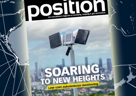
- COVER STORY: Soaring to new heights — Australian company Kurloo has introduced the ‘Kurloo Wing’ solar power system to enhance position monitoring performance.
- Q&A with Mell Greenall — Before You Dig Australia’s CEO is on a mission to save lives and protect underground infrastructure from harm.
- Digital twins — Western Australia’s Advanced Spatial Digital Twin will see an entire third of the continent replicated in spatially accurate 4D.
- Reconciliation — Victoria’s Surveyor-General has made an historic apology for the role that Surveyors-General played in the dispossession of land from Victoria’s First Peoples.
- Awards — Outstanding individuals and teams in the geospatial sector have been recognised at a gala ceremony in Sydney.
- Urban planning — Two new white papers highlight technology’s role in ensuring Australia becomes a more climate-resilient nation.
- LiDAR — Aerial LiDAR mapping has helped reveal the extent of some of the first cities in the South Pacific.
- AquaWatch — Australia’s ground- and space-based water quality monitoring system will also be set up in the UK.
- Endangered species — The IDS Stream DP ground penetrating radar has proven vital in efforts to conserve the endangered northern hairy nosed wombat.
- Positioning — SouthPAN has reached a new service availability milestone level of 99.5%.
- Earth observation — A new report reiterates the fact that Australia is not taking its sovereign Earth observation needs seriously enough.
- Scanning — Demand for terrestrial data collection is growing, yet the technology still requires extensive surveying expertise and can be costly to implement. A new mobile solution aims to change that.
- Research — Were ancient Aboriginal tracks and pathways the forerunners of some of our modern roads and highways?
- Hydrography — CSIRO’s research vessel RV Investigator delivers a keystone capability for mapping Australia’s vast marine estate.
This issue also contains the latest updates from the Geospatial Council of Australia (GCA):
- GCA CEO’s Column — Tony Wheeler outlines the many ways in which the geospatial sector contributes to the Australian economy.
- Profile — Alison Watson, founder and Chief Executive of education and social enterprise ‘Class Of Your Own,’ is inspiring tomorrow’s builders.
Plus all the latest industry news, a full list of upcoming conferences and details of the latest products on the market.
Stay up to date with developments in the Australian surveying, space and spatial sectors — sign up today to receive Position magazine by heading to our subscription page.


