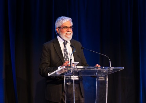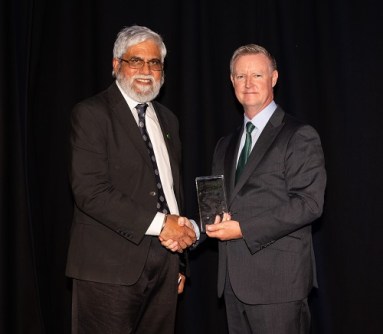
Celebrating 30 years of accomplishments with the Australian Hydrographic Office.
Jasbir Randhawa is a superstar within the field of hydrography, having spent 30 years with the Australian Hydrographic Office (AHO) and 20 years before that in other endeavours within the disciplines of land and hydrographic surveying.
During the course of his 50-year career, he has been presented with many awards, prizes and commendations, including Fellowship of the Surveying and Spatial Sciences Institute (now GCA), multiple Commendations from the Hydrographer of Australia, a Department of Defence Australia Day Medallion, and this year the GCA Hydrographic Excellence Award (Oceanic). In June this year, he formally retired from his role of Assistant Director of External Relations with the AHO.
We spoke with Randhawa to learn more about his career.
How did you get into hydrography?
Upon completing high school in Malaysia, I obtained a scholarship from a British mining company, Osborne & Chappel, to attend a three-year land surveying course at the national Technical College (now the University Technology Malaysia). I graduated with a first-class diploma and proceeded to the UK where I successfully completed The Royal Institution of Chartered Surveyors (RICS) Professional Examinations.
My initial employment was as an Assistant Surveyor with Hunting Surveys in the UK, which was then the largest international survey company carrying out projects in Africa and the Middle East. During my one-year stint there I gained experience in a range of surveying disciplines — land, topographic, engineering and hydrographic — including a hydrographic survey for an oil pipe-line route in the North Sea.
Upon returning to the Far East in 1974, I joined the Hydrographic Department, Port of Singapore Authority (PSA) as an assistant hydrographer. During my career with PSA I was sent overseas to upgrade my skills and qualifications — a Category B course at the Indian Navy Hydrographic School, Cochin in 1975 and a Category A course at the Royal Navy Hydrographic School, HMS Drake, Plymouth, UK in 1983.
In 1989 I migrated to Australia and joined the Australian Hydrographic Office in North Sydney.
Tell us more about your work at the AHO.
My role as Assistant Director External Relations in the Australian Hydrographic Office (AHO) involved co-ordinating many of the national and international responsibilities of the Australian Hydrographer. This entailed provision of secretariat support (since early 1990s) to a number of forums chaired by the Australian Hydrographer, one of which is the Australasian Hydrographic Surveyors Certification Panel, or AHSCP (see page 18).
The AHO was instrumental in establishing the AHSCP in 1994 as a regional certification scheme, providing a pathway for certification of professional hydrographic surveyors to international standards. The incumbent Australian Hydrographer is the ex-officio Chair and I was the Secretary for 30 years (1994 to 2023).
Another important body is the Ports Australia Hydrographic Surveyors Working Group (PAHSWG), which provides a forum for the exchange of ideas and information relating to all aspects of hydrographic surveying. The WG meets every six months, with participants from Australian state and local port operators. Reports are presented relating to survey projects carried out as well as current and future development works. It is also a useful forum for an exchange of ideas and advise on standards for hydrographic surveying and provides co-ordination of surveying activity where appropriate. In 2005 the WG prepared the ‘Principles for Gathering and Processing Hydrographic Information in Australian Ports’ document for use in Ports and supplement the International Hydrographic Organization (IHO) Special Publication S-44 (Standards for Hydrographic Surveys). Work is in progress to develop the current version into a ‘Standards’ document.
Hydrographic Seminars organised by GCA and/or the Australasian Hydrographic Society are held in conjunction with PAHSWG meetings as a means of providing CPD activity to the attendees and regionally based hydrographic surveyors.
A third crucial body is the Tides & Sea Levels Working Group (TSLWG), a working group of the Intergovernmental Committee on Survey and Mapping (ICSM), with representation from national, state, port and scientific agencies engaged in the determination of tides and sea level. Its predecessor, the Permanent Committee on Tides and Mean Sea Level, was established in 1979 by the then National Mapping Council to co-ordinate a national database of tidal records, as well as develop national standards and best practice guidelines for tidal related matters.
The TSLWG has published the Australian Tides Manual, which provides operating procedures for operators of tide gauges on the Australian National Network (first published in 1984 and now revised regularly), and the Tidal Interface Compendium of Australian and New Zealand terms used in the inter-tidal zone.
The TSLWG’s current activities include:
- Developing an Australian Tidal Data exchange format to assist in data exchange between agencies and users.
- Standardising tidal analysis methods to provide for improved tidal predictions for safe navigation of large vessels.
- Investigation of mean sea levels around Australia and their significance for land-based vertical datums.
- Supporting national and global oceanographic community activities with Intergovernmental Oceanographic Commission (IOC) Global Sea Level Observing System (GLOSS) stations, tsunami stations and long-term sea-level monitoring.

How about hydrography in the Pacific?
The South West Pacific Hydrographic Commission (SWPHC), one of the 15 Regional Hydrographic Commissions of the IHO, was established in 1993 to coordinate hydrographic activity and cooperation at the regional level. Currently it comprises of 12 Members (IHO Member States) and six Associate Members. Australia through the AHO is the current Chair — we provide secretariat support and are an active participant in most of the activities.
The current focus of the SWPHC includes:
- S-100 workshops to promote digital innovation and data standards. S-100 is the new Universal Hydrographic Data Model that supports a greater range of hydrographic-related digital data sources, products and customers.
- MSDIWG meetings to promote Marine Spatial Data Infrastructure (MSDI) in the region for the sustainable development and use of the oceans, seas and inland waters in line with the UN Sustainable Development Goals. The focus is on encouraging coastal states to share data and adopt open data policies.
- The SWPHC Hydrographic Leaders Programme aims to build and encourage a network of leaders for the region. The pilot program comprises a cohort of 17 participants from 12 nations, each matched with a mentor.
- The Empowering Women in Hydrography Project aims to build relationships and support career growth through mentoring, opportunity and awareness.
- And the Pacific One Maritime Framework (POMF) is seeing governments across the Pacific realising the importance of hydrography to meet their country goals. SWPHC has been invited by The Pacific Community (SPC) to actively participate in the POMF.
What other work have you been involved in?
During the early years with the AHO I was involved in the analysis of international technical standards and documentation relating to work carried out by the IHO Working Group on Quality of Data. I also contributed to the implementation of AHO’s Hydrographic Information System, relating mainly to technical and professional issues of hydrographic surveying which were important in reshaping the project.
My early years with the PSA provided me the opportunity to participate in several regional projects, such as joint hydrographic surveys and joint tidal and current studies of the Malacca and Singapore Straits, and hydrographic surveys and flood control studies of Muara Port and the Brunei River in Brunei.
What’s something that might surprise people about Australian hydrography?
Most people are unaware that hydrography underpins almost every activity associated with the sea. It has a vital role in ensuring safe navigation, protecting the environment, managing resources, maritime boundary delimitation, understanding climate change, etc.
The AHO performs a legislated role under the Australian Navigation Act 2012 which relates to the International Convention for the Safety of Life at Sea (SOLAS) and United Nations Convention on Law of the Sea (UNCLOS). Its remit is to provide hydrographic services in Australian Waters. We have over 60,000 km of coastline and an Exclusive Economic Zone of over 8 million square kilometres, so our maritime estate is bigger than our land estate. Our marine domain covers 10% of the Earth’s surface; interestingly, approximately 70% of Australia’s jurisdiction lies beneath the ocean’s surface.
We chart from northern Australia to Antarctica, and also support Papua New Guinea, the Solomon Islands and Timor Leste to meet their SOLAS requirements. Our charts enable approximately 26,500 ship arrivals in Australian ports each year. We have 70 international trading ports and another 70 to support domestic commercial vessels. Approximately $1.2 billion of trade moves through our ports each day — so hydrography is a true enabler for our Australian economy as we know that 99% of our trade is undertaken via shipping.
What are you most proud of from your career?
I consider it a great privilege to have worked for a world-class national hydrographic office during my lengthy career. As mentioned earlier, my role involved engagement with external forums, national as well as international. It has been an extremely rewarding professional experience working with dedicated and competent personnel carrying out the incredible work we do. Two forums celebrated their 30th Anniversary this year — the AHSCP and the SWPHC. I was actively involved in their initial establishment, have participated in their activities throughout this period, and I am proud of the significant things we have achieved for hydrography in Australia, New Zealand and the South West Pacific.


