

Here’s what you’ll find in the December/January 2024–25 issue of Position magazine, Australia’s journal for the geospatial, surveying, GIS, remote sensing, hydrography and mapping sectors.
If you’re a subscriber, please keep an eye out for your copy in your letterbox any day now.
If you’re not already a subscriber, please head to our subscription page and sign up today to stay fully informed of developments in the Australasian geospatial sector.
Inside you’ll find:
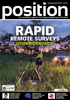
- COVER STORY: Rapid remote surveys — Find out how Mangoesmapping helped Revolver Resources make its Dianne copper mine more efficient, by conducting a range of surveys in weeks rather than months.
- Annual Leaders Forum — We asked leading industry representatives to dust off their crystal balls and forecast what’s to come for the year ahead. Hear from:
- Adam Burke, Aptella
- Alistair Hart, Map Gear/Mangoesmapping
- Diane Dumashie, President, FIG
- Alison Patrick, Australian Geospatial-Intelligence Organisation
- Philip Byrne, C.R. Kennedy
- Travis Gains, Survey Management Solutions
- Samantha Garbutt, Australian Spatial Analytics
- Seabed partnership — Learn how Geoscience Australia will play an active role in supporting Seabed 2030’s mission of accelerating ocean floor mapping.
- Awards — The final Geospatial Excellence Awards regional ceremonies have been held, with the winners now in the running for the national awards.
- Disaster data — Data visualisation and mapping have a vital role to play in preparing for and responding to hazards and disasters.
- PNT CRC — Leading geospatial experts say the time is right for Australia to develop and strengthen its positioning, navigation and timing capabilities via a proposed PNT Co-operative Research Centre.
- Surveying history — From manual map scribing to digitised data, the NSW Spatial Cadastre has come a long way over the decades.
- On the level — Learn how new advanced sensors are making barometric levelling valuable for obtaining elevation data where GNSS data are unavailable.
Plus, the latest updates from the Geospatial Council of Australia (GCA):
- GCA CEO’s Column — Tony Wheeler reports the findings of the recent deep dive into the economic contribution the geospatial sector will make to the nation over the coming decade.
- In conversation — Xristi Gibson has navigated a fulfilling career in engineering surveying and tells us about the value of obtaining certification.
And there’s all the latest industry news, a full list of upcoming conferences and details of the latest products on the market.
Stay up to date with developments in the Australian surveying, space and spatial sectors — sign up today to receive Position magazine by heading to our subscription page.


