

Perth-based Soar Atlas has launched its 3D Mode Beta data visualisation product.
The company claims the update to its “community-driven digital atlas” software can turn any 2D map or satellite image into an immersive, browser-based visualisation window.
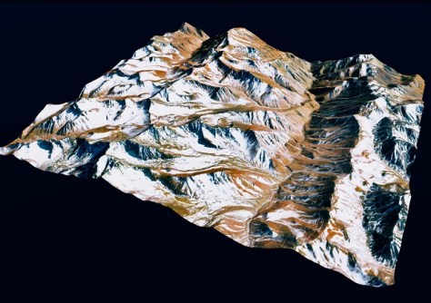
3D Mode renders a decade of Sentinel and Landsat archives in real-world terrain, transforming more than “one million georeferenced maps and satellite images into explorable 3D landscapes”.
There’s also an option for draping historical timelapses across 3D terrain with just a few clicks.
“3D Mode is an important milestone for our platform,” says Soar Atlas’ CEO, Amir Farhand.
“For too long, the most powerful geospatial tools have been confined to specialists and technical users.
“By bringing together immersive 3D experiences and accessible mapping technology, we’re helping more people explore, understand, and interact with the world around them.
“Our vision is simple: to make geospatial knowledge easier to access and more useful for everyone,” Farhand added.


