The City of Onkaparinga- Smart Coastal Mapping, by AEROmetrex
In the South Australian regional city of Onkaparinga, Bentley’s ContextCapture software has been used to process 25,000 oblique photographs and 125 ground-control points and generate a detailed 3D mesh accurate to 100 millimetres. In doing so, this allowed The City of Onkaparinga to quantify volume, distance, and texture, and visually identified rocks, ground types, and the various structures.
The City of Onkaparinga is also geographically expansive, encompassing an area of 518.3 kilometres and 30 kilometres of coastline, much of which is extremely vulnerable to coastal erosion, damage to property and safety concerns. By capturing imagery at different points in time, Onkaparinga can analyse the current state and condition of the coastline and also detect change in condition over time.
Previously an undertaking of such scale would only be possible by labour intensive field surveying techniques, or satellite obervations available only at poor spatial and time resolution. By using photographs and ContextCapture, however, the city is now able to monitor the coastline to help assess these safety concerns and provide high-definition models with a high degree of accuracy and timeliness.
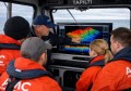
The AUD 50,000 project by the city of Onkaparinga was aimed to document the state of its coastline to an accuracy of 100 millimetres and to create a base dataset for future assessments. The imagery was captured by Australian aerial service providers, AEROmetrex who were able to capture the rugged coastline by taking photographs from a helicopter.
David Byrne, technical director AEROmetrex, said, “Without the use of Bentley’s remarkable ContextCapture software the amazing detail and accuracy achieved in this project would not have been possible.”