

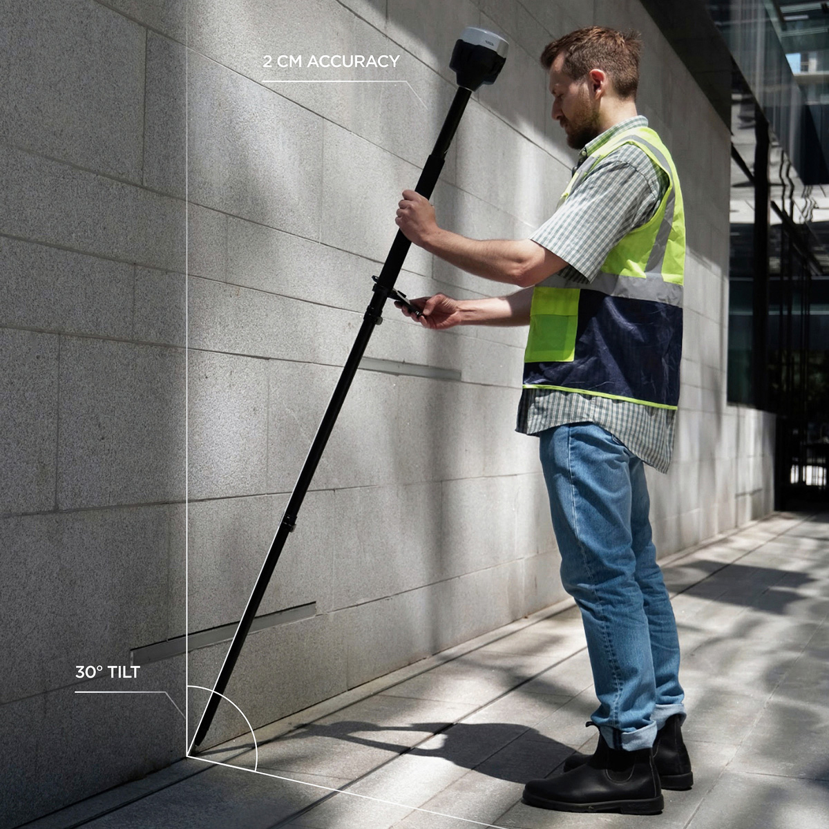
The Emlid Reach RS3 with IMU tilt compensation allows you to stake out faster, and easily survey hard-to-reach locations such as building corners, points on the road or at the edges of an excavation.
More flexible
Working with tilt compensation on the Reach RS3 allows you to affordably map challenging environments like building outlines. You can also acquire point features like flag poles, trees and other vertical objects where it’s really hard to get your receiver hard up level against that object.
The IMU tilt compensation in Reach RS3 enables you to make measurements with up to 60 degrees of tilt while still staying within 20 mm of accuracy. You can throw it out on a bit of a tilt to improve your sky view and still manage to get hard to reach points with precision.

Survey and stakeout faster
With tilt compensation enabled, you can take your eye off the bubble and collect points or stakeout in less time. Here’s a great birds eye view speed comparison showing the Emlid RS3 collecting points with – and without, tilt compensation activated.
Dual Band radio
In addition to the internal LoRa transceiver, the Emlid Reach RS3 contains an integrated 450 MHz radio receiver for receiving corrections. This allows you to consume corrections from an existing site base using this frequency.
If you’ve got a radio transmitter that can broadcast 450 MHz you can connect that to your own Emlid Reach base and broadcast at 450 MHz UHF corrections to your Emlid Reach RS3’s integrated UHF 450 megahertz radio receiver.
Battery performance
The Reach RS3 can log static for up to 22 hours. Battery performance with tilt compensation activated is up to 18 hours.
Emlid Flow Survey
As part of the release of this new model, Emlid are including a free 3 months of subscription to the Survey subscription. The Survey subscription gives access to additional features including localization, background imagery, custom WMS layers, a custom code library and linework.
Map Gear


