

The companies’ new partnership will give farmers across the world access to near-daily satellite imagery.
Google’s Photorealistic 3D Tiles for ArcGIS suite
By jnally on 12 March, 2025Esri has announced that Google’s Photorealistic 3D Tiles will be integrated into its ArcGIS suite.
QGIS WCPS plugin for multidimensional datacubes
By jnally on 12 March, 2025The new QGIS WCPS Plugin enables seamless querying and visualisation of multidimensional datacubes.
Sphere Drones transitions to in-house production
By jnally on 12 March, 2025Sphere boosts its local manufacturing capabilities to meet market demand for its HubX solution.
NASA Worldview HLS imagery by area of interest
By jnally on 12 March, 2025A new tutorial shows how to find harmonised Landsat and Sentinel-2 imagery by area of interest.
Last chance for YEP grants for FIG/Locate25
By jnally on 5 March, 202510 March is the grant application deadline for young professionals to attend FIG Working Week/Locate25.
First images released from the Kanyini satellite
By jnally on 5 March, 2025Kanyini’s first EO images have been released more than 200 days after the spacecraft went into orbit.
Latest Geospatial News
View all
The satellites will use reflected GNSS signals to monitor Earth’s land- and ice-covered surfaces and oceans.
 2025-11-12
ADVERTISEMENT
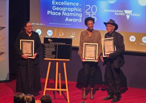
This week: WA’s new spatial cadastre, place name awards, SAR satellite launches, history of mapping and more.
2025-11-12 
Dozens of worthy recipients have been presented with Excellence in Surveying and Spatial Information Awards.
2025-11-11 
The City of Kingston has been presented with the 2025 Vicmap Custodianship Award for its road register data work.
2025-11-11 
Rea is an internationally recognised expert, advisor and consultant in weather, water and climate.
2025-11-10 
The Women Surveyors Summit 2025 in Las Vegas combined connection, courage and growth, writes Peta Cox.
2025-11-10
ADVERTISEMENT

The 2025 award recipients work in fields such as cadastral, engineering, hydrography, positioning and more.
2025-11-07 
- Sponsored Content
Aidedo was founded based on the practical experience of CEO Aiden Tong while studying and working with many Civil Engineering and Land Surveying firms in developed countries.
2026-06-02
For the first time, rainfall flood maps covering different parts of the country can be viewed in a single online tool.
2025-11-06 



Events
View All-
Nov 9
2026 Advancing Earth Observation Forum
 Hobart, Tasmania
-
Nov 10
SouthPAN Industry Day
Online -
Nov 13
South West and Great Southern Surveyors Conference
Mantra Bunbury Lighthouse, Bunbury, WA -
Nov 24
Locate26 Conference / 10th Digital Earth Summit
Melbourne Convention & Exhibition Centre -
Nov 30

