

Getmapping has launched a new service to stream UK Ordnance Survey maps and aerial photography over the internet. The service enables georeferenced map imagery to be used in a variety of web-based applications, and with GIS and CAD software. The service offers the ability to transfer specific information, rather than a whole dataset, which […]
ArcGIS Guide
By Spatial Source on 13 May, 2010A new reference guide from ESRI Press will help overcome problems in aligning disparate map projections with GIS technology. Designed for beginning and advanced ArcGIS practitioners, Lining UpData in ArcGIS: A Guide to Map Projections offers techniques for identifying and creating accurate map projections and co-ordinate systems. The content ranges from procedures to identify […]
SuperGeo Distributes Datascrip in Indonesia
By Spatial Source on 13 May, 2010SuperGeo Technologies is to distribute Datascrip software in Indonesia. Jakarta-based Datascrip provides business services and products across the Indonesian market. SuperGeo is a global provider of GIS software and Solutions. Under the partnership, Datascrip will distribute a broad range of SuperGeo products, including its SuperGIS Desktop and SuperPad, the mobile GIS software. […]
MDA Tracks Oil Spill
By Spatial Source on 13 May, 2010Canadian geospatial services provider MacDonald, Dettwiler and Associates Ltd is providing a multi-source surveillance service to help track the oil spill in the Gulf of Mexico. The information will help support the operations that are currently underway to monitor the spill and minimise its environmental impact, and to optimise the clean up process. […]
GeoEye Web Mapping Service
By Spatial Source on 13 May, 2010GeoEye will provide web mapping services under the US National Geospatial-Intelligence Agency 's Rapid Delivery program. This is an extension of an earlier contract with the NGA. The imagery provider’s dissemination system can provide secure access to unclassified, high-resolution colour imagery of an entire country over the web. Images are acquired by the GeoEye-1 […]
Spot Celebrates Shanghai World Expo
By Spatial Source on 13 May, 2010Spot Image is celebrating Shanghai’s World Expo in suitable fashion – with satellite animations. The international satellite data service company has created two image collections that track the extensive changes in the city as it prepared for the recently opened World Expo. One presentation displays images captured between 1994 and 2010, in and around […]
Trimble Airborne Laser Scanning System
By Spatial Source on 13 May, 2010Trimble has released a new addition to its Harrier aerial imaging and laser scanning system. The Trimble Harrier 68i, which is designed for aircraft and helicopter operations, is designed for long-range corridor, project, and wide-area mapping. The new scanner extends operational altitudes to 1,600 meters. The system incorporates a wide-angle laser scanner with a […]
Clark Labs Data Archive
By Spatial Source on 13 May, 2010Clark Labs has released a DVD archive of monthly global Normalised Difference Vegetation Index and Enhanced Vegetation Index MODIS data. The data was processed at NASA’s Goddard Space Flight Centre from the Terra sensor, and projected on a 0.05 degree climate modelling grid. The DVD contains more than 3GB of data from the […]
Garmin GPS Offers BirdsEye
By Spatial Source on 13 May, 2010High-resolution BirdsEye satellite imagery is now available on Garmin GPS handsets. Users can download and transfer unlimited high-resolution satellite images to a compatible Garmin unit, using BaseCamp software. The images can also be integrated into maps on handheld devices. The images offer a detailed overview of a location, and include elements such as […]
Garmin Nuvi 3700
By Spatial Source on 13 May, 2010Garmin International has released the nüvi 3700 series of GPS devices. With a thickness of less than 9mm, it is the thinnest portable navigator on the market, says Garmin. A new multi-touch display allows users to zoom in and out by double-tapping or “pinching” the map. Dragging a finger enables browsing across the map. […]
Latest Geospatial News
View allCool Tools
View All-
 Responsible AI for better decisions: Why geospatial context matters
-
 Stop parking it: meeting the Essential Eight with ArcGIS may be more achievable than you think
-
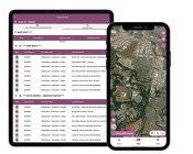 GBM Konect launches Konect 2 to close the field data gap
-
 Inside the 12d Tech Forum 2026: Automation, Collaboration, and the Industry’s Next Chapter
Events
View All-
Oct 30
Tasmanian Surveying & Geospatial Conference 2026
 Country Club, 100 Country Club Avenue, Prospect Vale (Launceston)
-
Oct 30
Western Australia EISSI Awards 2026
Pan Pacific, Perth -
Nov 9
2026 Advancing Earth Observation Forum
Hobart, Tasmania -
Nov 10
SouthPAN Industry Day
Online -
Nov 13
South West and Great Southern Surveyors Conference
Mantra Bunbury Lighthouse, Bunbury, WA

