

KLJKGHASDF
New Product for Mapping Australian Boundaries
By Spatial Source on 26 July, 2010The Australian Standard Geographical Classification (ASGC) has launched a new digital product which outlines the official boundaries for a number of different regions. The new product includes boundaries of local government areas, statistical local areas, statistical divisions, statistical subdivisions, states, statistical districts, major statistical regions, statistical regions and statistical region sectors, as of July 2010. […]
GPS Tracking of Suspects Approved in US Court
By Spatial Source on 26 July, 2010A Wisconsin court has given approval for police to monitor a suspect through the use of a GPS. The state’s Supreme Court decision involved the case of a man who was booked for stalking his ex-girlfriend, based on data from a GPS, which was installed on his car without his knowedge. The police used the […]
Geospatial Technology Underway in Indian Secondary Schools
By Spatial Source on 26 July, 2010Thirty-three Indian secondary schools are piloting courses teaching the use of geospatial technologies. Kapil Sabal, India’s minister for human resource and development launched the new courses last week. “We need to prepare our children for the 21st century, which is going to be a century of enormous challenges,” he said. “Both school and university education […]
Geotourism on the Curriculum
By Spatial Source on 26 July, 2010Missouri State University has developed a new bachelor’s degree program in geotourism. The new degree is being offered by the university’s department of geography, geology and planning. The four-year course will combine cultural and environmental geography with community planning, development and tourism. The university based the course on information, concepts and materials from National Geographic’s […]
Monitoring Natural Disasters with Formation Flying
By Spatial Source on 26 July, 2010Scientists at the University of New South Wales will develop satellite surveying technologies that can monitor flooding, bushfires, deforestation and earthquakes in real-time thanks to a $4.7m government grant. The project involves using multiple satellites, flying in a formation, to provide highly accurate, three-dimensional imaging of the Earth’s surface. It is based on using data […]
Predicting Sandstorms with Satellite Data
By Spatial Source on 26 July, 2010A new method for predicting dust and sandstorms using infrared satellite images has been developed by researchers at the University of Pittsburgh in the US. The scientists have been able to determine when destructive sandstorms are likely to occur. They used their methods to accurately forecast a large 2008 dust storm in New Mexico, two […]
Space Junk to get Tracked by Laser
By Spatial Source on 26 July, 2010An Australian company has developed a laser tracking system that will help stop chunks of space debris colliding with spacecraft and satellites in the Earth's orbit. The laser tracking system has previously been used to track satellites, but Electric Optic Systems said it could now locate and track debris as small as 10 centimetres […]
Best of the Blogs 26th July
By Spatial Source on 26 July, 2010Here are a few of the most exciting, new and interesting posts from the blogosphere over the past couple of days: Incidents from the huge leak of US military War Logs to Wikileaks have been plotted on Google maps. Strange Maps plots the eccentricities of Libya’s leader Colonel Muammar Gadaffi. The All Points blog […]
Annual Survey Summit
By Spatial Source on 26 July, 2010The conference will include technical sessions, presentations and a commercial expo. WHEN: 2011-07-09 to 2011-07-11WHERE: San Diego, CaliforniaSTATE: NSWCOUNTRY: AUS
Latest Geospatial News
View allCool Tools
View All-
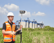 CHC Navigation at Locate26: Connected Geospatial Solutions Across Land, Air and Water
-
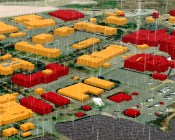 Responsible AI for better decisions: Why geospatial context matters
-
 Stop parking it: meeting the Essential Eight with ArcGIS may be more achievable than you think
-
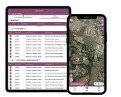 GBM Konect launches Konect 2 to close the field data gap
Events
View All-
Nov 6
GIS in Local Government Day 2026
 Amora Hotel Adelaide, 233 Victoria Square, Adelaide
-
Nov 9
2026 Advancing Earth Observation Forum
Hobart, Tasmania -
Nov 10
SouthPAN Industry Day
Online -
Nov 13
South West and Great Southern Surveyors Conference
Mantra Bunbury Lighthouse, Bunbury, WA -
Nov 24
Locate26 Conference / 10th Digital Earth Summit
Melbourne Convention & Exhibition Centre

