

GeoInformation for disaster management WHEN: 2011-05-03 to 2011-05-08WHERE: Antalya, TurkeySTATE: InternationalCOUNTRY: INT The conference will cover user requirements, monitoring and processing, early warning systems, early impact systems, and spatial data infrastructures. www.gi4DM2011.org
Entire 12d Model Projects, In The Field!
By Spatial Source on 16 September, 201012d Field gives Surveyors and Engineers the ability to use the full functionality of 12d®Model™ on small daylight readable tablets and notebooks in the field. Developed With Surveyors & Engineers. Tested On Major Projects. 12d Field has been developed in consultation with leading surveyors and engineers. Site needs have continually been added to the […]
Spar International
By Spatial Source on 16 September, 2010Conference on 3D imaging for design, construction, manufacturing and security. WHEN: 2011-03-21 to 2011-03-24WHERE: The Woodlands, Houston, TexasSTATE: InternationalCOUNTRY: INT SPAR International welcomes presentation abstracts from process and power, civil infrastructure and transportation, and discrete manufacturing facility owners and contractors on their use of 3D imaging technologies. Presentations on the application of 3D imaging and […]
NZ spatial data worth $1bn to economy
By Spatial Source on 14 September, 2010Innovative use of spatial information pumped more than NZD1.2bn into the New Zealand economy in 2008 – and better access to data could see another NZD500m added to the economy over the next year, according to a report into the value of spatial information in New Zealand. Ambulance response times, urban planning, emissions mapping, […]
GPS to guide like humans
By Spatial Source on 14 September, 2010A new in-vehicle GPS system will be launched in Australia in 2011 that gives drivers directions in a more human way. Launched by Navteq in the US and Europe last week, the system uses distinctive points of interest and landmarks to give directions. So instead of saying “turn right in 50 metres”, the system […]
Aerodata capturing Australia with new cameras
By Spatial Source on 14 September, 2010Aerodata International Surveys will soon begin offering images from its VisionMap A3 digital aerial survey camera in Australia. The firm has recently acquired two VisionMap A3 digital cameras capable of capturing high-resolution imagery over very large areas from high altitude in a short time. The A3 camera module consists of two lenses, a motor unit, […]
Nike launches GPS iPhone App for runners
By Spatial Source on 14 September, 2010Nike has launched a new app that allows runners to use their iPhone to visually map every run while tracking pace, distance and time. The app uses the iPhone’s GPS capabilities to map a run as it happens, allowing runners to keep track of their exact routes and distances run. The app includes a […]
Infotech hires Greg Oaten for utility role
By Spatial Source on 14 September, 2010Geospatial firm Infotech Enterprises has hired Greg Oaten as strategy advisor for utilities. Oaten will play a strategic role in developing Infotech’s products in areas such as smart grid and power engineering for its customers in the APAC region. Before joining Infotech, Mr Oaten was working as executive manager for network revenue operations at […]
NZ quake cleanup assisted by spatial data clearing area
By Spatial Source on 14 September, 2010New Zealand’s emergency services are now able access to spatial data and aerial imagery online to assist with the clean up of the devastating earthquake last week. The earthquake reached 7.0 on the Richter scale and caused NZ$2bn of damage, though nobody was killed. The online service, developed by the Australian Research Collaboration Service […]
Latest Geospatial News
View allCool Tools
View All-
 CHC Navigation at Locate26: Connected Geospatial Solutions Across Land, Air and Water
-
 Responsible AI for better decisions: Why geospatial context matters
-
 Stop parking it: meeting the Essential Eight with ArcGIS may be more achievable than you think
-
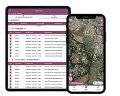 GBM Konect launches Konect 2 to close the field data gap
Events
View All-
Nov 6
GIS in Local Government Day 2026
 Amora Hotel Adelaide, 233 Victoria Square, Adelaide
-
Nov 9
2026 Advancing Earth Observation Forum
Hobart, Tasmania -
Nov 10
SouthPAN Industry Day
Online -
Nov 13
South West and Great Southern Surveyors Conference
Mantra Bunbury Lighthouse, Bunbury, WA -
Nov 24
Locate26 Conference / 10th Digital Earth Summit
Melbourne Convention & Exhibition Centre

