

The latest satellite launch brings new opportunity.
Best of the Blogs – 20 September 2016
By Anthony Wallace on 21 September, 2016Software, your imagination; Food insecurity map; Buying a drone; Visualisations for good – best of the blogs time!
Tickets soon closing for ‘An afternoon with Jack’
By Anthony Wallace on 16 September, 2016Founder of Esri Jack Dangermond will present at the Sydney Opera House 13 October.
Zika virus maps highlight areas at risk
By Anthony Wallace on 14 September, 2016Climate and travel data identify countries in greatest risk of habouring Zika.
New MH370 search areas to be mapped with drift modelling
By Anthony Wallace on 14 September, 2016Vague government tender calls for “Drift Modelling and Search and Rescue System” in Indian Ocean.
Updated gravity datasets – a “treasure map” for mineral exploration
By Anthony Wallace on 14 September, 2016The first gravity datasets from Geoscience Australia in five years highlights exploration hotspots in new detail.
Innovation Nation offers $50,000 for solutions to spatial problems
By Anthony Wallace on 14 September, 2016QSSA are behind one of Australia’s biggest opportunities, the Innovation Nation Awards (INA16).
Latest Geospatial News
View all
ADVERTISEMENT

A new player has entered the Australian GNSS and RTK market.
 2018-02-14

Think you can out-count a drone? Think again.
2018-02-13 
Aeolus will provide near-realtime data on global wind patterns.
2018-02-13 
Trimble targets new users with its latest mobile mapping unit.
2018-02-13 
Seabed Constructor disappears from AIS, agitating followers of search and relatives of those on board MH370.
2018-02-08
ADVERTISEMENT
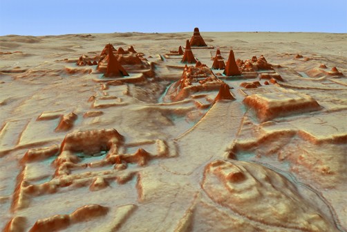
Use of LiDAR instrumental in uncovering of ancient cities beneath the Guatemalan jungle.
2018-02-07 
- Sponsored Content
Aidedo was founded based on the practical experience of CEO Aiden Tong while studying and working with many Civil Engineering and Land Surveying firms in developed countries.
2026-06-02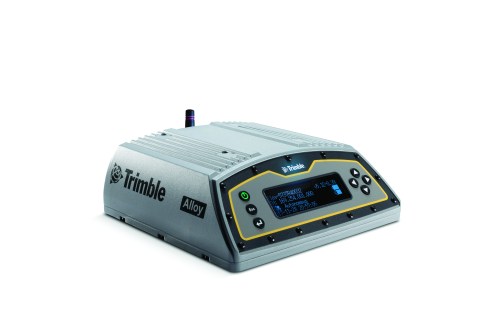
Trimble's new Alloy GNSS unit promises class-leading features.
2018-02-07 



Events
View All-
Nov 9
2026 Advancing Earth Observation Forum
 Hobart, Tasmania
-
Nov 13
South West and Great Southern Surveyors Conference
Mantra Bunbury Lighthouse, Bunbury, WA -
Nov 24
Locate26 Conference / 10th Digital Earth Summit
Melbourne Convention & Exhibition Centre -
Nov 30
-
Feb 5
2026 National EISSI Awards
Melbourne Convention & Exhibition Centre

