Exciting News for GNSS users. September 27th 2022 saw the reinstatement of the Australian & New Zealand SBAS (Satellite-Based Augmentation System) to provide FREE Space-based Differential Corrections. The Test Bed ran for more than 2 years and proved highly successful. However, SBAS was suspended for probity reasons during the tender evaluation process by Geoscience Australia. Now referred to as SouthPAN (Southern Pacific Augmentation Network), the initial service is sub metre precision across Australia and New Zealand.
Very exciting times for GNSS users. Higher Accuracy, No registration, no licencing, and no cost. In the future there will be a DFMC (Dual Frequency, Multi Constellation) service providing precision down to around 100 mm. An appropriate receiver using L1 and L5 frequencies will be required.
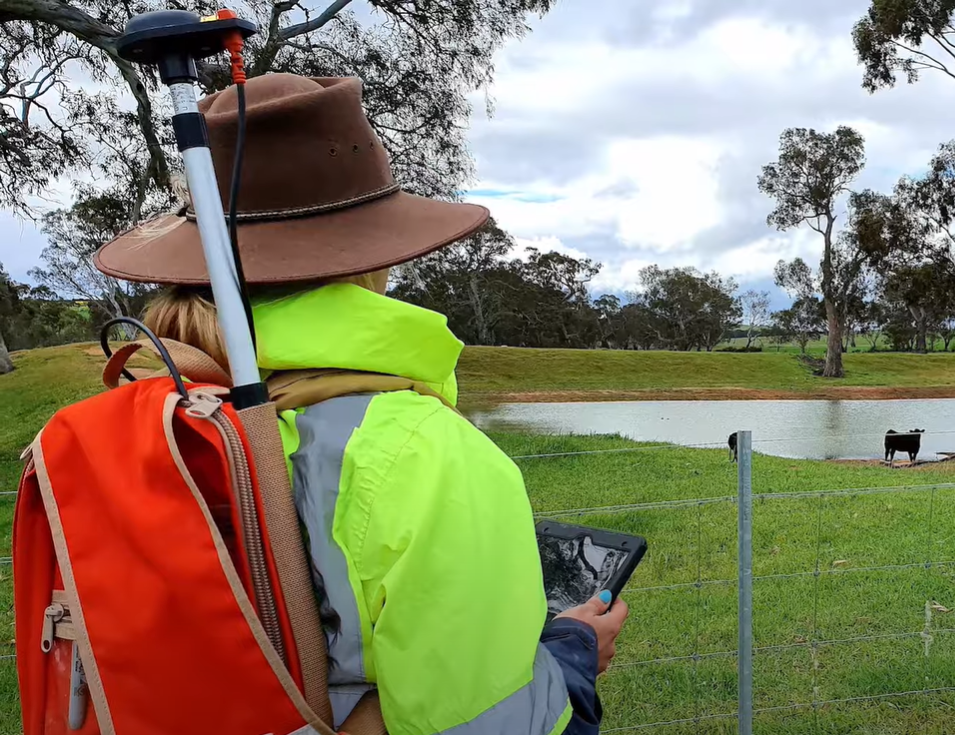
The precision you achieve will be dependant of several factors including the quality of your GNSS receiver, your environment and field methods. To elaborate, the quality of your receiver will include the number of constellations it can track (the more the better) and the quality of the antenna and receiver. Environmental considerations include how good the view the sky is (blockages tend to reduce accuracy) and if there are reflective surfaces that may induce multipath.
Field method is about giving the antenna the best possible view of the sky and being patient. In the field, your experience is a little different using a CORSNet via mobile wireless data or UHF base station in that there is a convergence process. Typically, when using a CORSNet or UHF base station, it takes literally seconds to get to best accuracy for sub metre (L1) or RTK (Dual or Multi Frequency). With SBAS it is slower to get down to its’ highest accuracy. For sub metre, depending on the environment you are working in, this may be (initially) a couple of minutes. DFMC when available will take much longer.
So here are some key tips when using SBAS in the field for sub metre when dealing with reasonable tree coverage. Occupy the location you want to record and give the antenna the best view of the sky. Do not move it as losing a satellite behind a tree means it will need to reconverge. Patience helps you to achieve good results in difficult environments. If you need some assistance, please don’t hesitate to contact 4D Global for technical expertise. We have been using GPS/ GNSS since 1986 and know how to get you the best results in ANZ.
Peter Terrett is a GNSS Specialist with more than 36 years hands on experience across all industries.
pterrett@4dglobal.com.au (03) 9466 5255 www.4dglobal.com.au
Contact us to help you map and manage your world – 4D Global