New Zealand’s Ministry for the Environment is providing NZ$1.2 million to the Otago Regional Council so that it can complete its aerial LiDAR ground mapping project.
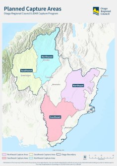
The funding will enable the Council (ORC) to attain 100% LiDAR coverage across the province, which currently has only 28% coverage (around 10,200 square kilometres).
That coverage includes the cities of Dunedin and Mosgiel, along the coast from the Waitaki River to the Catlins, parts of the Central Otago and Queenstown Lakes districts, and the Clutha and Waitaki rivers’ catchments.
“The new project and flyovers of four inland and the alpine lakes areas will collate a further 23,000 sq km of data, or 72% of Otago,” said Andrew Welsh, ORC’s Spatial Analyst for Natural Hazards.
“Combined with the earlier flyover data, there’ll be 100% LiDAR coverage of the province; all eventually accessible to the public.”
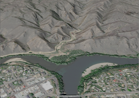
“The data LiDAR generates is invaluable in understanding and preparing for natural hazards, such as flooding, erosion or landslips, as well as assisting with infrastructure management, hydrology and catchment planning,” he added.
Flights have already begun around the Southwest area, and the whole project is expected to be completed within two to three years.
Related news:
Four-year LiDAR mapping project completed
LINZ begins 3D LiDAR mapping of NZ’s coastline