

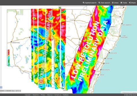
The Live NSW NSW Gravity Model has reached the 90% data capture point, and preliminary data has been made publicly available via the Geological Survey of NSW’s MinView online portal.
The NSW Gravity Model aims to provide a consistent high-quality, high-density dataset of measurements, comprising two-kilometre spacings across the whole state — around 800,000 square kilometres — and out to 50 kilometres off the coast.
Capture of the data is being funded by the NSW Government through the Digital Restart Fund as part of the Live NSW Spatial Digital Twin program.
The purpose of the new gravity dataset is to assist and improve:
- Exploration and management of groundwater stores
- Earthquake hazard detection
- Inform land use decision making
- Bushfire and natural disaster recovery efforts
- Large infrastructure projects
- Property, construction, agriculture, mining & surveying, and
- Flood mapping
It will also reduce expenditure on levelling surveys for all three tiers of government.
According to Spatial Services, “The gravity data captured from this project will be used to create a much-improved NSW quasi-geoid model an essential part in determining ‘real-world heights’ using GNSS positioning (including GPS).”
“A state-wide gravity model will significantly improve the quality and dependability of positioning for NSW, as well as helping to deliver an improved height reference surface that facilitates the development of a digitally and spatially-enabled society.
“This model will form one of the critical building blocks for an accurate and reliable foundation upon which current and future 3D and 4D digital twins can be built.”

The gravity data is being captured in five stages, using an aircraft equipped with an airborne gravity sensor flying at an altitude of more than above 300 metres over populous areas and 160 metres in all other areas.
The survey is being accomplished with the support and expertise of the Geological Survey of NSW (Department of Regional NSW) and Geoscience Australia.


