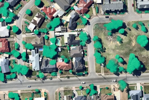
Image courtesy Nearmap
Nearmap has announced that is has completed the research and testing phase for its new proprietary aerial camera system, HyperCamera3.
The company has commenced production of the system and is on track to roll out the technology in Australia and North America later this year.
Nearmap’s previous generation aerial camera system, HyperCamera2, was launched in 2017. That system had the ability to capture, process and publish 3D models. The first content was provided to customers in 2018, with wider commercial availability in 2020.
“The next generation of out aerial camera system will enable Nearmap to expand the scale and reach of our coverage and will offer new mapping and artificial intelligence products across North America, Australia and New Zealand,” said the company’s CEO, Rob Newman.
HyperCamera3’s advantages are expected to include:
- Higher efficiency, providing faster captures and wider reach
- Higher quality, including more-detailed imagery
- More capture angles, providing additional perspectives and better 3D models
- Four-band imaging, enabling new and better artificial intelligence capabilities
“We expect demand to increase significantly for high-resolution, high-frequency aerial imaging captures from aeroplanes, enabling companies to scale up applications including urban planning, remote inspections of assets, the management of transportation, utility and construction projects, and emergency services,” added Newman.
Nearmap says that it is transforming from being a content provider to becoming a solutions provider.
“Out technology strategy aims to drive innovation and technology across all hardware and software layers of the Nearmap solution-stack,” said the company’s CTO, Tom Celinski.
“This starts with world-leading aerial imaging systems, and continental-scale processing pipelines for 2D and 3D content, and artificial intelligence processing.
“We’re also developing user-friendly web tools, and reliable, highly scalable and secure APIs to support customer workflows,” he added.
“The development of HyperCamera3, and the significant milestone we’ve reached in starting commercial production of our new aerial camera system, will significantly extend the technology moat which Nearmap has already built.”
Stay up to date by getting stories like this delivered to your inbox.
Sign up to receive our free weekly Spatial Source newsletter.


