Kate Williams chairs the plenary sessions at Locate19.
Organisers say this year’s conference to emphasise geospatial technology’s role in meeting immediate and serious global challenges.
The line-up for the Locate20 conference in Brisbane has been released, featuring over 50 speakers from government, the tertiary sector, surveying, agriculture, natural resources, utilities and more.
Newly annoucned sponsors for the 2020 event are a showreel of industry heavyweights: Vexcel Imaging, Geoscience Australia, RIEGL Australia, Esri and Maxar Technologies.
Chair of Locate Conferences Australia Maurits van der Vlugt said that the spatial industry is moving ahead in leaps and bounds, with an increasing rate of technological advancement around location technologies, along with automation and machine learning.
“Spatial underpins every other industry, but not everyone is aware of that, so our annual conference is very important for bringing together not only the immediate geospatial industry, but also introducing the case studies and technologies to others who could be using location data to inform and enable better decision making around some serious challenges our society is facing,” he said.
The three day program will feature keynote and breakout sessions, workshops, panel discussions, the Asia Pacific Excellence Awards (APSEA’s), a Young Professional Symposium, and Market Day.
Confirmed Market Day exhibitors include Omnilink, 1Spatial, AURIN, Aerometrex, SBG Systems, GlobalPos, Pitney Bowes, The University of Melbourne, CSIRO Data61, 12D, Synergy, Frontier SI and Carlson software.

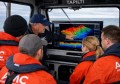
Chair of Locate Conferences Australia Maurits van der Vlugt in the exhibition hall at Locate19.
The exhibition hall will also feature a meeting place for delegates to work on Open Street Maps for bushfire recovery, a space open for the length of the conference for attendees to coordinate and discuss ideas for bushfire recovery materials, in light of the conference theme.
Locate20 will feature the national Asia-Pacific Spatial Excellence Awards (APSEA) gala dinner, recognising excellence and innovation from the pool of talent nominated in the regional APSEA awards in late 2019.
Locate20 organisers have indicated that spaces in the workshops are already filling up, so delegates are encouraged to register as soon as possible.
Highlights from the newly released speaker lineup include:
- Scott Dewar, Director Australia Geospatial-Intelligence Organisation (AGO)
Topic: How the Defence Geospatial Intelligence (GEOINT) Community will transform to meet the future needs of the Australian Defence Force - Panel discussion featuring: Mustak Shaikh, Department of Planning, Industry and Environment; Chris Tanner, Cooperative Research Centre for Water Sensitive Cities; Claire Krause, Geoscience Australia
Topic: The drops are running out – managing water scarcity in an increasingly variable global climate - Justin Mendelow & Ryan Bannister, Urban Utilities
Topic: Spatially Managing Asset Risk at Urban Utilities - Karen Joyce, Senior Lecturer, James Cook University, Queensland
Topic: Guiding the Geospatial Workforce of 2030 towards a stronger economy - Anne Harper, Koordinates
Topic: Why Oceania needs to open up geospatial data — and how - Kangmin Moon, Victorian Commissioner’s Office for Environmental Sustainability
Topic: Accessing geo-spatial data to assist in filling data gaps identified in reporting on Victoria’s State of the Environment Report - James Johnson, CEO, Geoscience Australia
Topic: Creating a location-enabled Australia - Eamon Mansoor, Omnilink
Topic: Spatial Data in Business
Registration for Locate20 is open until March 27, after which a late fee will be incurred.
Stay up to date by getting stories like this delivered to your mailbox.
Sign up to receive our free weekly Spatial Source newsletter.