Adrian Cleeve, Chief Technology Officer, Altavec
In our annual Leaders Forum, we ask experts to look ahead into 2023. Today we talk data with Adrian Cleeve.
Adrian Cleeve has over 20 years’ experience in the geospatial industry and is CTO at Altavec (a Tech Mahindra company), a Melbourne-based firm specialising in providing advanced geospatial products and services for customers (such as utilities) that have large asset pools.
Is the geospatial sector in good shape to help solve the needs of the nation, e.g. climate change, renewable energy, infrastructure projects?
Absolutely. With data being the new gold, the geospatial sector has an added responsibility to aid Australia’s progress into a cleaner future. The nation needs national infrastructure that delivers for the wider populace in a secure, reliable and efficient form… and for this, geospatial is a key enabler. The sector is well poised to continue to make the most of AI/ML, capture technologies, analytics, visualisation and other tools that we have at our disposal.
Renewable energy is a perfect example, with the location of new sources requiring detailed input from the geospatial sector; likewise, determining where the demand is and how it interacts with the grid.
What are the most important challenges facing the sector?
Security. With national infrastructure under the threat of state and non-state actors, it is important that the geospatial sector ensures data integrity and security. Asset owners require reliable and secure services and supply to keep communities running. Our solution to this has been to work with our cloud partners and regularly review and update our internal processes, and apply learning from other regions and industries from our parent organisation.
Then there’s the democratisation of data. While the use of geospatial data is widespread, access to data is often restricted to a handful of users within a company, limiting its useability, its potential use cases and its overall value to the business. Altavec strives to provide secure, easy-to-use, web-based access to LiDAR, panoramic and high-resolution imagery.
Which technologies or innovations are going to make their mark in 2023?
Innovation is likely to come from a convergence of previously unrelated technological advances. Rapid progress in capture technology, combining inputs from multiple sources such as satellite imagery, LiDAR, thermal, multispectral and hyperspectral sensors, will continue to mature in 2023. Increased scalability via cloud computing services and AI/ML is likely to continue being the key enabler for innovation, as will digital twins.
What’s on your wish list for 2023?
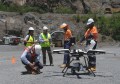
Widespread use of drone-based, BVLOS capture is still very limited, with regulators being understandably cautious about the potential risks. As these risks are addressed, and new capture techniques enter the mainstream, there is potential to revolutionise the industry. Capture costs will drop to a fraction of what they are today, enabling more use cases to be addressed using geospatial data. At Altavec, we are positioning our products and platform to help our customers manage the anticipated rapid growth in geospatial data that this change, combined with other rapid improvements in capture technologies, will inevitably lead to.
What are your customers and collaborators looking for in 2023?
Our customers are looking for increased return on investment from the geospatial datasets they capture. For example, while LiDAR capture to help detect vegetation encroachments around power lines remains as critical as ever, our customers want to see the same datasets generate other meaningful insights, such as conductor-to-conductor, ground-to-conductor and building-to-conductor clearances, hazard tree detection, and vegetation species and growth analysis.
What are your company’s plans or priorities for 2023?
2023 will see us focus on delivering scale, automation using ML, product features, and building and rewarding our valued team, all aimed at supporting our customer aspirations while expanding internationally and across industries. One of the key challenges our customers report is the difficult of getting a clear view of where they stand in terms of regulatory compliance for their vegetation and asset inspection programs. We’re working to help solve this by combining inputs from program planning, field service providers and geospatial capture programs.
This article was first published in Issue 116 (Dec/Jan 2022-23) of Position magazine.
Stay up to date by getting stories like this delivered to your inbox.
Sign up to receive our free weekly Spatial Source newsletter.