©stock.adobe.com/au/Piotr Krzeslak
PARTNER FEATURE
Developments such as SouthPAN and GNSS are enabling higher positioning accuracy in the trickiest of environments.
By Peter Terrett
If someone had told me 10 years ago that they needed sub-metre accuracy under tree canopy, I would have warned them that achieving it may prove difficult and expensive at best, and, at worst, not possible in many environments.
However, satellite positioning just keeps on innovating. Recent developments have greatly increased the availability of higher accuracy in more places and for more industries, at a vastly reduced cost and with less user skill required.
There are many industries that need to work in areas that have varying amounts of sky obstructions such as tree trunks and canopy cover; these include arboriculture, forestry, environmental, cultural heritage, and archaeology. For sure, there are some environments where it is hard to see that GNSS will ever provide a solution… such as dense old-growth forests with trees that are tall, have wide trunks or thick branches.
But many forested environments have now yielded accurate location via space-based positioning since the advent of newer technologies such as SouthPAN, as well as better antennas, GNSS boards and firmware, and the ability to use all four global constellations at once — GPS (US), GLONASS (Russia), Galileo (European) and BeiDou (China).
In Australia we also have access to a Japanese regional system called the Quasi-Zenith Satellite System (QZSS) which can add three or four extra satellites to the in-view constellations. QZSS is typically not used on L1-only sub-metre systems, but often is used on multi-frequency (L1, L2, L5) GNSS receivers such as the Eos Arrow Gold.

One of the major contributing factors to accuracy is how well spread around the sky the satellites are. You’re better off having a satellite in each quadrant than 20 satellites in a single quadrant. Having four constellations provides more opportunities to see a greater number of satellites and in a better geometry.
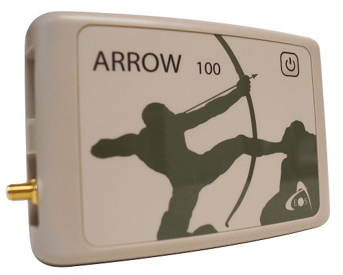
A receiver such as the Eos Arrow 100, which can use all four constellations in (for instance) tree canopy environments, provides an increase in performance and accuracy by using satellites that appear between the branches of the trees. GPS alone (or GNSS that only supports GPS and GLONASS) cannot use the additional satellites in view and therefore will suffer from lower performance and lower accuracy.
The second part in the accuracy solution for sub-metre is SouthPAN, Australia and New Zealand’s Space-Based Augmentation System (SBAS). Although quite new to Australasia, SBAS has been around for more than 20 years. Originally conceived for aviation to increase accuracy at remote landing sites, it is now used by nearly all industries that require sub-metre accuracy.
SBAS provides corrections for satellite orbit and clock errors plus an ionospheric correction. The corrections are highly accurate even when there is no local GNSS base station, and, as the corrections are provided by the L band transmission, there is no need for internet.
SouthPAN has complete coverage of mainland Australia, Tasmania and New Zealand. At present there is only one satellite (an Inmarsat geostationary satellite above the equator at 143.5° east) providing the correction data, but using the same frequency band (L band) as the GNSS satellite systems… so it is received by the GNSS antenna, passed through and processed.
You have to be able to see the satellite to receive and apply the corrections. In the field with obstructions, this could prove problematic, however once you have received and applied the corrections, they can remain valid for quite a while as the corrections are for the orbit and clock of the GPS satellites, which do not change quickly.
It is important to be aware that SBAS works a little differently to CORSNet corrections; the issue is that there is a longer convergence time to get the highest accuracy. In the field, you place the antenna where you need the location, having consideration for the environment, then be patient and let GNSS do its job. Moving the antenna around and changing the satellites in use means that the convergence will have to start again for new satellites. Note also that not all GNSS receivers are capable of using SouthPAN until it achieves SoL (Safety of Life) Certification, expected in 2028.
In summary, new technologies are enabling many users to achieve surprising accuracy and performance in what once would have been deemed to be challenging environments.
Peter Terrett is a GNSS specialist with more than 36 years’ hands-on experience with GPS/GNSS.
For answers to all your GPS, GNSS and SouthPAN questions, contact 4D Global or Peter Terrett direct on pterrett@4dglobal.com.au or 0419 307 770.


