

Ezra Miller attended the FIG 2026 Congress as an early career surveyor and returned to Australia with lots of valuable insights.
By Ezra Miller
It is easy to think of surveying as a local profession until you find yourself discussing cadastral reform with delegates from Nigeria, Uganda and Denmark in the same afternoon.
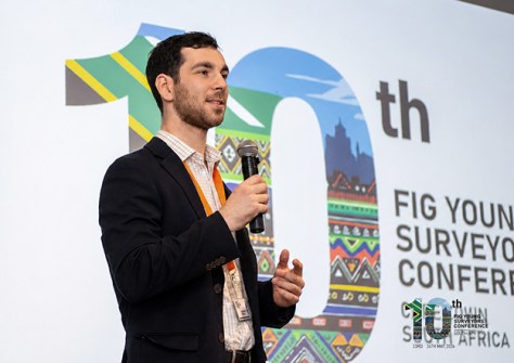
As a final-year surveying student, arriving in Cape Town in late May as one of four International Federation of Surveyors (FIG) Foundation Young Surveyor Grant recipients — and the only Australian among them — was not something for which I had fully prepared myself.
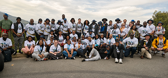
The FIG Congress, held from 24 to 29 May 2026, brought together more than a thousand surveyors, geospatial engineers, academics and policymakers from around the world. I knew it was a significant event on the global geospatial calendar, but I had not anticipated how much a single week could change the way I understand my own profession.
Cape Town itself added an important dimension to the experience. Land rights, dispossession and restitution are not historical abstractions in South Africa; they remain active social and political issues.
That context gave many of the discussions about land administration and tenure security a level of immediacy that would have been difficult to replicate elsewhere.
How other countries approach surveying challenges
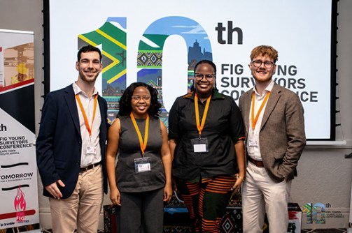
Before the main congress began, I spent two days at the 10th Young Surveyors Conference, a dedicated gathering for early career professionals that set the tone for the week ahead.
It was here that I began building connections with delegates from across Africa, Europe, Asia and the Americas — all at similar career stages and grappling with many of the same questions about the future of the profession.
I delivered two presentations during the Young Surveyors Conference.
The first was a panel session examining cadastral and land administration systems from different countries, where I spoke about Australia’s systems alongside delegates from Uganda, Nigeria and Denmark.
The contrast between systems was immediately instructive. Australia’s cadastre is mature, increasingly digital and comparatively well resourced, which can appear enviable from many parts of the world.
At the same time, hearing how other jurisdictions approach similar challenges highlighted that there is no single model for success. Historical, legal and cultural contexts continue to shape cadastral systems in ways that technology alone cannot overcome.
My second presentation formed part of the FIG Foundation Impact Session, where I discussed what receiving the Young Surveyor Grant meant to me and how it was influencing the beginning of my professional career.
The discussions that followed were particularly rewarding.
Several delegates expressed interest in Australia’s cadastral framework and were surprised by the extent to which Australian boundary definition still relies on physical survey marks and monumentation, rather than co-ordinates alone.
These conversations reinforced that practices we often regard as normal are not necessarily universal, and that international engagement can challenge assumptions on both sides.
Different countries, universal surveying issues
One of the more unexpected aspects of the week was simply encountering the profession at full scale.
Knowing that surveying encompasses hydrography, cadastral surveying, engineering surveying, geodesy and remote sensing is one thing; meeting practitioners who work exclusively within those disciplines, and seeing the distinct international communities that exist around them, makes the breadth of the profession tangible in a way that is difficult to appreciate from a university classroom or workplace.
The range of technical sessions across the main congress reflected that breadth.
A presentation on UAV photogrammetry for communal land registration demonstrated how drone-based surveying can deliver outcomes more rapidly and cost-effectively than conventional GNSS approaches, while also supporting participatory models of data collection.
Rather than being a future concept, these systems are already being deployed to address practical land administration challenges.
I found this one of the most thought-provoking sessions I attended.
Another presentation from Norway explored the use of artificial intelligence to reconstruct property boundaries from historical maps and cadastral records. For Australia, where cadastral gaps remain a persistent challenge and workforce capacity is limited, I found this one of the most thought-provoking sessions I attended.
A session on modern marine surveying revealed a broader trend that appeared throughout the congress. The major transformation underway is not simply a shift from crewed to uncrewed operations; it is a shift towards richer, integrated spatial datasets.
Technology is changing not only how data is collected, but also the nature and value of the information being produced.
Thinking globally for Australian surveying
Across almost every stream, one issue repeatedly surfaced: attracting and retaining the next generation of professionals. It emerged in different contexts, but the underlying concern was remarkably consistent.
Whether in Europe, Africa, Asia or Australia, the profession is confronting similar workforce challenges. It was a useful reminder that the difficulty of promoting surveying and geospatial careers is not uniquely Australian — it is a global issue.
For Australian practitioners like me, several themes from the Congress are worth reflecting on. For instance, our federated system has produced genuine fragmentation in cadastral and land administration practice, with differing standards, legislation and processes across jurisdictions.
What the Congress highlighted, however, is that these co-ordination challenges are not unique to Australia. Countries such as Nigeria face similar complexities and are developing pragmatic approaches that deserve closer attention than they often receive within Australian professional discussions.
I will definitely be thinking more globally as I develop and use my knowledge and skills.
The congress also highlighted the growing international momentum behind fit-for-purpose land administration. The principle is straightforward: spatial data should be sufficiently accurate for its intended purpose and delivered in time to be useful. In many contexts, this can provide greater societal benefit than pursuing technically perfect data that arrives too slowly or at excessive cost.
Australia is well positioned to contribute to this conversation, particularly as we consider how emerging technologies can help address workforce shortages and historical cadastral deficiencies.
FIG Congress: A valuable learning experience
One of the most valuable lessons I took away from the Congress was that presenting internationally forces you to examine your own assumptions. Explaining Australia’s cadastral system to an audience from other countries required me to articulate concepts that I had previously accepted without question. In doing so, I gained a much clearer understanding of both the strengths and limitations of our own system.
Discussions about monumentation, digital cadastres and land administration highlighted approaches that differ significantly from our own. Those conversations were often as informative as the formal presentations themselves.
As an early career surveyor, I would not have had this opportunity without the support of the FIG Foundation Young Surveyor Grant. For students and young professionals with an interest in the international dimension of this profession, it is an opportunity worth pursuing.
The value of this opportunity is not just the wealth of knowledge and experience of attending, but the exposure to global ideas, practices and networks which contribute to strengthening the profession as a whole.
The strongest lesson that I took from Cape Town was that surveyors around the world, despite working across vastly different legal systems, technologies and geographies, are grappling with remarkably similar challenges. There is considerable value in looking beyond our own borders.
For me, that perspective alone made the journey worthwhile.
Ezra Miller is a final-year Surveying Engineering and Commerce student at UNSW Sydney, with a passion for drones, remote sensing and the intersection of engineering and spatial science. He works as a student surveyor at Aurecon and was selected as one of four FIG Foundation Young Surveyor Grant recipients for the 2026 FIG Congress in Cape Town.


