

Developments and discussions of global and local importance from the recent FIG 2026 Working Week in Cape Town.
By Kate Fairlie
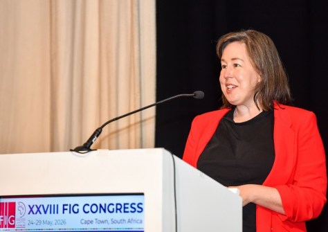
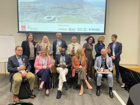
The dust has settled from the International Federation of Surveyors (FIG) 2026 Working Week in Cape Town and the 24 Aussies and four Kiwis who attended have all returned home.
Perhaps you followed the conference and its developments online? Or perhaps you’ve never heard of the FIG? Regardless, let’s recap on some of what the conference covered.
We’ll start with the most shocking and controversial news first. They relate to FIG’s finances and the now-defunct Geospatial Council of Australia (GCA).
Whilst the joint Locate25/2025 FIG Working Week event in Brisbane in April last year delivered a strong technical program, GCA’s subsequent collapse into administration meant FIG and the FIG Foundation did not receive their agreed conference fees — and let’s be clear, the event achieved a nominal surplus — nor recouped their expenses that should have been reimbursed.
This has left a significant hole in FIG’s finances, which has yet to recover from the impacts of COVID-19. As a former chair of the Young Surveyors Network, I was particularly disturbed to learn that the income from the YSN Charity Event had also not been paid.
This fallout is both reputational and structural. FIG is now signalling more cautious financial settings and will likely be instigating more protective checks and clauses to prevent such a scenario occurring again. For Australians, and for professional bodies seeking to fill the gap that GCA leaves… well, it would be nice to think that there will be some way to make amends in the future.
Showing leadership in surveying and geospatial
To happier news, the Cape Town Working Week was stellar event with many highlights.
As far as the city being a venue and a world leader is concerned… for anyone who has visited there, you will already know the answer! The food, the scenery, and — if you’re lucky — the safaris! But even more than that, Cape Town and South Africa are showing some serious leadership in surveying and geospatial.
Cape Town has repurposed the World Bank’s Ease of Doing Business framework as a city dashboard to measure progress and, amongst other measures, to continuously identify, repackage and make available municipal land that is no longer required.
South Africa is also demonstrating clear applications for drone surveying — from community-led spatial planning to development of fit-for-purpose digital twins. Clinton Heimann, Deputy Director General of Spatial Planning and Land Use Management and his colleagues presented some excellent papers.
Of relevance to Australia, the South African Minister of Land Reform and Rural Development, Mr Mzwanele Nyhontso, spoke powerfully about how spatial planning was weaponised as part of apartheid… and how spatial data in South Africa still carries the exclusion of this period.
Australian surveyors too, must continue to reflect on how our profession has been involved in dispossessing and disconnecting first nations’ people from their land, culture and livelihoods. What can we do to move forward?
Land and sea on the agenda
The UN’s Food and Agriculture Organisation relaunched its State of Land Tenure and Governance report, and I highly recommend giving it a glance through. The report offers the first real comprehensive, data-driven assessment of land tenure systems worldwide, providing the data we need to convince policymakers to take action. Who’s heard that only 35% of the world’s land has formally documented tenure or use rights? We now have the evidence to back this up.
The report also flags that 89% of agricultural land is operated by the top 10% of the largest landholders — something we’re again all too aware of in Australia.
For surveyors in coastal areas, or readers in the hydrography domain, you’ll be pleased to know that the land/sea interface is an increasingly central theme in FIG and related arenas. The Director General of the International Hydrographic Organisation (IHO) reiterated that only 28.7% of our planet’s seabed has been mapped, and with an accuracy about the size of a football field.
The United Nations Global Geodetic Centre of Excellence, headed up by Australia’s very own Nick Brown, has hosted several workshops on this important topic of ‘joining land to sea’. I strongly recommend reviewing their publications on this, and the more recent State of Geodesy 2026 report or the Hidden Risk video if visuals are more your thing.
Singapore’s geospatial masterplan for societal wellbeing
From Singapore, Chief Surveyor Victor Khoo gave us an excellent presentation on geospatial advancements in the island nation — a country that has pledged to spend $100 billion over 100 years to tackle the climate challenge.
Victor walked us through Singapore’s high-level aims:
- Establish a baseline. Take stock of what is at risk and what to protect. Which datasets are fundamental?
- Formulate solutions. This might be an urban digital twin, integrated land and sea spatial data, or mitigation plans for low-lying areas.
- Monitor changes. Singapore is just 740 square kilometres and has 10 continuously operating reference stations (CORS). For its latest project on long-term nationwide land motion monitoring, a key challenge is the integration of separate measurement infrastructure.
- Measure effectiveness. It’s not enough to collect data; this data must be purposefully used to inform change. Singapore is developing GeoAI models and capabilities to rapidly map and extract information necessary to manage and plan for the future city.
- Communicate and grow. Ensure citizens are informed of climate impacts and actions to take/being taken. Ensure all government agencies are combining efforts and working together.
Singapore has a Geospatial Masterplan 2024-33 that might be of interest to some, and the Singapore Land Authority has previously released a video on Shaping a Geo-enabled World.
For those in climate change and climate resilience, FIG also launched Publication 85, Surveying for Climate Resilience: Practical Climate Actions.
And last but not least in this way-too-short list, we launched Publication 89, Advancing Women’s Land Rights: A call to Action through Ten Commitments for Surveyors and Other Land Professionals. This publication originally sought to update the 20-year-old FIG Guidelines on Women’s Access to Land (FIG Publication 24), but became so much bigger as we sought to make it really tangible in addressing how surveyors can take action, individually and professionally.
Our sector’s crucial role in global land equity
Since the backdrop for the Advancing Women’s Land Rights publication is the United Nations Sustainable Development Goals, you might be thinking, ‘What relevance does this have for Australia?’ Or as a practicing surveyor, and not a land registration specialist, ‘What can I do?’
Our provocateurs at the publication’s launch addressed this, asking: Is it acceptable for land administrators to not be able to tell how many women are in the system? For Australia, no Australian state routinely publishes gender-disaggregated cadastral or land title statistics. Yet the SDGs ask developing nations to do so.
So, are we really developing inclusive, responsive policy if we don’t know? Cotality (formerly CoreLogic) commissioned research into disaggregated property ownership across Australia, noting particularly that property investment skews towards men. As the decision-makers of which data is captured about land, and how that data is handled — and simply as professionals who communicate what we do on a daily basis — I think we have a role to play in ensuring equity of property ownership (and risk).
A related question is: Do we provide surveyors with the social skills and people-centred training necessary to effectively do their job? How are we creating safe workspaces in our profession? How are playing a role to reduce gender-based violence in our communities?
And stepping back further… My work is in international development, and I contributed the section on Pacific Women’s land access, together with some stellar Pacific women in geospatial. My key request is that, as a surveying profession, we ramp up our communication to politicians to demonstrate that investment in infrastructure alone is not enough.
We need investment in surveying, geodetic infrastructure and geospatially enabled decision-making to reduce the risks inherent in infrastructure development and ensure sustainability and future financial (and social) returns on investment.
In summary
Packing four-plus days of intensive discussions into one short piece is simply impossible. I encourage you to take a look at the online technical program or reach out with specific questions.
And perhaps join us next year in Stavanger, Norway!
Kate Fairlie is a Land Administration Specialist and Project Director with Land Equity International.


