

In time for World Hydrography Day on 21 June, CSIRO has released results of bathymetry work to map the seafloor south of Tasmania.
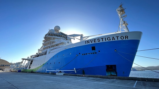
During June 2023, CSIRO research vessel RV Investigator departed Hobart on a collaborative international voyage into the Southern Ocean to study ocean nutrients.
Aboard were representatives from 14 leading ocean chemistry laboratories from 12 countries, whose objective was to collect important ocean data, share knowledge and ensure best practice in how ocean measurements are made.
In addition, the wide research capabilities of RV Investigator meant that, at the same time, additional seafloor mapping was undertaken to help fill gaps in seafloor mapping in our region.
Two major mapping milestones were achieved during the voyage.
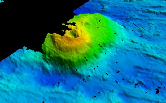
First, the CSIRO Geophysical Survey and Mapping (GSM) team was able to fill in the last major gap in the dataset for bathymetry of the southern Tasman Fracture Marine Park. These data are needed for the marine park manager, Parks Australia, to understand and manage these areas in order to seek to preserve important ocean habitats and biodiversity. They are also vital elements in protecting wider ocean productivity and prosperity.
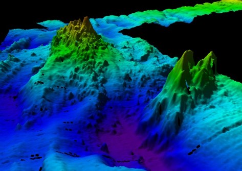
Secondly, the team mapped several new seamounts in the Southern Ocean south of Tasmania. These seamounts represent a volatile time in Earth’s history — the break-up of Australia and Antarctica about 40 million years ago that created an environment of frequent volcanism as a mid-ocean ridge formed. Identifying seamounts gives geoscientists clues to the geological history of both Australia and Antarctica.
Along with the new seamounts, several other new significant seafloor features were also mapped, including vast seafloor ridges, plateaus and canyons.


