
Held on Sunday, 9th February, 2020, the SSSI National Bushfire Recovery Map-a-thon was a way for the national and international community to work together to map a total of 2,793,879 hectares affected by recent Australian bushfires with the focus being on burnt infrastructure. Join us for this Webinar to hear more about the initiative.
Speakers:
Dr Lesley Arnold (SSSI National Board Director) will give an overview of the Map-a-thon initiative and discuss overall logistics of planning; industry, government and NGO engagement; the challenges and overall execution of the event.
Nathan Eaton, Executive Director, NGIS Australia will give an overview of the technical set-up of this mammoth Map-a-thon and highlight some of the challenges and triumphs experienced.
This is a free event open to those who participated in the Map-a-thon or are involved in the surveying and spatial community.
Details about how to join the Webinar will be emailed to you prior to the event.
To read more about the SSSI National Bushfire Recovery Map-a-thon see the news item here
The Space Symposium attracts thousands of representatives of the space industry, governments, militaries, research agencies and more. The event brings all these groups together in one place to provide an opportunity to examine space issues from multiple perspectives, to promote dialog and to focus attention on critical space issues.
This year, the Space Symposium will be a hybrid in-person/virtual event, with the in-person sessions taking place in Boulder, Colorado, along with a vast exhibition display space which, this year, has been increased by 8,300 square metres.
The 10th Land Administration Domain Model Workshop (LADM 2022) will be held in Dubrovnik, Croatia from 31 March to 2 April 2022. This is an on-site event at Hotel Dubrovnik Palace, with possibilities for remote participation. The workshop is being organised in conjunction with 7th Croatian Congress on Cadastre.
Image credit: ©stock.adobe.com/au/incomible

The ITS Australia Summit 2022 in Brisbane will feature a strong industry program over three days driven by abstract submissions & invited keynote presentations, and will include technical tours & demonstrations, cutting edge industry exhibition, workshops, panel discussions, and an exciting social program.
As Australia’s leading transport technology event, Summit will demonstrate new insights and initiatives that will determine our path toward an accessible and automated future transport network.
Advancing Earth Observation Forum 2022 will be a face-to-face, fully interactive forum. It will host user, industry, government, research and technical focused plenaries and interactive panels, poster and workshop sessions to interest and engage end-users, industry, researchers, government, analysts, start-up companies, educators and students.
The International Cartographic Association (ICA) invites you to share your research, practice and experiences in cartography and GIScience at the 31st International Cartographic Conference (ICC 2023), to be held from 13 to 18 August 2023 in Cape Town, South Africa.
The conference theme will be ‘Smart Cartography for Sustainable Development’.
Important dates:
- 5 December 2022 – Submission of full papers closes
- 12 December 2022 – Submission of abstracts closes
- February 2023 – Conference registration opens
- 28 February 2023 – Notification of acceptance
- 8 May 2023 – Submission of revised abstracts and papers
- 15 May 2023 – Early Bird registration closes
- 15 May 2023 – Registration deadline for presenters of abstracts, papers and posters
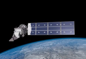
SmartSat partners, participants, students and staff are invited to come together to share their research outcomes and network with industry colleagues at the SmartSat CRC Conference 2023.
The SmartSat CRC is a consortium of universities and other research organisations, partnered with industry that has been funded by the Australian Government to develop know-how and technologies in advanced telecommunications and IoT connectivity, intelligent satellite systems and Earth observation next generation data services.
Landsat image courtesy NASA/GSFC

The Andy Thomas Space Foundation is looking forward to welcoming a global audience to the 16th edition of the Australian Space Forum, to be held in Sydney on 6 December 2023.
This will be the first time the Forum will have been held in a city other than Adelaide; the organisers announced at the 15th Forum in May 2023 that from then on, every second Forum will be held in a city other than Adelaide.
The Forum provides an ideal opportunity to stimulate ideas, share information about emerging technologies and network with influential space sector leaders and the broader community.

The 3rd International Land Management Conference, hosted by the University of the West of England, will be held online on 14 and 15 March 2024. The event will bring together experts and professionals in land management to discuss inclusive land tenure, efficient land markets, sector reform and innovations in land research.
The conference will focus on four themes:
- Theme 1: Can we build more inclusive and resilient land tenure systems by understanding social value and climate change?
- Theme 2: How can land administration systems contribute to efficient and equitable land markets?
- Theme 3: What approaches can Development Partners use to help achieve more successful Land Administration sector reform?
- Theme 4: LINK – Early Career Professionals and Junior Researchers – Innovations in Land Research and Practice
The conference is organised by LINK, the Land–International Network for Knowledge — a network of academic organisations, professional practice and development partners, as well as public and private sector country partners — in association with the University of the West of England.


