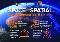
During 2020 an expert group drafted the SPACE+SPATIAL Industry Growth Roadmap 2030 – a national snapshot for Australian professionals to better understand the bold new future that’s rapidly approaching and what it means for them, their careers, their organisations and all of Australia.
The National Steering Committee is seeking feedback on the Roadmap from spatial professionals of all levels across the country. There are a number of ways to get involved, one of which is to participate in this SSSI and SIBA|GITA SPACE+SPATIAL Roadmap Online Session.
You will hear about the key plans, activities and issues and have the opportunity to have a meaningful discussion with colleagues about your thoughts on the Roadmap Consultation Paper and the topic in general.

Join Bentley Systems at the launch of what it says is the industry’s most complete Survey and Site Design Solution ever offered to the ANZ market.
As technology advances and industry expectations increase, your software needs to keep pace with this ever-changing environment. In short, your software needs to deliver on today’s requirements and be ready for tomorrow’s challengers.
If you work in road design, site surveying, site development and related fields, this webinar is for you.
Throughout the launch, Bentley Systems will demonstrate traditional survey data capture capabilities, coupled with the latest mass data collection survey methods, including Total Station techniques, Point Cloud techniques and Digital Photogrammetry techniques.
Leveraging the above survey results, the launch will continue through a typical site design workflow, incorporating aspects such as:
- Terrain creation and analysis
- Urban road widening design
- Carpark and recreational area design
- Drainage and Utility design and analysis
- Plan production and digital model delivery
- Model visualisation
Air Inspect Australia will also be joining the webinar to share their insights and learnings of their project.
If you or your company perform any of the above-mentioned workflows, then this is one webinar you should not miss.

The 15th International Conference on Spatial Information Theory, COSIT 2022, will be held in Kobe, Japan, 5 to 9 September, 2022. Established in 1993, the Conference on Spatial Information Theory (COSIT) is a biennial international conference series concerned with theoretical aspects of space and spatial information, aimed at advancing geographic information science and its emerging research frontiers.
The conference offers three (refereed) submission tracks with double-blind reviews: vision papers, full papers, and short papers. Embedded in the conference will also be an on-site mentoring program for doctoral students.
Contributions can cover a broad set of conference-relevant themes such as (but not limited to):
- activity-based models of spatial knowledge
- cognitive aspects of geographic information
- cognitive-behavioural geography, naive geography
- data-driven spatial information theory
- geo-ethics and geo-privacy
- events and processes in geographic space and time
- geographic information visualisation and geovisual analytics
- knowledge representation for space and time
- navigation and wayfinding of sentient beings and robots
- ontology of space and time
- place
- quality and interoperability of geographic information
- social and cultural organisation of space
- spatial and temporal language
- spatial aspects of social networks
- spatial decision support, impact of model design
- spatial (digital) humanities
- theory-driven spatial machine learning, artificial intelligence of space
- theories on volunteered geographic information
- theory and practice of spatial and temporal reasoning
- user interfaces, virtual spaces and collaborative spaces

The US National States Geographic Information Council (NSGIC) Annual Conference is the place to enhance geospatial excellence and collaboration for state, local, tribal and federal GIS policymakers and coordinators, private sector partners and other leaders in the geospatial ecosystem.
Providing critical and timely networking opportunities, the conference also offers the chance to connect, collaborate, and share with colleagues and partners.
The agenda will comprise:
Roll Call of States — Where state representatives will share a snapshot of achievements, challenges and upcoming activities.
Plenary Sessions — Presentations by and for the NSGIC community exploring challenges, successes and new approaches for collaboration in the geospatial ecosystem.
State Caucus — A roundtable discussion with state and local government representatives to talk frankly about current pressing issues.
GIO Academy — Leadership sessions and networking for state government GIOs and equivalents only (separate registration is required).
Speed Networking — A fun and fast-paced activity where sponsors, who have allocated points, will rotate to complete the circuit of visiting with state reps.
Annual Business Meeting — Including the election of new board members and leadership transition.
Awards Reception — Recognising exceptional work through the Geospatial Excellence Awards & NSGIC Service Awards.

The annual Geo Connect Asia Show & Conferences offers a two day, in-person meeting place for ASEAN’s vibrant geospatial community. Bringing geospatial solutions to the heart of decision-making the event combines with technologies from the digital construction, drone and remote sensing markets.
Geo Connect Asia looks to host its ASEAN neighbours and build on a vibrant community as new technologies add new application tools to enable the Industry 4.0 Revolution. The emergence of AI, blockchain, IoT, robotics and UAVs create a new dynamic and platforms for a region well equipped to take on the challenges ahead.

The Geospatial World Forum is an annual gathering of geospatial professionals and leaders representing the entire ecosystem of public policies, national mapping agencies, private sector enterprises, multilateral and development organisations, scientific and academic institutions, and large end-users from government businesses and citizen services.
Geospatial World Forum 2024 will be held from 13 to 16 May in Rotterdam. Having its theme as ‘Geospatial Transition: Powering the World Economy,’ the event will showcase various facets of the ongoing transition of the geospatial industry and its existing and potential value in the world economy.


