Speaker:
Rebecca Price is the Principal Policy Officer, Land Management Policy | Energy, Environment and Climate Change at DELWP.
Rebecca will be presenting on the update of the Marine and Coastal Policy that was recently released. Join in the questions and answers after the presentation.
If you are involved in sea level implications from beach erosion, storm surges, the tidal interface, land tenure etc, don’t miss this webinar!
Second speaker to be announced.
Cost
Member FREE | Non-member $45
Contact

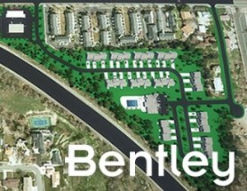
Join Bentley Systems at the launch of what it says is the industry’s most complete Survey and Site Design Solution ever offered to the ANZ market.
As technology advances and industry expectations increase, your software needs to keep pace with this ever-changing environment. In short, your software needs to deliver on today’s requirements and be ready for tomorrow’s challengers.
If you work in road design, site surveying, site development and related fields, this webinar is for you.
Throughout the launch, Bentley Systems will demonstrate traditional survey data capture capabilities, coupled with the latest mass data collection survey methods, including Total Station techniques, Point Cloud techniques and Digital Photogrammetry techniques.
Leveraging the above survey results, the launch will continue through a typical site design workflow, incorporating aspects such as:
- Terrain creation and analysis
- Urban road widening design
- Carpark and recreational area design
- Drainage and Utility design and analysis
- Plan production and digital model delivery
- Model visualisation
Air Inspect Australia will also be joining the webinar to share their insights and learnings of their project.
If you or your company perform any of the above-mentioned workflows, then this is one webinar you should not miss.

The Australian Association for Unmanned Systems’ ‘RPAS in Australian Skies 2022’ conference aims to continue discussion on the safe integration of RPAS into Australian airspace. It is supported by key government and industry participants and has established itself as a landmark event in the Australian RPAS calendar.
The 2022 themes will cover:
- Policy and Regulatory updates from the Department of Infrastructure, Transport, Regional Development and Communications, CASA, AirServices Australia and the Australian Defence Force relating to the use of emerging aviation technology in Australia.
- UAS Traffic Management (UTM), low level airspace, integrated airspace systems challenges and opportunities.
- Industry challenges and perspectives
- Continuing development of a professional and safe industry.
- ATSB RPAS data and trends
- Emerging technology and innovative solutions enabling integration or RPAS into Australian airspace.
- Future infrastructure requirements to enable drone delivery and advanced air mobility (AAM).
- Emerging RPAS and AAM applications – benefits, viability and social acceptance.
The conference will be a hybrid event incorporating face to face (live) and online (virtual) choices for participants. It will also include the AAUS Gala Dinner featuring the AAUS Industry Awards.

Since the establishment of Scott Base on Ross Island by the late Sir Edmund Hillary in 1957, surveyors have been appointed to assist scientists with survey related tasks on the ice.
This presentation by a panel of Antarctic surveyors promises to be educational, entertaining and informative, as they talk about their experiences on projects on the frozen continent over the last 35-plus years.
Image credit: ©stock.adobe.com/au/hrathke

Featuring a spotlight on crowd-sourced bathymetry, the Map the Gaps Symposium 2023 will bring people together to learn, share and contribute to ocean discovery.
Held on behalf of GEBCO, this event draws global experts in ocean technology, science and policy to discuss deep and coastal ocean exploration, offshore surveying technology, policy, diversity, equity and inclusion, the Nippon Foundation-GEBCO Seabed 2030 project and GEBCO alumni activities.
Participation is open to all, including industry professionals, explorers, authors, students, researchers, government representatives and emerging technologists. Participants can attend in person or online.

The 2024 edition of the International Conference on Geographical Information Systems Theory, Applications and Management (GISTAM 2024) aims to create a meeting point of researchers and practitioners that address new challenges in geo-spatial data sensing, observation, representation, processing, visualization, sharing and managing, in all aspects concerning both ICT as well as management information systems and knowledge-based systems.
The conference welcomes original papers of either practical or theoretical nature, presenting research or applications, of specialised or interdisciplinary nature, addressing any aspect of geographic information systems and technologies, such as:
- Data acquisition and processing
- Remote sensing
- Interaction with spatial-temporal information
- Spatial data mining
- Managing spatial data
- Modelling, representation and visualisation
- GIS and climate change
- Domain applications


