
SSSI in conjunction with the Hunter Environmental Institute will present this webinar with three pre-eminent speakers:
Amy Steiger (Cardno)
Title: RPAS and thermal cameras for wildlife detection post-bushfire and coastal monitoring
Details: Amy has promoted the use of Remotely Piloted Aircraft Systems (RPAS) gaining experience with remote data capture to cover a range of coastal, environmental and land development applications.
RPAS thermal inspection capability was deployed this summer in wildlife detection post-bushfires.
Amy has also done volumetric surveys of beaches and flown isolated coastal cliff faces in NSW to capture high-resolution photography and derived photogrammetric models to identify geotechnical hazards and contribute to coastal monitoring.
Charity Mundava (WaterNSW)
Title: Remote Sensing in Water Management
Details: Charity will discuss the use of GIS and remote sensing to support water catchment management, feasibility and environmental studies for critical water infrastructure across the state and to support ongoing research into and management of river catchments. Charity will touch on the significance and spatial support for this in the recent NSW bushfires coordinating reservoir availability (in drought) and access for helicopter water drops and supporting bushfire fighting efforts.
Associate Professor In-Young Yeo (University of Newcastle)
Title: Remote sensing and GIS applications for water resources management
Details: Dr Yeo will explain how remote sensing can be used as a technique for assessing soil moisture using multi-source data fusion approaches, vegetation monitoring and water requirement with remote sensing and water balance approach.
She will explain the impacts of conservation management practices in agricultural catchments assessed using catchment model and remote sensing/GIS drawing on examples from Australian and American case studies
CPD Points
BOSSI CPD is 1 SP for this webinar.
Cost
As per details as follows
Contact
rom.nsw@sssi.org.au
Check out our upcoming Webinar which talks more about the Growing Data Foundation’s FireWater App and the SSSI FireWater Map-a-thon. Details are as follows:
Date: Wed, 7th October, 2020
Time: 12PM AEDT
RSVP: Further details click here
And don’t forget to register for the SSSI FireWater Map-a-thon here

The Institution of Surveyors NSW (ISNSW) Annual Conference (formerly Australia Day Seminar) is the premier ISNSW event. Held annually, this two-day conference attracts over 400 surveyors from metropolitan and regional areas of New South Wales.
The conference content will address pressing issues common to surveyors working in New South Wales, and offers a quality, value for money education and networking experience covering a range of topics.
Throughout history, surveyors have remained the pioneers of discovery shaping our world to its current existence by exploring the unknown on earth and in space. Fast forward to 2013 when the signing of the Budapest declaration created a common worldwide celebration for those leaders, past and present.
Global Surveyors’ Day is a way to globally recognise the ground-breakers, pioneers, individuals and the industry that has shaped our history and continues to be the foundation of our communities.
Image credit: ©stock.adobe.com/au/Yuttana Studio

The Australian Association for Unmanned Systems’ ‘RPAS in Australian Skies 2022’ conference aims to continue discussion on the safe integration of RPAS into Australian airspace. It is supported by key government and industry participants and has established itself as a landmark event in the Australian RPAS calendar.
The 2022 themes will cover:
- Policy and Regulatory updates from the Department of Infrastructure, Transport, Regional Development and Communications, CASA, AirServices Australia and the Australian Defence Force relating to the use of emerging aviation technology in Australia.
- UAS Traffic Management (UTM), low level airspace, integrated airspace systems challenges and opportunities.
- Industry challenges and perspectives
- Continuing development of a professional and safe industry.
- ATSB RPAS data and trends
- Emerging technology and innovative solutions enabling integration or RPAS into Australian airspace.
- Future infrastructure requirements to enable drone delivery and advanced air mobility (AAM).
- Emerging RPAS and AAM applications – benefits, viability and social acceptance.
The conference will be a hybrid event incorporating face to face (live) and online (virtual) choices for participants. It will also include the AAUS Gala Dinner featuring the AAUS Industry Awards.
The Country Surveyors Association of NSW Annual Easter Conference will be held on 22 and 23 April 2002, in association with Consulting Surveyors NSW, at the Remington Hotel, Orange, and online.
The program includes an update from the NSW Surveyor General; other legislative, regulatory, training and cybersecurity updates; and case studies covering a variety of topics, eg. ‘Sealing the Silver City and Cobb Highways’ and ‘NT Surveying Tales & Section 19 Leases under Aboriginal Land Rights Act’. Other topics to be covered include mining lease surveys, seismic surveys, and the REAP scheme.
There will be a technical tour, dinner at the Borrodell Vineyard, and presentations from media personalities Dr Karl Kruszelnicki and Pip Courtney.
The full two-day registration includes Friday and Saturday evening meals. A Partners Program is additional. 5 CAD and 10 SP points apply.

The FIG Congress — the largest and most prestigious conference of surveying and geospatial professionals — will this year be held in Poland.
The organisers are expecting an attendance of 1,000 to 1,500 surveying and geospatial experts from all over the world.
This year the local host is the Association of Polish Surveyors, and the conference theme is ‘Volunteering for the future – Geospatial excellence for a better living’. Geospatial excellence and all related professions and topics are now seen in a much broader context and as public goods and beneficial for the well-being and betterment of the entire society.
The sub themes are:
- Surveyor 4.0
- The surveying profession in and after COVID times
- Open access to data
- Surveying competence for other disciplines
The FIG Congress 2022 will give passionate professionals the opportunity to:
- Learn globally, with participation from around 80 to 90 countries
- Learn across silos, from other countries, industries and professional roles – with sessions and representation from a broad range of surveyors and geospatial experts
- Have influence on careers, organisations and communities
The Association of Public Authority Surveyors, NSW (APAS) annual conference for 2023 will be held at Opal Cove Resort in Coffs Harbour, from 20 to 22 March 2023.
The theme for the event will the ‘Pirates of the Cadastre’. The program is being developed, with a call for abstracts currently in place (as of June 2022).
Important dates and deadlines to note, are:
- Abstract submission deadline: Friday, 23 September 2022
- Draft paper deadline: Friday, 18 November 2022
- Final paper deadline: Friday, 20 January 2023

Throughout history, surveyors have remained the pioneers of discovery shaping our world to its current existence by exploring the unknown on earth and in space. Fast forward to 2013 when the signing of the Budapest declaration created a common worldwide celebration for those leaders, past and present.
Global Surveyors’ Day is a way to globally recognise the ground-breakers, pioneers, individuals and the industry that has shaped our history and continues to be the foundation of our communities.
Image credit: ©stock.adobe.com/au/Yuttana Studio
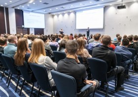
The Tasmanian Spatial Information Council (TASSIC) will hold a Geospatial Workforce Development Forum on 9 November 2023, to help shape the future of the geospatial sector in Tasmania.
The Forum will bring together key stakeholders from education, employers, government and suppliers to address critical challenges and opportunities facing the sector.
The Forum will include presentations from representatives of industry, government and the education sector, as follows:
- Paul Digney (Jacobs)
- Rob Rowell (Insight GIS)
- Ben Morris (Local Government Association of Tasmania)
- Michael Krome (Australian Spatial Analytics)
- Arco Lucieer (University of Tasmania)
- Sam Ebert (TAFE NSW)
- Troy Robbins (TasTAFE)
The event will conclude with a moderated discussion session led by Danika Bakalich (Geospatial Council of Australia).
The Forum will be a hybrid event with both in-person and online attendance options available, and it will employ the Menti-Meter program to facilitate discussions, ensuring that each delegate’s voice is heard and their input valued.
Image credit: ©stock.adobe.com/au/borisblik


