WHERE TO NEXT? LOCATION, HOW WE DRIVE OUR DIGITAL FUTURE
The Locate Conference (Locate19) will explore how geospatial science is underpinning the rapid changes we are experiencing now in the fourth industrial revolution. From advanced data capture techniques, positioning, data analytics, artificial intelligence to strategy and policy, Locate 19 will explore how surveying and spatial science is a core enabling technology of the digital age . From health care, transport, consumer experience through to environment, energy, water, resources and smart cities, Locate19 will uncover the geospatial technologies driving our digital future, identify new insights and better outcomes for your organisation.
INVITATION TO ATTEND
On behalf of the Locate Conferences Australia it is our pleasure to invite you to join us at the Locate19 Conference, 8 – 10 April in Melbourne, Victoria.
Consistently named at the top of the world’s most liveable cities lists, Melbourne is Australia’s home of sport, art, live music, theatres, education and more. The MCEC Conference venue is on the banks of the Yarra River, in the heart of the city – the perfect location for the premier conference of the surveying and spatial industries in Australia and New Zealand.
With a theme of “Where to next? How geospatial science is driving our digital future” this conference will have an engaging approach that will bring together innovative global leaders who will share their ideas, knowledge, and experiences on a wide range of subjects. Every year Locate sets and shares the future direction of the industry, and brings speakers together across the government, private, non-profit and academic sectors.
You will have an opportunity to network with colleagues from all corners of the globe, have direct access to vendors and subject matter experts in the Interactive Zone, see the newest technology, and be introduced to the newest ideas in the spatial sector.
We look forward in seeing you in Melbourne.
GLENN COCKERTON & KATE WILLIAMS, CO-CONVENORS

A panel of data and industry experts will examine changes to IP and copyright and the disruption of current business models that current and future technologies are creating, with an open discussion about governance considerations that may affect surveying businesses now and in the coming years. This will be an insightful, interesting and challenging discussion around how technology and big data are redefining business opportunities.
The speakers will be:
- Professor Kevin McDougall, Head of School, Civil Engineering and Surveying University of Queensland
- Rachel Sciascia, Partner, Gadens
- Nicole Stephensen, Principal Consultant, Ground Up Consulting Pty Ltd
- Adam Beck , Executive Director, Smart Cities Council Australia New Zealand Secretariat, Centre for Data Leadership
Image credit: ©stock.adobe.com/au/boreala

The Australian Association for Unmanned Systems’ ‘RPAS in Australian Skies 2022’ conference aims to continue discussion on the safe integration of RPAS into Australian airspace. It is supported by key government and industry participants and has established itself as a landmark event in the Australian RPAS calendar.
The 2022 themes will cover:
- Policy and Regulatory updates from the Department of Infrastructure, Transport, Regional Development and Communications, CASA, AirServices Australia and the Australian Defence Force relating to the use of emerging aviation technology in Australia.
- UAS Traffic Management (UTM), low level airspace, integrated airspace systems challenges and opportunities.
- Industry challenges and perspectives
- Continuing development of a professional and safe industry.
- ATSB RPAS data and trends
- Emerging technology and innovative solutions enabling integration or RPAS into Australian airspace.
- Future infrastructure requirements to enable drone delivery and advanced air mobility (AAM).
- Emerging RPAS and AAM applications – benefits, viability and social acceptance.
The conference will be a hybrid event incorporating face to face (live) and online (virtual) choices for participants. It will also include the AAUS Gala Dinner featuring the AAUS Industry Awards.

The 2022 SSSI Victorian Surveying & Spatial Summit and APSEA-V Dinner will take place on Thursday, 27 October 2022. It will be an opportunity for all Victorian surveying and spatial professionals to come together to learn, share and connect.
The event will feature an array of speakers, along with plenty of networking opportunities and the chance to see the latest products and services from local suppliers.
Image credit: ©stock.adobe.com/au/Wirestock

The 2023 Victorian Geospatial Conference & Awards Dinner be an opportunity for Victorian professionals of all geospatial disciplines to come together to learn, connect and share, and also celebrate local excellence with the awards dinner in the evening.
This year’s program will feature three concurrent streams covering GIS, data, cadastral surveying, digital twins, remote sensing and more.
The Victorian Geospatial Excellence Awards dinner will take place from 6.00pm, immediately following the conference.
Image credit: ©stock.adobe.com/au/ink drop

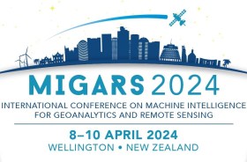
The International Association of the IEEE-Geoscience and Remote Sensing Society (GRSS), the IEEE-Computational Intelligence Society (CIS) and the local organising committee invite geospatial and computing professionals to attend the International Conference on Machine Intelligence for GeoAnalytics and Remote Sensing (MIGARS) to be held in Wellington, Aotearoa New Zealand in April 2024.
MIGARS aims to explore the interface of machine intelligence approaches with geosciences, spatial analytics, and remote sensing. With the tremendous developments in remote sensing technology, data acquisitions and sensing platforms, digital data have grown leaps and bounds to stream and are too big by volume, variety, and veracity. The challenge is handling, processing, and automating geo-data from various sources, such as multi-platform remote sensors and IoT devices, informing decision-making and monitoring our planet.
The conference will focus on connecting researchers from various disciplines, including computation/artificial intelligence, engineering, remote sensing, hydrology, agriculture and geosciences, and look for the potential use of intelligent computational approaches for geo-data-based applications and for serving society at large.


