Organised by OSGeo, this international annual gathering of location enthusiasts is the largest global gathering for geospatial software. Now in its 15th year, FOSS4G (ie. Free and Open Source Software for Geospatial) brings together developers, users, decision-makers and observers from a broad spectrum of organisations and fields of operation.
Through six days of workshops, presentations, discussions, and cooperation, FOSS4G participants create effective and relevant geospatial products, standards, and protocols. The 2021 event will be focused for the first time on South America and will be held with the close collaboration of the GeoLibres Association in Buenos Aires, Argentina.

In partnership with the Australian Space Agency, the Space Industry Association of Australia will host the Southern Space Symposium at the National Press Club in Canberra on 29-30 November 2021.
The Southern Space Symposium is the Australian space industry’s flagship annual conference, bringing together space industry experts and decision-makers from across Australia. At a pivotal moment, the Southern Space Symposium will this year bring space industry together with government and parliament for two days in Canberra to help shape the future agenda for Australian space’s aspirations.
Participants will include federal government departments and agencies, international agencies and missions, defence and space prime contractors, listed space companies, academic and research organisations, small and medium enterprises, space start-ups, and individual space professionals.

Join Bentley Systems at the launch of what it says is the industry’s most complete Survey and Site Design Solution ever offered to the ANZ market.
As technology advances and industry expectations increase, your software needs to keep pace with this ever-changing environment. In short, your software needs to deliver on today’s requirements and be ready for tomorrow’s challengers.
If you work in road design, site surveying, site development and related fields, this webinar is for you.
Throughout the launch, Bentley Systems will demonstrate traditional survey data capture capabilities, coupled with the latest mass data collection survey methods, including Total Station techniques, Point Cloud techniques and Digital Photogrammetry techniques.
Leveraging the above survey results, the launch will continue through a typical site design workflow, incorporating aspects such as:
- Terrain creation and analysis
- Urban road widening design
- Carpark and recreational area design
- Drainage and Utility design and analysis
- Plan production and digital model delivery
- Model visualisation
Air Inspect Australia will also be joining the webinar to share their insights and learnings of their project.
If you or your company perform any of the above-mentioned workflows, then this is one webinar you should not miss.

The 16th annual congress of the Open Source Geospatial Foundation, the non-profit organisation that supports and promotes the collaborative development of free and open source geographic technologies and open geospatial data, will be held in Florence, Italy, at the Palazzo dei Congressi, Palazzo degli Affari and the University of Florence.
FOSS4G (ie. Free and Open Source Software for Geospatial) brings together developers, users, decision-makers and observers from a broad spectrum of organisations and fields of operation.

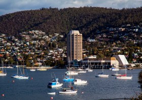
The 2022 Tasmania Surveying & Spatial Conference will be held on Friday, 2 September at Wrest Point in Hobart, and promises to be a fantastic opportunity to learn and network with SSSI members and the broader surveying and spatial community.
This year’s event will include a gala dinner, held in partnership with the University of Tasmania, to celebrate that institution’s 50 years in the field of surveying and spatial teaching.
In addition, the event will include the presentation of the 2022 Tasmanian Asia-Pacific Spatial Excellence Awards.
Image credit: ©stock.adobe.com/au/Norman

The 2023 Tasmanian Geospatial Conference & Awards Reception will be held at the Crowne Plaza in Hobart on 1 September 2023, where delegates will hear the latest news from across the local geospatial industry, including presentations on cadastral surveying, GIS, education and more.
Immediately following the conference will be the Geospatial Excellence Awards Reception, where all attendees will have the chance to enjoy drinks and canapes whilst networking and celebrating the local winners.
The full conference program is now available.
Image credit: ©stock.adobe.com/au/Norman


