About this Event
Everybody talks about UAV LiDAR – the engineer in planning, the forester involved in wood mass calculation, the construction companies taking part in large projects to model it before, during and after its implementation or the utility companies for their corridor mapping and infrastructures management.
Reasons enough for us to continue the Yellowscan Demo tour in Australia, under the motto « Measuring the world with UAV LiDAR ». The scope is to show this high tech tool in a real working environment and how easy it is to generate topographic data with UAV LiDAR.
During our tour you will learn about the latest solutions and use cases from YellowScan and its partners with lectures, workshops and open discussions.
We look forward to meeting you !
YellowScan will be demonstrating two systems:
– YellowScan Surveyor Ultra, the high density & long-range LiDAR solution for UAV. Thanks to its high density (600 000 shots per second), this turn-key fully autonomous system is ideally suited for high speed & long-range projects. Its light weight (1.7 kg battery included) makes it also easy to mount on any drone.
Ideal Use cases: Mining, Archeology, Powerlines.
Applanix APX-15 & Velodyne VLP-32 inside.
– YellowScan Vx-20, the high precision & long-range LiDAR solution for UAV. This system is ideally suited for long range survey needs advanced accuracy (2,5 cm) and precision (1 cm).
Ideal Use Cases: Civil engineering, Forestry
Applanix APX-20 & Riegl miniVUX inside.
LiDAR systems are renowned for under vegetation 3D modeling, and fast data processing.
Contact :
Contact us for any question at laure.fournier@yellowscan-lidar.com

During GEO Week 2021, the Group on Earth Observations will present the multidisciplinary activities of the GEO Work Programme that address policy agendas involved in the UN Framework Convention on Climate Change (UNFCCC) COP26, the Convention on Biological Diversity (CBD) COP15, the UN Decade of Ocean Science for Sustainable Development and the UN Decade of Ecosystem Restoration.
The online event will include the GEO-17 plenary, plus anchor and side events. Time will be scheduled each day for virtual networking. On Monday, November 22, the 56th Executive Committee will be held as a closed meeting.
Of particular importance will be the anchor events: These are the main events designed by GEO week 2021 organisers to explain the multidisciplinary nature of GEO through the concept of nexus thinking. Working on multiple topics simultaneously is essential in today’s rapidly changing environmental and social conditions. For example, work in one area will have a knock-on effect or impact in another area, such as the water, energy and food nexus. These events are linked to the global policy agendas that underpin most of GEO’s work.
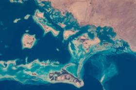
Image credit: NASA

Presented by the Space Industry Association of Australia, the Southern Space Symposium brings together space industry experts and decision-makers from across Australia.
This year’s Symposium will connect the space industry together with government and parliament for two days to help shape the future agenda of Australian space’s aspirations.
Participants will include federal government departments and agencies, international agencies and missions, defence and space prime contractors, listed space companies, academic and research organisations, small and medium enterprises, space start-ups and individual space professionals.

The Space & Geospatial Collaborative Workshop is being jointly hosted by the Andy Thomas Space Foundation and SSSI in Adelaide on 10 May 2023, in between the first 2023 Australian Space Forum and the Locate23 Conference.
This inter-disciplinary workshop will provide an opportunity for professionals from both space and spatial sectors to connect and discuss the increasing synergy and collaborative opportunities that have resulted from Australia’s renewed commitment to space technology development and the requirements and capabilities of the modern spatial information industry. The spatial professional has been an enduring end-user of space applications such as PNT (positioning, navigation and timing), EO (Earth observation) and telecommunications.

Hosted by the Riverina Eastern Regional Organisation of Councils and the Riverina Spatial Information Group, Mapped Out 2023 will bring together public- and private-sector professionals to learn about the latest geospatial developments.
Mapped Out will highlight the diversity of applications for spatial data, geographic information systems and their supporting technologies. Guest speakers with local and national experience will be showcasing the use of spatial data to enhance the operation and delivery of government services.
The Conference is a great opportunity for people working in regional NSW in both local government and the private sector to keep abreast of the latest technology and geographical information systems that can be utilised in their day-to-day work.


