Speaker:
Rebecca Price is the Principal Policy Officer, Land Management Policy | Energy, Environment and Climate Change at DELWP.
Rebecca will be presenting on the update of the Marine and Coastal Policy that was recently released. Join in the questions and answers after the presentation.
If you are involved in sea level implications from beach erosion, storm surges, the tidal interface, land tenure etc, don’t miss this webinar!
Second speaker to be announced.
Cost
Member FREE | Non-member $45
Contact

SSSI in conjunction with the Hunter Environmental Institute will present this webinar with three pre-eminent speakers:
Amy Steiger (Cardno)
Title: RPAS and thermal cameras for wildlife detection post-bushfire and coastal monitoring
Details: Amy has promoted the use of Remotely Piloted Aircraft Systems (RPAS) gaining experience with remote data capture to cover a range of coastal, environmental and land development applications.
RPAS thermal inspection capability was deployed this summer in wildlife detection post-bushfires.
Amy has also done volumetric surveys of beaches and flown isolated coastal cliff faces in NSW to capture high-resolution photography and derived photogrammetric models to identify geotechnical hazards and contribute to coastal monitoring.
Charity Mundava (WaterNSW)
Title: Remote Sensing in Water Management
Details: Charity will discuss the use of GIS and remote sensing to support water catchment management, feasibility and environmental studies for critical water infrastructure across the state and to support ongoing research into and management of river catchments. Charity will touch on the significance and spatial support for this in the recent NSW bushfires coordinating reservoir availability (in drought) and access for helicopter water drops and supporting bushfire fighting efforts.
Associate Professor In-Young Yeo (University of Newcastle)
Title: Remote sensing and GIS applications for water resources management
Details: Dr Yeo will explain how remote sensing can be used as a technique for assessing soil moisture using multi-source data fusion approaches, vegetation monitoring and water requirement with remote sensing and water balance approach.
She will explain the impacts of conservation management practices in agricultural catchments assessed using catchment model and remote sensing/GIS drawing on examples from Australian and American case studies
CPD Points
BOSSI CPD is 1 SP for this webinar.
Cost
As per details as follows
Contact
rom.nsw@sssi.org.au

Join us for the first session in our ‘Locate Connect’ online learning series! Hear from Scott Dewar, Director, Chris Hewett, Assistant Secretary GEOINT Capability and Development & Phil Shears, Director DEF799 Phase 2.
In this session from 1300 – 1400, the Australian Geospatial-Intelligence Organisation (AGO) will be launching the Defence Geospatial-Intelligence (GEOINT) Strategy, a document that addresses how the Defence GEOINT Community will transform to meet the future needs of the Australian Defence Force. The AGO Executive will also provide an update on their GEOINT projects and announce upcoming opportunities for industry and discuss how the COVID-19 pandemic has impacted the organisation.
Then from 1430 – 1545, AGO, along with Frontier SI will describe how The Analytics Lab Program (AGO Labs) fits into the bigger picture of AGO capability and summarise the outcomes of their 2019 activities. AGO Labs, coordinated through FrontierSI, is investigating a number of ways to better engage and work with industry. Specifically, the AGO is keen to attract a wider pool of companies and technologies to draw on for automated geospatial intelligence. The primary focus of this program is to address AGO capability challenges through a small number of short-term industry projects, with a focus on machine learning and analytics for producing automated imagery analysis, including automated object classification. AGO will announce a new 2020 program of challenges hoping to find innovative solutions through their partnership with FrontierSI.

The Three Day Mini-Conference will be delivered in July, with 21 speakers over 3 days and taking place for 2 hours late in the afternoon. This exciting event will feature highly anticipated keynote speakers such as Bruce Thompson, Dr Karen Joyce and Nyall Dawson covering topics such as smart cities, surveying, sustainable development objectives, key projects and much, much more.
Wednesday 8 July – Friday 10 July 2020 – 1530 – 1730
Program: Download the program HERE
Cost: $90 – Mini-Conference attendee
Full access to all 3 days of the Mini-Conference, and access to the recording post-event

BEYOND THE 2026 AGENDA
The presentation will focus on a major initiative called the 2030 Space and Spatial Industry Growth Roadmap. The Government has set three key objectives for the space industry by 2030; 20,000 new jobs, $12B additional contribution to GDP and an extra one billion dollars into the investment pipeline. The combination of space and spatial working together will make a great contribution to meeting these targets. The space industry sets up critical elements of the communications supply chains (satcoms) together with content (GNSS and EO). The spatial industry provides the vast bulk of the data infrastructure, value-added content and analytics, and the ‘last yard’ delivery channels to customers. Getting this ecosystem right creates a premium competitive advantage for Australia and greatly strengthens our sovereignty and security. The presentation will discuss the next steps in the development of the roadmap; the development of a white paper which sets out the critical issues, the creation of an ecosystem map will help identify key areas for investment, and a risk analysis that will set out Australia’s critical dependence on space based assets and the steps we can take as a nation to improve our resilience, and sovereignty over, these assets. It will also provide an update on the latest developments of the 2026 Spatial Industry Transformation and Growth Agenda and how this initiative will contribute to the roadmap.

The 42nd Canadian Symposium on Remote Sensing will be a virtual event that will bring together academics, practitioners, vendors and policymakers from the remote sensing community in an informative and productive four-day event under the theme of Understanding Our World: Remote Sensing For A Sustainable Future. It fill have special sessions, general sessions, keynotes, panel discussions and workshops featuring speakers from around the world. Attendees will enjoy both technical sessions and networking opportunities online.

The Space & Geospatial Collaborative Workshop will be jointly hosted by the Andy Thomas Space Foundation and the Surveying and Spatial Sciences Institute in Adelaide the day following the 12th Australian Space Forum and the day before Spatial Information Day.
This inter-disciplinary workshop will provide a unique opportunity for professionals from both space and spatial sectors to:
- Learn about Australia’s renewed commitment to space technology development
- Get updates on the requirements and capabilities of the modern spatial information industry using applications such as PNT (positioning, navigation and timing), EO (Earth Observation) and telecommunications
- Connect and discuss the increasing synergy and collaborative opportunities between the two sectors.

The Andy Thomas Space Foundation is looking forward to welcoming a global audience to the 14th Australian Space Forum, which will be held on Tuesday, 25 October 2022 at the Adelaide Convention Centre in South Australia.
Supported by the Australian Space Agency, the South Australian Space Industry Centre and SmartSat CRC, the Forum will provide an opportunity to stimulate ideas, share information about emerging technologies and network with influential space sector leaders and the broader community.
Participants can attend in-person, or virtually through the event’s global interactive platform.
Forum sessions will include international panels covering highly pertinent topics that shape our industry:
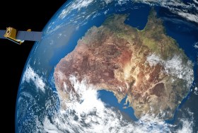
Earth Observation: The National Space Mission for Earth Observation is a major investment that will expand Australia’s capability in designing, manufacturing and operating space- and ground-based systems.
Optical Communications: A quantum leap in Australia’s secure and high-bandwidth communications to connect the world and beyond.
Foundation Services Rover: Exploring remote operations and autonomous systems by building on Australian expertise in the resources and mining sectors for the collection of lunar soil (regolith).

Each year, the Locate conference attracts hundreds of national and international delegates from within and outside the spatial and surveying industry.
As Australia’s premier spatial and surveying conference, Locate provides guests with a unique opportunity to learn about the latest trends and applications in geospatial technologies.
Are you passionate about our industry and want to get involved? Maybe you have an idea for a local tour, or a project site visit or even have another event that can run in conjunction with Locate. This is your opportunity to help shape the 2023 event — no idea is too big or too small. Reach out to the organisers via info@locateconference.com or +61 2 4319 8519.

SmartSat partners, participants, students and staff are invited to come together to share their research outcomes and network with industry colleagues at the SmartSat CRC Conference 2023.
The SmartSat CRC is a consortium of universities and other research organisations, partnered with industry that has been funded by the Australian Government to develop know-how and technologies in advanced telecommunications and IoT connectivity, intelligent satellite systems and Earth observation next generation data services.
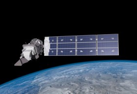
Landsat image courtesy NASA/GSFC


