SSSI in conjunction with the Hunter Environmental Institute will present this webinar with three pre-eminent speakers:
Amy Steiger (Cardno)
Title: RPAS and thermal cameras for wildlife detection post-bushfire and coastal monitoring
Details: Amy has promoted the use of Remotely Piloted Aircraft Systems (RPAS) gaining experience with remote data capture to cover a range of coastal, environmental and land development applications.
RPAS thermal inspection capability was deployed this summer in wildlife detection post-bushfires.
Amy has also done volumetric surveys of beaches and flown isolated coastal cliff faces in NSW to capture high-resolution photography and derived photogrammetric models to identify geotechnical hazards and contribute to coastal monitoring.
Charity Mundava (WaterNSW)
Title: Remote Sensing in Water Management
Details: Charity will discuss the use of GIS and remote sensing to support water catchment management, feasibility and environmental studies for critical water infrastructure across the state and to support ongoing research into and management of river catchments. Charity will touch on the significance and spatial support for this in the recent NSW bushfires coordinating reservoir availability (in drought) and access for helicopter water drops and supporting bushfire fighting efforts.
Associate Professor In-Young Yeo (University of Newcastle)
Title: Remote sensing and GIS applications for water resources management
Details: Dr Yeo will explain how remote sensing can be used as a technique for assessing soil moisture using multi-source data fusion approaches, vegetation monitoring and water requirement with remote sensing and water balance approach.
She will explain the impacts of conservation management practices in agricultural catchments assessed using catchment model and remote sensing/GIS drawing on examples from Australian and American case studies
CPD Points
BOSSI CPD is 1 SP for this webinar.
Cost
As per details as follows
Contact
rom.nsw@sssi.org.au

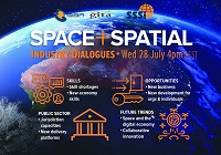
During 2020 an expert group drafted the SPACE+SPATIAL Industry Growth Roadmap 2030 – a national snapshot for Australian professionals to better understand the bold new future that’s rapidly approaching and what it means for them, their careers, their organisations and all of Australia.
The National Steering Committee is seeking feedback on the Roadmap from spatial professionals of all levels across the country. There are a number of ways to get involved, one of which is to participate in this SSSI and SIBA|GITA SPACE+SPATIAL Roadmap Online Session.
You will hear about the key plans, activities and issues and have the opportunity to have a meaningful discussion with colleagues about your thoughts on the Roadmap Consultation Paper and the topic in general.

Join Bentley Systems at the launch of what it says is the industry’s most complete Survey and Site Design Solution ever offered to the ANZ market.
As technology advances and industry expectations increase, your software needs to keep pace with this ever-changing environment. In short, your software needs to deliver on today’s requirements and be ready for tomorrow’s challengers.
If you work in road design, site surveying, site development and related fields, this webinar is for you.
Throughout the launch, Bentley Systems will demonstrate traditional survey data capture capabilities, coupled with the latest mass data collection survey methods, including Total Station techniques, Point Cloud techniques and Digital Photogrammetry techniques.
Leveraging the above survey results, the launch will continue through a typical site design workflow, incorporating aspects such as:
- Terrain creation and analysis
- Urban road widening design
- Carpark and recreational area design
- Drainage and Utility design and analysis
- Plan production and digital model delivery
- Model visualisation
Air Inspect Australia will also be joining the webinar to share their insights and learnings of their project.
If you or your company perform any of the above-mentioned workflows, then this is one webinar you should not miss.

The presenters for this topical webinar will be Dr Craig Roberts, Senior Lecturer in Surveying/GPS/Geodesy at UNSW and Wayne Patterson Director, Spatial Operations at the NSW Department of Customer Service.
Roberts will give a short update on the revision of the Australian Standard, AS_5488 Classification of subsurface utility information in the context of datum modernisation, low-cost multi-GNSS and recent advances in positioning infrastructure in Australia.
Data storage, data distribution and security are identified as challenges suggesting a reimagined data governance will be needed. Could a spatial digital twin assist? What is a spatial digital twin? Is it a BIM? Where does it come from? What is an open data policy? Who can use it? Can I use it? Which datum? How accurate is the data?
Rather than just another PowerPoint webinar, Roberts will interview Patterson in a free-flowing format. Attendees will be invited to ask their own questions live in the chat as the conversation evolves.
This webinar is targeted at surveyors, geospatial users, students and the wider spatial community.


