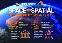
During 2020 an expert group drafted the SPACE+SPATIAL Industry Growth Roadmap 2030 – a national snapshot for Australian professionals to better understand the bold new future that’s rapidly approaching and what it means for them, their careers, their organisations and all of Australia.
The National Steering Committee is seeking feedback on the Roadmap from spatial professionals of all levels across the country. There are a number of ways to get involved, one of which is to participate in this SSSI and SIBA|GITA SPACE+SPATIAL Roadmap Online Session.
You will hear about the key plans, activities and issues and have the opportunity to have a meaningful discussion with colleagues about your thoughts on the Roadmap Consultation Paper and the topic in general.

The International Cartographic Association (ICA) Commission on Atlases, the ICA Commission on Map Design, the Joint ICA-IGU Commission on Toponymy, the National Geographic Institute of Spain (IGN) and the Spanish Society for Cartography, Photogrammetry and Remote Sensing (SECFT) will jointly host a conference on atlases, toponymy and map design in Madrid.
During six sessions of four presentations each, questions concerning evolving dissemination concepts and techniques for atlases, recent development and examples of national atlases as well as important map design and toponomastic issues in atlas production will be discussed.
The theme of the event will be ‘Atlases in time’. Presentations will be held in a 20-minute format of 15 minutes presenting and 5 minutes discussion.

The International Society for Photogrammetry and Remote Sensing (ISPRS) will hold its 2022 congress in Nice, France, in June 2022. The event will be hosted by the French Society for Photogrammetry and Remote Sensing.
A wide-ranging program has been put together, and it includes a host of leading speakers, such as Australia’s Professor Sisi Zlatanova from the University of South Wales. More than 1500 papers will be presented in the various scientific tracks and sessions over the week. In addition to these presentations, participants will also have the chance to interact and network face-to-face with the authors in poster sessions.
In order to help the registered participants to choose the sessions and the presentations to build their own program during the week, pre-recorded video presentations of the papers will made accessible before the beginning of the event through the digital platform of this event.
The Congress will have a strong technology track, with a large exhibition space that will gather the major players of the geospatial business. A geospatial prospective forum will also address hot topics of our community in order to draw recommendations.
The deadline for both full papers and abstracts is January 10, 2022.

INTERGEO returns for 2023 with the motto, ‘Inspiration for a smarter world,’ with the event this year also incorporating the German Cartography Congress.
The conference and exhibition will cover the topics of geoinformation, geodesy, land management, Earth observation, urban planning, disaster prevention, environmental protection and energy efficiency, while tackling challenges such as the climate crisis, urbanisation and securing resources.
This year, there will be a special emphasis on drone technologies and BIM.

Hosted by Eric Andelin CP, Senior Workflow Specialist with guest speaker Michael O’Sullivan, VP Sales, SimActive Inc.
It is often challenging for new entrants into the aerial imagery and mapping service profession to determine cost savings when it comes to their processing software solution. Smaller sensors, altitude restrictions, line of sight requirements and overall flight duration create unique challenges for drone operators. Medium and large format sensors acquire much larger areas, but require a much larger investment, or the ability to subcontract out the acquisition. Mapping expenses tend to increase as projects become larger. And using the wrong image processing software can exacerbate this, leading to narrowing project profits. This webinar will show how a higher-end software such as SimActive’s Correlator3D™ can reduce overall project costs. REGISTER HERE.
Specifically, attendees will learn about the following:
- Common challenges and impact on costs
- Cost variations as projects increase in size
- Workflows in Correlator3D to minimize man-hours
- Accelerating timelines with distributed processing
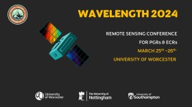
The Wavelength meeting was launched in 2013 for PhD students and early career researchers, addressing the demand for representation of new professionals as well as students from RSPSoc — the UK society for remote sensing and photogrammetry science.
Every year, Wavelength gathers participants from student and early career levels, as well as senior members and individuals within academia and business. The conference offers a setting to present student and EC work and meet new, like-minded contacts.
The 2024 conference will be run in a hybrid format, to accommodate those who can and those who cannot travel to Worcester.

The 4th International Symposium on Applied Geoinformatics (ISAG2024), which will take place at the Wroclaw University of Science and Technology, Wroclaw, Poland, on 9 and 10 May 2024. ISAG2024 is jointly organised by the Department of Geomatics Engineering, Yildiz Technical University, Istanbul, Türkiye, Wroclaw University of Science and Technology, Wroclaw, Poland and Technical University of Crete, Chania, Crete, Greece.
The aim of the 4th ISAG is to bring scientists, engineers and industry researchers together to exchange and share their experiences and research results and discuss the practical challenges encountered and the solutions adopted in geoinformatics.
Topics to be covered include recent advances in AI, satellite imagery, advanced remote sensing, photogrammetry, image processing, global navigation satellite systems, height systems, terrestrial laser scanning, GIS, smart cities and land management.

The ISPRS Technical Commission II ‘Photogrammetry’ focuses, at various scales, on geometric, radiometric and multi-temporal aspects of the image- and range-based 3D surveying, mapping and modelling in the age of AI and mixed reality.
The organisers of the June 2024 Symposium welcome researchers, practitioners and companies involved in photogrammetry and computer vision to present and discuss their results with a broader audience. The Symposium will feature four days of plenary and keynote talks, along with parallel sessions of oral and poster presentations from academia and industry.
The symposium’s theme is ‘The Role of Photogrammetry for a Sustainable World,’ emphasising machine learning and mixed reality. The event is being organised in collaboration with ASPRS (American Society of Photogrammetry and Remote Sensing) and SGPF (Swiss Society of Photogrammetry and Remote Sensing).
Image credit: ©stock.adobe.com/au/Lifes_Sunday


