Did you know Australia is located on one of the Earth’s most rapidly moving tectonic plates? Resulting in Australia moving seven centimetres north-east per year!
Australian Government departments and private sector organisations are now contemplating their game plan for the migration of GDA94 to GDA2020. This data implementation is important for organisations that want to take advantage of having sub-decimetre coordinate accuracy when capturing high accuracy data.

Here at 1Spatial, we continue to work with customers across a range of diverse sectors delivering exciting and challenging projects that deliver new tools and platforms for managing their data. We have worked on projects with different customers to manage and track the transition to GDA2020- enabling users to migrate their data to the new datum.
During the session, we will hear from the latest case studies to help you understand the requirements needed to replace GDA94 with the new GDA2020.
Agenda:
- Opening intro – Andrej Mocicka
- Case Study – Whittlesea Council
- Case Study – Bayside Council
- Open Q & A with guest presenter Richard Stanaway from Quick Close
Join our webinar to learn how these organisations migrate their data to this new datum!
In the meantime, if you have any technical questions you would like answered during our session, send us an email sales.australia@1spatial.com and we’ll be sure to cover it.

Organised by OSGeo, this international annual gathering of location enthusiasts is the largest global gathering for geospatial software. Now in its 15th year, FOSS4G (ie. Free and Open Source Software for Geospatial) brings together developers, users, decision-makers and observers from a broad spectrum of organisations and fields of operation.
Through six days of workshops, presentations, discussions, and cooperation, FOSS4G participants create effective and relevant geospatial products, standards, and protocols. The 2021 event will be focused for the first time on South America and will be held with the close collaboration of the GeoLibres Association in Buenos Aires, Argentina.

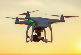
The World of Drones & Robotics Congress 2021 (WoDaRC) will be held at the Brisbane Convention and Exhibition Centre on 15 and 16 November 2021. Like last year, it will be presented in a hybrid format, providing in-person physical participation for those able to attend in Brisbane and a high-quality digital experience for those who cannot.
Due to additional companies seeking display space, WoDaRC has moved to a larger space (the Boulevard Auditorium) within the Brisbane Convention and Exhibition Centre. The Auditorium will also cater to larger numbers and provide increased social distancing for all those attending sessions.
Physical and virtual registration options are available. Al registration options, physical and digital, include access to all congress sessions for six months post-event on an on-demand basis via the WoDaRC viewer portal.
Image credit: ©stock.adobe.com/au/ValentinValkov

The Australian Association for Unmanned Systems’ ‘RPAS in Australian Skies 2022’ conference aims to continue discussion on the safe integration of RPAS into Australian airspace. It is supported by key government and industry participants and has established itself as a landmark event in the Australian RPAS calendar.
The 2022 themes will cover:
- Policy and Regulatory updates from the Department of Infrastructure, Transport, Regional Development and Communications, CASA, AirServices Australia and the Australian Defence Force relating to the use of emerging aviation technology in Australia.
- UAS Traffic Management (UTM), low level airspace, integrated airspace systems challenges and opportunities.
- Industry challenges and perspectives
- Continuing development of a professional and safe industry.
- ATSB RPAS data and trends
- Emerging technology and innovative solutions enabling integration or RPAS into Australian airspace.
- Future infrastructure requirements to enable drone delivery and advanced air mobility (AAM).
- Emerging RPAS and AAM applications – benefits, viability and social acceptance.
The conference will be a hybrid event incorporating face to face (live) and online (virtual) choices for participants. It will also include the AAUS Gala Dinner featuring the AAUS Industry Awards.

The ROTORTECH 2022 Helicopter and Unmanned Flight Exposition is the premier industry event for the Helicopter/Rotary Wing and RPAS/UAV/eVTOL community in Australia, New Zealand and the Indo-Asia-Pacific region.
The event provides a vital interface between industry, regulators and government, including:
- Operations and safety presentations
- Industry conferences
- Industry exposition showcasing the products and services of helicopter and unmanned flight related companies
ROTORTECH 2022 will host conferences by the Australian Helicopter Industry Association (AHIA) and Australian Association for Uncrewed Systems (AAUS) and feature presentations by key rotary and unmanned systems industry experts from Australia and the Indo-Asia-Pacific region.

The 16th annual congress of the Open Source Geospatial Foundation, the non-profit organisation that supports and promotes the collaborative development of free and open source geographic technologies and open geospatial data, will be held in Florence, Italy, at the Palazzo dei Congressi, Palazzo degli Affari and the University of Florence.
FOSS4G (ie. Free and Open Source Software for Geospatial) brings together developers, users, decision-makers and observers from a broad spectrum of organisations and fields of operation.

Commercial UAV Expo, September 6-8 in Las Vegas is the premier event for the commercial drone industry focusing on the integration/operation of commercial UAS.
The event will feature exhibits and demonstrations by UAS solutions providers; keynotes, panel discussions, and presentations with interactive Q&A and chat; AI-powered networking; and more.
Industries covered include Construction; Drone Delivery; Energy & Utilities; Forestry & Agriculture; Infrastructure & Transportation; Mining & Aggregates; Public Safety & Emergency Services; Security; and Surveying & Mapping. It is presented by Commercial UAV News and organised by Diversified Communications.
Use code SAVE100 for a US$100 discount and/or FREE expo admission.

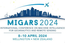
The International Association of the IEEE-Geoscience and Remote Sensing Society (GRSS), the IEEE-Computational Intelligence Society (CIS) and the local organising committee invite geospatial and computing professionals to attend the International Conference on Machine Intelligence for GeoAnalytics and Remote Sensing (MIGARS) to be held in Wellington, Aotearoa New Zealand in April 2024.
MIGARS aims to explore the interface of machine intelligence approaches with geosciences, spatial analytics, and remote sensing. With the tremendous developments in remote sensing technology, data acquisitions and sensing platforms, digital data have grown leaps and bounds to stream and are too big by volume, variety, and veracity. The challenge is handling, processing, and automating geo-data from various sources, such as multi-platform remote sensors and IoT devices, informing decision-making and monitoring our planet.
The conference will focus on connecting researchers from various disciplines, including computation/artificial intelligence, engineering, remote sensing, hydrology, agriculture and geosciences, and look for the potential use of intelligent computational approaches for geo-data-based applications and for serving society at large.

The 4th International Symposium on Applied Geoinformatics (ISAG2024), which will take place at the Wroclaw University of Science and Technology, Wroclaw, Poland, on 9 and 10 May 2024. ISAG2024 is jointly organised by the Department of Geomatics Engineering, Yildiz Technical University, Istanbul, Türkiye, Wroclaw University of Science and Technology, Wroclaw, Poland and Technical University of Crete, Chania, Crete, Greece.
The aim of the 4th ISAG is to bring scientists, engineers and industry researchers together to exchange and share their experiences and research results and discuss the practical challenges encountered and the solutions adopted in geoinformatics.
Topics to be covered include recent advances in AI, satellite imagery, advanced remote sensing, photogrammetry, image processing, global navigation satellite systems, height systems, terrestrial laser scanning, GIS, smart cities and land management.


