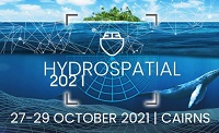
The Australasian Hydrographic Society’s HydroSpatial2021 Conference will focus on how hydrography will develop in the future, noting the development of ‘digital twinning’ and the emerging name variants for hydrography such as ‘hydrospatial’ or ‘hydrogeomatics’.
The conference theme, Hydrography of the Future, morphs two modern yet wide-ranging aspects of the hydrographic surveying profession, and should draw papers from relevant scientific, technological, operational and environmental communities. The aim is to provide delegates with valuable insights, creative ideas and inspiration on how to harness current and future technologies, systems and processes so that they can deal with present challenges and prepare for a more sustainable future.

FIRA is a leading global event series, which this year is focused on the new era of robotics in agriculture and the huge impact it will have on the whole value chain. For the sixth year running, FIRA will be a hybrid in-person/online event, and is expected to attract 3000-plus attendees from around the world, including robot manufacturers, agricultural businesses, producers, investors, suppliers and entrepreneurs.

The Australian Association for Unmanned Systems’ ‘RPAS in Australian Skies 2022’ conference aims to continue discussion on the safe integration of RPAS into Australian airspace. It is supported by key government and industry participants and has established itself as a landmark event in the Australian RPAS calendar.
The 2022 themes will cover:
- Policy and Regulatory updates from the Department of Infrastructure, Transport, Regional Development and Communications, CASA, AirServices Australia and the Australian Defence Force relating to the use of emerging aviation technology in Australia.
- UAS Traffic Management (UTM), low level airspace, integrated airspace systems challenges and opportunities.
- Industry challenges and perspectives
- Continuing development of a professional and safe industry.
- ATSB RPAS data and trends
- Emerging technology and innovative solutions enabling integration or RPAS into Australian airspace.
- Future infrastructure requirements to enable drone delivery and advanced air mobility (AAM).
- Emerging RPAS and AAM applications – benefits, viability and social acceptance.
The conference will be a hybrid event incorporating face to face (live) and online (virtual) choices for participants. It will also include the AAUS Gala Dinner featuring the AAUS Industry Awards.

Hosted by Eric Andelin CP, Senior Workflow Specialist with guest speaker Michael O’Sullivan, VP Sales, SimActive Inc.
It is often challenging for new entrants into the aerial imagery and mapping service profession to determine cost savings when it comes to their processing software solution. Smaller sensors, altitude restrictions, line of sight requirements and overall flight duration create unique challenges for drone operators. Medium and large format sensors acquire much larger areas, but require a much larger investment, or the ability to subcontract out the acquisition. Mapping expenses tend to increase as projects become larger. And using the wrong image processing software can exacerbate this, leading to narrowing project profits. This webinar will show how a higher-end software such as SimActive’s Correlator3D™ can reduce overall project costs. REGISTER HERE.
Specifically, attendees will learn about the following:
- Common challenges and impact on costs
- Cost variations as projects increase in size
- Workflows in Correlator3D to minimize man-hours
- Accelerating timelines with distributed processing


