
Eugene Lamnek created GeoIT Solutions in 2002, and has been developing ArcGIS customizations, add-ins and applications ever since. In this time Eugene has developed numerous bushfire applications for the CFS and the CFA as well as water and wastewater modelling software, asset management applications and interfaces, and open source applications for numerous clients including SA Water, Santos and DEW.
The Treatment Reporting System (TRS) currently in pilot phase, will allow organisations to store and manage their bushfire mitigation tasks, as well as measuring these tasks against the requirements of the Bushfire Management Area Plans (BMAPs). The system will allow users to store bushfire mitigation tasks, their spatial extent, values of work, time of work and completion status. Tasks are mapped and measured against required actions, defined by within the CFS BMAPs. The TRS will provide an effective mechanism for reporting the adequacy of on ground mitigation work (potentially at a State-wide level) by measuring mitigation work against well-defined mitigation targets. Users of the system will include local government, state government, private organisations and potentially even individual landholders.
Venue
Zoom Webinars
Cost
SSSI Members $30 | Non-Members $45 | SSSI YPs $20 | SSSI Student Members FREE
Contact
SSSI South Australia | rom.sa@sssi.org.au | 08 8212 0359

Are you a young surveyor and always wondered what the digital frontier of the profession looked like? Are you mid career but developed foundation skills but have not yet ventured into the digital data part of the discipline? Are you a seasoned professional who loves to see what amazing things you can do with the tools and technologies of the 21st century?
If you answered yes to any of those questions then this is a webinar you won’t want to miss!
Michael Finlay is a Geospatial Engineer who specialises in 3D laser scanning and point cloud technologies. He is an early career professional who has been working at Jacobs for 8 years and is passionate about all things 3D laser scanning, especially mobile laser scanning (MLS). Michael is a trail blazer in developing the digital data team and discipline at Jacobs as not only a real value add, efficiency but product and service enricher for the surveying team. He gets involved with the planning, scanning, processing, adjusting, classifying, extracting, automation, analysis, visualisation and supports the interfaces of surveying and digital engineering and GIS environments for stakeholders from a broad variety of disciplines.
Check out Michael’s profile to see some of the amazing projects he has been involved in and how he champions this modern digital space for surveying and geospatial engineers.
Registration
By registering below, you receive access to the watch the webinar live OR if you can’t watch it live, you receive the link to the recording 24 hours after the event date. You can then watch the recording at your leisure.
CPD
This event is worth one SSSI CPD Point. BOSSI points to be confirmed.
Note, only the individual registered for the event is entitled to receive the associated CPD points.
Contact
Katie Le Miere, National Events Manager
katie.lemiere@sssi.org.au
The Advancing Earth Observation Forum 2021 is a new, completely online, single-day event, focused on high-value sessions that will give members of the EO community the opportunity to actively engage, contribute, learn and connect with others. This will be a chance for individuals, businesses and organisations to build professional expertise and contribute to Australia’s collective national capabilities.
The 2021 event will be followed by monthly webinars from September 2021 to June 2022 and an in-person and interactive Advancing Earth Observation Forum that will take place in Brisbane in August 2022.
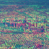
The Future of Place Summit aims to be a day filled with critical discussion, knowledge sharing and networking around the intersection of people, place technology and data.
The event will focus on four themes:
- Designing for digital lifestyles — A new human-centred planning approach
- From precinct plans to development reality — The evolving digital and data DNA of urban growth
- Data-inspired discussions — Tapping into the real voice of the community
- Streets reimagined — The digital backbone for better experiences
Delegates can take part in person or via Zoom.
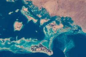
During GEO Week 2021, the Group on Earth Observations will present the multidisciplinary activities of the GEO Work Programme that address policy agendas involved in the UN Framework Convention on Climate Change (UNFCCC) COP26, the Convention on Biological Diversity (CBD) COP15, the UN Decade of Ocean Science for Sustainable Development and the UN Decade of Ecosystem Restoration.
The online event will include the GEO-17 plenary, plus anchor and side events. Time will be scheduled each day for virtual networking. On Monday, November 22, the 56th Executive Committee will be held as a closed meeting.
Of particular importance will be the anchor events: These are the main events designed by GEO week 2021 organisers to explain the multidisciplinary nature of GEO through the concept of nexus thinking. Working on multiple topics simultaneously is essential in today’s rapidly changing environmental and social conditions. For example, work in one area will have a knock-on effect or impact in another area, such as the water, energy and food nexus. These events are linked to the global policy agendas that underpin most of GEO’s work.
Image credit: NASA
Advancing Earth Observation Forum 2022 will be a face-to-face, fully interactive forum. It will host user, industry, government, research and technical focused plenaries and interactive panels, poster and workshop sessions to interest and engage end-users, industry, researchers, government, analysts, start-up companies, educators and students.

Smart Cities Week Australia and New Zealand 2022 will bring together the who’s-who in smart cities, digital twins and future-of-place thought leadership in an energising, open dialogue on how to leverage technology to deliver better quality of life for citizens.
Smart Cities Week offers sessions designed to bring demand and supply side stakeholders together in a way that incubates business opportunities and incubates the smart cities investment pipeline.
This year, the event will be delivered in conjunction with Digital Twin Week, known as the premier platform for showcasing, exchanging and networking around all things Digital Twin in the built and natural environment. The event will offer a series of opportunities to connect and gain information and insights on Digital Twin activity, policy and practice from government and industry leaders.
Leading the line-up for the 2022 event is Platinum event sponsor, Amazon Web Services, who will offer attendees a look at AWS-powered twin cities, and how towns, regions and cities, can use cloud benefits, technology and support, to realise their local planning vision.
Image credit: ©stock.adobe.com/au/Blue Planet Studio
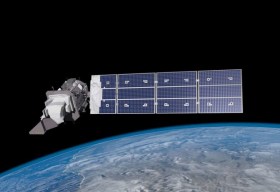
SmartSat partners, participants, students and staff are invited to come together to share their research outcomes and network with industry colleagues at the SmartSat CRC Conference 2023.
The SmartSat CRC is a consortium of universities and other research organisations, partnered with industry that has been funded by the Australian Government to develop know-how and technologies in advanced telecommunications and IoT connectivity, intelligent satellite systems and Earth observation next generation data services.
Landsat image courtesy NASA/GSFC

The Indo-Pacific Space & Earth Conference will delve into technologies that can be applied both on Earth and in space — from AI and robotics to remote operations. All industries from mining, oil and gas, agriculture, medicine and more can benefit from investing resources into these technologies.
Supported by key industry players and the government, the goal of the conference is to bring everyone together to discover new innovations and capabilities to create future opportunities.
Image credit: ©stock.adobe.com/au/MclittleStock


