Learn how to ‘geo-enlighten your organisation’ at Directions LIVE 2016.
This year’s roadshow will highlight how you can extend the benefits of geospatial technology throughout your entire business – to streamline workflows and maximise your return on investment.
Discover how to further leverage the ArcGIS platform’s spatial analysis capabilities and see how this technology gives your organisation the competitive edge.
At Directions LIVE 2016, you will learn the benefits of working with 3D and 4D data, how to select the perfect app to tackle any challenge, and how ArcGIS Pro complements ArcMap functionality.
We will also be showcasing the innovative ways local organisations are improving operational efficiency with GIS technology.
Directions LIVE is free for Esri users – with light lunch provided.
Register today to join our team of ArcGIS experts and your local GIS user community, and learn how to unlock the full potential of the platform – the market’s only complete GIS solution.

During 2020 an expert group drafted the SPACE+SPATIAL Industry Growth Roadmap 2030 – a national snapshot for Australian professionals to better understand the bold new future that’s rapidly approaching and what it means for them, their careers, their organisations and all of Australia.
The National Steering Committee is seeking feedback on the Roadmap from spatial professionals of all levels across the country. There are a number of ways to get involved, one of which is to participate in this SSSI and SIBA|GITA SPACE+SPATIAL Roadmap Online Session.
You will hear about the key plans, activities and issues and have the opportunity to have a meaningful discussion with colleagues about your thoughts on the Roadmap Consultation Paper and the topic in general.

The Future of Place Summit aims to be a day filled with critical discussion, knowledge sharing and networking around the intersection of people, place technology and data.
The event will focus on four themes:
- Designing for digital lifestyles — A new human-centred planning approach
- From precinct plans to development reality — The evolving digital and data DNA of urban growth
- Data-inspired discussions — Tapping into the real voice of the community
- Streets reimagined — The digital backbone for better experiences
Delegates can take part in person or via Zoom.

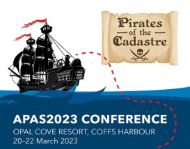
The Association of Public Authority Surveyors, NSW (APAS) annual conference for 2023 will be held at Opal Cove Resort in Coffs Harbour, from 20 to 22 March 2023.
The theme for the event will the ‘Pirates of the Cadastre’. The program is being developed, with a call for abstracts currently in place (as of June 2022).
Important dates and deadlines to note, are:
- Abstract submission deadline: Friday, 23 September 2022
- Draft paper deadline: Friday, 18 November 2022
- Final paper deadline: Friday, 20 January 2023


