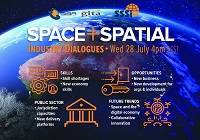
During 2020 an expert group drafted the SPACE+SPATIAL Industry Growth Roadmap 2030 – a national snapshot for Australian professionals to better understand the bold new future that’s rapidly approaching and what it means for them, their careers, their organisations and all of Australia.
The National Steering Committee is seeking feedback on the Roadmap from spatial professionals of all levels across the country. There are a number of ways to get involved, one of which is to participate in this SSSI and SIBA|GITA SPACE+SPATIAL Roadmap Online Session.
You will hear about the key plans, activities and issues and have the opportunity to have a meaningful discussion with colleagues about your thoughts on the Roadmap Consultation Paper and the topic in general.

A panel of data and industry experts will examine changes to IP and copyright and the disruption of current business models that current and future technologies are creating, with an open discussion about governance considerations that may affect surveying businesses now and in the coming years. This will be an insightful, interesting and challenging discussion around how technology and big data are redefining business opportunities.
The speakers will be:
- Professor Kevin McDougall, Head of School, Civil Engineering and Surveying University of Queensland
- Rachel Sciascia, Partner, Gadens
- Nicole Stephensen, Principal Consultant, Ground Up Consulting Pty Ltd
- Adam Beck , Executive Director, Smart Cities Council Australia New Zealand Secretariat, Centre for Data Leadership
Image credit: ©stock.adobe.com/au/boreala
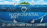
The Australasian Hydrographic Society’s HydroSpatial2021 Conference will focus on how hydrography will develop in the future, noting the development of ‘digital twinning’ and the emerging name variants for hydrography such as ‘hydrospatial’ or ‘hydrogeomatics’.
The conference theme, Hydrography of the Future, morphs two modern yet wide-ranging aspects of the hydrographic surveying profession, and should draw papers from relevant scientific, technological, operational and environmental communities. The aim is to provide delegates with valuable insights, creative ideas and inspiration on how to harness current and future technologies, systems and processes so that they can deal with present challenges and prepare for a more sustainable future.
The Australasian Hydrographic Society NZ Region, in conjunction with the Space & Spatial New Zealand Hydrography Stream, are holding a 1-day seminar on Friday, 8 July 2022 at the Miramar Golf Club, Wellington.
The seminar will align closely with the IHO’s World Hydrography Day theme “Hydrography – contributing to the United Nations Ocean Decade”.
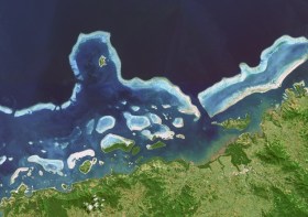
Hydrographers and all those with an interest in hydrography and related disciplines, are invited to attend a World Hydrography Day 2023 Seminar in Suva, Fiji, on 22 and 23 June.
The seminar will be held jointly by the Australasian Hydrographic Society and the Fiji Hydrographic Service. The venue will be the Moana Anglican Services and Teaching Centre at St John the Baptist Theological College.
The organisers are calling for potential sponsors and presenters to get in touch.
The theme for World Hydrography Day 2023 is ‘Hydrography: Contributing to the United Nations Ocean Decade’.
The seminar comes after a two-year pause due to the COVID pandemic and associated travel restrictions. It will provide an opportunity for professionals to network and share hydrospatial knowledge through presentations and discussion.
It is also intended that the presentations will highlight the empowerment of women within the hydrography field.
Registration is free but places are limited. Registrations must be secured by close of business, Tuesday, 20 June 2023.

Hosted by Eric Andelin CP, Senior Workflow Specialist with guest speaker Michael O’Sullivan, VP Sales, SimActive Inc.
It is often challenging for new entrants into the aerial imagery and mapping service profession to determine cost savings when it comes to their processing software solution. Smaller sensors, altitude restrictions, line of sight requirements and overall flight duration create unique challenges for drone operators. Medium and large format sensors acquire much larger areas, but require a much larger investment, or the ability to subcontract out the acquisition. Mapping expenses tend to increase as projects become larger. And using the wrong image processing software can exacerbate this, leading to narrowing project profits. This webinar will show how a higher-end software such as SimActive’s Correlator3D™ can reduce overall project costs. REGISTER HERE.
Specifically, attendees will learn about the following:
- Common challenges and impact on costs
- Cost variations as projects increase in size
- Workflows in Correlator3D to minimize man-hours
- Accelerating timelines with distributed processing
The Remote Hydrography conference and exhibition brings together manufacturers, operators, regulators, and research and development leaders from both industry and academia, within the field of remote surveying and uncrewed survey operations.
Remote Hydrography 2024 provides an opportunity to share experience gained in the development and application of autonomous and uncrewed platforms (surface, underwater, aerial and space-based) and the associated command and support services.
These and enabling technologies like machine learning and artificial intelligence will revolutionise workflows for hydrographic data collection, processing, analysis and presentation.


