Learn how to ‘geo-enlighten your organisation’ at Directions LIVE 2016.
This year’s roadshow will highlight how you can extend the benefits of geospatial technology throughout your entire business – to streamline workflows and maximise your return on investment.
Discover how to further leverage the ArcGIS platform’s spatial analysis capabilities and see how this technology gives your organisation the competitive edge.
At Directions LIVE 2016, you will learn the benefits of working with 3D and 4D data, how to select the perfect app to tackle any challenge, and how ArcGIS Pro complements ArcMap functionality.
We will also be showcasing the innovative ways local organisations are improving operational efficiency with GIS technology.
Directions LIVE is free for Esri users – with light lunch provided.
Register today to join our team of ArcGIS experts and your local GIS user community, and learn how to unlock the full potential of the platform – the market’s only complete GIS solution.

The AEGC petroleum, mineral and water resource industry conference, incorporating the ASEG-PESA International Geophysical Conference and Exhibition, will be jointly hosted by the Australian Institute of Geoscientists (AIG), Australian Society of Exploration Geophysicists (ASEG) and Petroleum Exploration Society of Australia (PESA).
Under the conference theme of Geoscience for a Sustainable World, the AEGC will attract a large number of international and national delegates and organisations from across the spectrum of Australasian geosciences, representing industry, government and academia. It is expected there will be dedicated streams for Australian basins, resourcing a sustainable energy challenge, data, innovation and technology, high-quality resources for future generations and developing the future workforce.

SmartSat partners, participants, students and staff are invited to come together to share their research outcomes and network with industry colleagues at the SmartSat CRC Conference 2023.
The SmartSat CRC is a consortium of universities and other research organisations, partnered with industry that has been funded by the Australian Government to develop know-how and technologies in advanced telecommunications and IoT connectivity, intelligent satellite systems and Earth observation next generation data services.
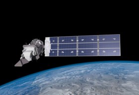
Landsat image courtesy NASA/GSFC

The Tasmanian Spatial Information Council (TASSIC) will hold a Geospatial Workforce Development Forum on 9 November 2023, to help shape the future of the geospatial sector in Tasmania.
The Forum will bring together key stakeholders from education, employers, government and suppliers to address critical challenges and opportunities facing the sector.
The Forum will include presentations from representatives of industry, government and the education sector, as follows:
- Paul Digney (Jacobs)
- Rob Rowell (Insight GIS)
- Ben Morris (Local Government Association of Tasmania)
- Michael Krome (Australian Spatial Analytics)
- Arco Lucieer (University of Tasmania)
- Sam Ebert (TAFE NSW)
- Troy Robbins (TasTAFE)
The event will conclude with a moderated discussion session led by Danika Bakalich (Geospatial Council of Australia).
The Forum will be a hybrid event with both in-person and online attendance options available, and it will employ the Menti-Meter program to facilitate discussions, ensuring that each delegate’s voice is heard and their input valued.
Image credit: ©stock.adobe.com/au/borisblik


