
Although it has been almost 50 years since there have been a requirement for field information to be lodged, Sec 71 (e) of the Cadastral Rules for Survey 2021 requires the submission of “all relevant field information, in a form that ensures permanent usability”.
While surveyors have been retaining field information electronically, LINZ has found that in many cases the data has been inadequate or needs specific software, or there can be difficulty identifying raw measurements after processing or to relate them to the dataset.
This seminar will share insights from knowledgeable suppliers and practitioners to assist surveyors develop systems and processes to comply with the Rules and to present electronic field data in a clearly readable way.
Participants can attend in person or online.
A panel of data and industry experts will examine changes to IP and copyright and the disruption of current business models that current and future technologies are creating, with an open discussion about governance considerations that may affect surveying businesses now and in the coming years. This will be an insightful, interesting and challenging discussion around how technology and big data are redefining business opportunities.
The speakers will be:
- Professor Kevin McDougall, Head of School, Civil Engineering and Surveying University of Queensland
- Rachel Sciascia, Partner, Gadens
- Nicole Stephensen, Principal Consultant, Ground Up Consulting Pty Ltd
- Adam Beck , Executive Director, Smart Cities Council Australia New Zealand Secretariat, Centre for Data Leadership
Image credit: ©stock.adobe.com/au/boreala

Supported by the Australian Space Agency, the South Australian Space Industry Centre and SmartSat CRC, the 12th Australian Space Forum will provide an opportunity to stimulate ideas, share information about emerging technologies and network with space sector leaders and the broader community.
Participants will be able to attend in-person at the Adelaide Convention Centre in South Australia, or virtually through the event’s global interactive platform.
Forum sessions will include international panels covering the following thematic areas:
- National and international space trends
- Moving from cubesats to larger satellites — building Australian expertise and capability
- Reimagining the social, environmental and economic opportunities enabled by Earth observation technologies
- On-Earth and off-Earth remote operations, in the context of human exploration as well as applications right here on Earth

In partnership with the Australian Space Agency, the Space Industry Association of Australia will host the Southern Space Symposium at the National Press Club in Canberra on 29-30 November 2021.
The Southern Space Symposium is the Australian space industry’s flagship annual conference, bringing together space industry experts and decision-makers from across Australia. At a pivotal moment, the Southern Space Symposium will this year bring space industry together with government and parliament for two days in Canberra to help shape the future agenda for Australian space’s aspirations.
Participants will include federal government departments and agencies, international agencies and missions, defence and space prime contractors, listed space companies, academic and research organisations, small and medium enterprises, space start-ups, and individual space professionals.

The International Society for Photogrammetry and Remote Sensing (ISPRS) will hold its 2022 congress in Nice, France, in June 2022. The event will be hosted by the French Society for Photogrammetry and Remote Sensing.
A wide-ranging program has been put together, and it includes a host of leading speakers, such as Australia’s Professor Sisi Zlatanova from the University of South Wales. More than 1500 papers will be presented in the various scientific tracks and sessions over the week. In addition to these presentations, participants will also have the chance to interact and network face-to-face with the authors in poster sessions.
In order to help the registered participants to choose the sessions and the presentations to build their own program during the week, pre-recorded video presentations of the papers will made accessible before the beginning of the event through the digital platform of this event.
The Congress will have a strong technology track, with a large exhibition space that will gather the major players of the geospatial business. A geospatial prospective forum will also address hot topics of our community in order to draw recommendations.
The deadline for both full papers and abstracts is January 10, 2022.

The National Surveying Congress will be an opportunity for leaders in the surveying profession to discuss the opportunities and challenges facing the profession. The 2022 Congress theme is ‘Automatic Mutual Relaxation’.
As the profession comes to understand the impact of Automatic Mutual Recognition for surveyors across the country, the event will provide an opportunity for surveyors from across Australia to gather and discuss the issues facing the profession and the opportunities for the future. The highlight of the program each year is the Cadastral Leaders Panel which sees all the Surveyors-General on stage speaking about changes and opportunities in their states and territories as well as an update from ICSM and ANZLIC. There will also be an online option.
The National Surveying Consultancy Excellence Awards and Gala Dinner will be held on the second day of the event, 23 June 2022.

GeoBuiz Summit is an annual international conference focused on the geospatial industry, which encompasses a range of technologies and applications related to mapping, location-based services, and spatial data analysis.
The summit brings together industry leaders, government representatives, experts, and innovators to discuss the latest trends and innovations in geospatial technology and applications.
The conference covers a range of topics, including geospatial infrastructure, mapping and surveying, satellite imagery and remote sensing, location-based services, smart cities and urban planning, and much more. The GeoBuiz Summit aims to promote collaboration and knowledge-sharing within the geospatial industry and to showcase the latest developments in this exciting and rapidly evolving field.

The not-to-be-missed Geospatial Council of Australia (GCA) South Australia Cadastral Workshop, to be held in Adelaide on 16 March, will bring together professionals in the field of land surveying and provide an opportunity for them to expand their knowledge of the complexities of cadastral surveying.
This workshop offers a unique opportunity for professionals in the field of land surveying to gather and expand their knowledge in the complexities of cadastral surveying. Participants will hear expert-led discussions into topics ranging from advanced surveying techniques to legal frameworks governing land boundaries, and gain invaluable insights to enhance their expertise and address the challenges of modern cadastral surveying practices.
- Members: $90 (incl. GST)
- Non-members: $135 (incl. GST)
- Registered survey graduates and students: $45 (incl. GST)
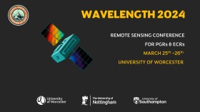
The Wavelength meeting was launched in 2013 for PhD students and early career researchers, addressing the demand for representation of new professionals as well as students from RSPSoc — the UK society for remote sensing and photogrammetry science.
Every year, Wavelength gathers participants from student and early career levels, as well as senior members and individuals within academia and business. The conference offers a setting to present student and EC work and meet new, like-minded contacts.
The 2024 conference will be run in a hybrid format, to accommodate those who can and those who cannot travel to Worcester.

The 4th International Symposium on Applied Geoinformatics (ISAG2024), which will take place at the Wroclaw University of Science and Technology, Wroclaw, Poland, on 9 and 10 May 2024. ISAG2024 is jointly organised by the Department of Geomatics Engineering, Yildiz Technical University, Istanbul, Türkiye, Wroclaw University of Science and Technology, Wroclaw, Poland and Technical University of Crete, Chania, Crete, Greece.
The aim of the 4th ISAG is to bring scientists, engineers and industry researchers together to exchange and share their experiences and research results and discuss the practical challenges encountered and the solutions adopted in geoinformatics.
Topics to be covered include recent advances in AI, satellite imagery, advanced remote sensing, photogrammetry, image processing, global navigation satellite systems, height systems, terrestrial laser scanning, GIS, smart cities and land management.


