AVALON 2019 – THE ESSENTIAL AVIATION, AEROSPACE AND DEFENCE SHOWCASE FOR AUSTRALIA AND THE ASIA PACIFIC REGION
The Asia Pacific region is undergoing major growth in defence and aviation, with budgets in many countries continuing to rise and an ever increasing level of sophistication in technologies, equipment, systems and operational methods.
One of the leading gateways to these important markets is AVALON 2019 – the Australian International Airshow and Aerospace & Defence Exposition staged at Avalon Airport, Geelong, Victoria.
AVALON 2019 will again present a unique opportunity to showcase products, technologies and services to an informed target audience and to demonstrate a marketing presence in this vibrant and vital region. High levels of economic growth and technological development have resulted in growing demand for aviation and aerospace services, products and technology, right across the spectrum from General Aviation to airlines, air forces and space.
AVALON 2019 will be a valuable opportunity for decision-makers to be informed and for exhibitors to connect with their customers.
The Australian International Airshow and Aerospace & Defence Exposition is the essential aviation, aerospace and defence event for the Asia Pacific.

Join us for the first session in our ‘Locate Connect’ online learning series! Hear from Scott Dewar, Director, Chris Hewett, Assistant Secretary GEOINT Capability and Development & Phil Shears, Director DEF799 Phase 2.
In this session from 1300 – 1400, the Australian Geospatial-Intelligence Organisation (AGO) will be launching the Defence Geospatial-Intelligence (GEOINT) Strategy, a document that addresses how the Defence GEOINT Community will transform to meet the future needs of the Australian Defence Force. The AGO Executive will also provide an update on their GEOINT projects and announce upcoming opportunities for industry and discuss how the COVID-19 pandemic has impacted the organisation.
Then from 1430 – 1545, AGO, along with Frontier SI will describe how The Analytics Lab Program (AGO Labs) fits into the bigger picture of AGO capability and summarise the outcomes of their 2019 activities. AGO Labs, coordinated through FrontierSI, is investigating a number of ways to better engage and work with industry. Specifically, the AGO is keen to attract a wider pool of companies and technologies to draw on for automated geospatial intelligence. The primary focus of this program is to address AGO capability challenges through a small number of short-term industry projects, with a focus on machine learning and analytics for producing automated imagery analysis, including automated object classification. AGO will announce a new 2020 program of challenges hoping to find innovative solutions through their partnership with FrontierSI.

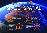
During 2020 an expert group drafted the SPACE+SPATIAL Industry Growth Roadmap 2030 – a national snapshot for Australian professionals to better understand the bold new future that’s rapidly approaching and what it means for them, their careers, their organisations and all of Australia.
The National Steering Committee is seeking feedback on the Roadmap from spatial professionals of all levels across the country. There are a number of ways to get involved, one of which is to participate in this SSSI and SIBA|GITA SPACE+SPATIAL Roadmap Online Session.
You will hear about the key plans, activities and issues and have the opportunity to have a meaningful discussion with colleagues about your thoughts on the Roadmap Consultation Paper and the topic in general.

The Committee of Experts on Global Geospatial Information Management (UN-GGIM) will convene the second United Nations World Geospatial Information Congress (UNWGIC) in Hyderabad, India from 10-14 October 2022.
Hosted by the Government of India through its Ministry of Science and Technology, the convening of the UNWGIC arises out of the mandate from the United Nations Economic and Social Council (ECOSOC) to the Committee of Experts to convene global forums to promote comprehensive dialogue on global geospatial information management with all relevant governments, international organisations and stakeholders.
With an overarching theme ‘Geo-Enabling the Global Village: No one should be left behind,’ the second UNWGIC will reflect the importance of integrated geospatial information to support sustainable development and the wellbeing of society, address environmental and climate challenges, embrace digital transformation and technological development, and catalyse vibrant economies.
The congress addresses the development and strengthening of integrated geospatial information management, its capacities and capabilities, and demonstrates the importance of international cooperation and coordination for building a human data and geography community, against the three pillars of sustainable development, for a shared future and a better world, leaving no one behind within an inclusive and equitable global society.
The UNWGIC will feature a high-level, plenary, special and parallel sessions. While the actual second UNWGIC program covers three days (11 – 13 October), the overall event will be a weeklong (10 – 14 October), and will include global and regional meetings, workshops and learning events, expert meetings and side events, including the eleventh plenary meeting of the Regional Committee of United Nations Global Geospatial Information Management for Asia and the Pacific (UN-GGIM-AP), as well as the annual meeting of the UN-GGIM Expanded Bureau.


