At 1Spatial we use validation, integration, automation and our rules-based approach to build strong data infrastructures, leading to better outcomes and making your data smarter.
Have you thought about how you will transform your data to GDA2020?
During this session, we will help you understand the requirements needed for GDA2020 and the best way to migrate your data to this new datum!
Join our team for a free webinar on Friday 27th November and hear how we can help you migrate your data to GDA2020.
Agenda
- Recognising your data and understanding the effect this will have on your data
- Authoritative data sets that already exist
- GA & ICSM slides defining the height datum + case studies of support issues
- Transformations with FME
- Ensuring your organisation has a plan for the transformation
- How we can help you implement the move
In the meantime, if you have any technical questions, or you’d just like a quotation on one of our products, some training or a dedicated consultancy session from one of our specialised consultants, just send us some details to sales.australia@1spatial.com and we’ll be sure to get back to you.
Whether you’re new to FME or an experienced user, our free webinars are packed with tips, tricks and knowledge to take your FME expertise to the next level!

FME 2021 has landed and there’s a lot to take in, so much so, that what might seem like an insignificant new feature at first can have some serious benefits to your data integration routines.
In this session, we’ll hear from our 5 highly qualified consultants on what their 5 hot features are in FME and why you might want to take a closer look.
Agenda
- Enterprise Integration – Using the connectors Safe continues to introduce each year to better integrate FME Server with other systems.
- The FME Parameter Manager – How to improve the user experience of FME parameters in 2021 with the FME Parameter Manager.
- Self Service –Are you tired of doing repetitive tasks? We’ll cover off how you can use FME technology to provide self-service functions to people within your organisation. Self-service data access, data submissions and requests can be streamlined using FME.
- Creating PDF Reports – Do you need to create PDF reports as part of your ETL process? These tips can help you create pretty PDF reports via FME.
- Getting Started Quickly with FME Cloud – Access the power of FME Server instantly without the burden of managing hardware and security.
This webinar is part of our free FME education programme where we focus on one specific topic and dive deep under the covers to highlight a particular data challenge or solution. All of our historic webinars are published on our on-demand webinar page, just in case you missed a session, you can review it there… but if you join us on the live session you’ll have the opportunity to ask our expert presenter some questions around the topic.
In the meantime, if you have any technical questions, or you’d just like a quotation for FME, some training or a dedicated consultancy session from one of our FME Certified Professionals, just send us some details to Sales.australia@1spatial.com and we’ll be sure to get back to you.

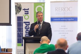
The latest in spatial data applications will be showcased at this year’s Mapped Out Conference to be held at the Rules Club in Wagga Wagga on Wednesday 2 & Thursday 3 March 2022.
Mapped Out will highlight the diversity of applications for spatial data, geographic information systems and their supporting technologies. Guest speakers with local and national experience will be showcasing the use of spatial data to enhance the operation and delivery of government services.
The Conference is a great opportunity for people working in regional NSW in both local government and the private sector to keep abreast of the latest technology and geographical information systems that can be utilised in their day to day work.

Update: This event has been rescheduled from its original date of 24 February.
The SSSI 2021 Victorian Surveying & Spatial Summit will be an opportunity for all Victorian surveying and spatial professionals to come together to learn, share and connect. The theme will be ‘Digital Transformation: Our Future’.
The one-day event will take place at the Novotel on Collins, Melbourne, and will be followed in the evening by the presentation of the Victorian Asia-Pacific Spatial Excellence Awards — the Awards celebrate the outstanding work being undertaken by individuals and organisations in the region.
Discounts are available for SSSI members and students. You can choose to register just for the Summit or select full registration which includes a ticket to APSEA-V event as well. Tickets for APSEA-V only (individual or full table of 8) are also available.
There will also be a pre-summit breakfast on the topic of Diversity and Inclusion, and organisers encourage potential participants to consider purchasing a ticket when registering for the Summit.
Put your pedal to the FMEdal and join us for the FME World Tour 2022!

Is your data driving you crazy? Overtake the competition with FME 2022! Register now to join us in a city near you. Whether you’re a newbie, just discovering the power of FME or an expert and hungry for new functionality, these fun events should be in your calendar!
Take a look at some of the most popular reasons to attend a World Tour event near you:
- Hear customer success stories and gain valuable insight on data integration strategies
- Get up to speed with FME 2022 new capabilities
- Our FME Pit Crew “Certified professionals” will be on the ground to answer any questions you may have.
- Plus lots of great prizes to be won!

The ROTORTECH 2022 Helicopter and Unmanned Flight Exposition is the premier industry event for the Helicopter/Rotary Wing and RPAS/UAV/eVTOL community in Australia, New Zealand and the Indo-Asia-Pacific region.
The event provides a vital interface between industry, regulators and government, including:
- Operations and safety presentations
- Industry conferences
- Industry exposition showcasing the products and services of helicopter and unmanned flight related companies
ROTORTECH 2022 will host conferences by the Australian Helicopter Industry Association (AHIA) and Australian Association for Uncrewed Systems (AAUS) and feature presentations by key rotary and unmanned systems industry experts from Australia and the Indo-Asia-Pacific region.

Hosted by the Riverina Eastern Regional Organisation of Councils and the Riverina Spatial Information Group, Mapped Out 2023 will bring together public- and private-sector professionals to learn about the latest geospatial developments.
Mapped Out will highlight the diversity of applications for spatial data, geographic information systems and their supporting technologies. Guest speakers with local and national experience will be showcasing the use of spatial data to enhance the operation and delivery of government services.
The Conference is a great opportunity for people working in regional NSW in both local government and the private sector to keep abreast of the latest technology and geographical information systems that can be utilised in their day-to-day work.

Geo Week is an event for increased integration between the built environment, advanced airborne/terrestrial technologies, and commercial 3D technologies. It was created as a response to the changing needs of built world and geospatial professionals, and to acknowledge the convergence of technology taking place currently.
New technological innovations, the need for remote workflows, and hardware breakthroughs are redefining expectations across teams, organisations, and entire industries will canvassed at the event.
Attendees will hear about the latest updates, case studies, ideas and predictions from a variety of experts: innovators, end-users, regulators, and more. What trends and technologies do they see coming? What new challenges and opportunities lie ahead? How can you and your organisation prepare, anticipate, and benefit in a rapidly evolving environment?

The 2024 edition of the International Conference on Geographical Information Systems Theory, Applications and Management (GISTAM 2024) aims to create a meeting point of researchers and practitioners that address new challenges in geo-spatial data sensing, observation, representation, processing, visualization, sharing and managing, in all aspects concerning both ICT as well as management information systems and knowledge-based systems.
The conference welcomes original papers of either practical or theoretical nature, presenting research or applications, of specialised or interdisciplinary nature, addressing any aspect of geographic information systems and technologies, such as:
- Data acquisition and processing
- Remote sensing
- Interaction with spatial-temporal information
- Spatial data mining
- Managing spatial data
- Modelling, representation and visualisation
- GIS and climate change
- Domain applications


