Whether you’re new to FME or an experienced user, our free webinars are packed with tips, tricks and knowledge to take your FME expertise to the next level!

FME 2021 has landed and there’s a lot to take in, so much so, that what might seem like an insignificant new feature at first can have some serious benefits to your data integration routines.
In this session, we’ll hear from our 5 highly qualified consultants on what their 5 hot features are in FME and why you might want to take a closer look.
Agenda
- Enterprise Integration – Using the connectors Safe continues to introduce each year to better integrate FME Server with other systems.
- The FME Parameter Manager – How to improve the user experience of FME parameters in 2021 with the FME Parameter Manager.
- Self Service –Are you tired of doing repetitive tasks? We’ll cover off how you can use FME technology to provide self-service functions to people within your organisation. Self-service data access, data submissions and requests can be streamlined using FME.
- Creating PDF Reports – Do you need to create PDF reports as part of your ETL process? These tips can help you create pretty PDF reports via FME.
- Getting Started Quickly with FME Cloud – Access the power of FME Server instantly without the burden of managing hardware and security.
This webinar is part of our free FME education programme where we focus on one specific topic and dive deep under the covers to highlight a particular data challenge or solution. All of our historic webinars are published on our on-demand webinar page, just in case you missed a session, you can review it there… but if you join us on the live session you’ll have the opportunity to ask our expert presenter some questions around the topic.
In the meantime, if you have any technical questions, or you’d just like a quotation for FME, some training or a dedicated consultancy session from one of our FME Certified Professionals, just send us some details to Sales.australia@1spatial.com and we’ll be sure to get back to you.
The Space Symposium attracts thousands of representatives of the space industry, governments, militaries, research agencies and more. The event brings all these groups together in one place to provide an opportunity to examine space issues from multiple perspectives, to promote dialog and to focus attention on critical space issues.
This year, the Space Symposium will be a hybrid in-person/virtual event, with the in-person sessions taking place in Boulder, Colorado, along with a vast exhibition display space which, this year, has been increased by 8,300 square metres.

Supported by the Australian Space Agency, the South Australian Space Industry Centre and SmartSat CRC, the 12th Australian Space Forum will provide an opportunity to stimulate ideas, share information about emerging technologies and network with space sector leaders and the broader community.
Participants will be able to attend in-person at the Adelaide Convention Centre in South Australia, or virtually through the event’s global interactive platform.
Forum sessions will include international panels covering the following thematic areas:
- National and international space trends
- Moving from cubesats to larger satellites — building Australian expertise and capability
- Reimagining the social, environmental and economic opportunities enabled by Earth observation technologies
- On-Earth and off-Earth remote operations, in the context of human exploration as well as applications right here on Earth
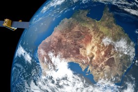
The Space & Geospatial Collaborative Workshop will be jointly hosted by the Andy Thomas Space Foundation and the Surveying and Spatial Sciences Institute in Adelaide the day following the 12th Australian Space Forum and the day before Spatial Information Day.
This inter-disciplinary workshop will provide a unique opportunity for professionals from both space and spatial sectors to:
- Learn about Australia’s renewed commitment to space technology development
- Get updates on the requirements and capabilities of the modern spatial information industry using applications such as PNT (positioning, navigation and timing), EO (Earth Observation) and telecommunications
- Connect and discuss the increasing synergy and collaborative opportunities between the two sectors.

Global Space and Technology Convention (GSTC) is Asia’s Premier Space & Technology event, bringing you the latest technology news, what’s hot in the satellite scene and space technology updates. Over 10 years in the making, GSTC has taken up a crucial role in highlighting how space technology and satellite communications will shape our lives here in Asia. From learning how satellite communication and data can transform urban cities, to its applications in maritime surveillance, security and IoT, GSTC is the go-to platform for your space and satellite business, to connect with the rapidly evolving space industry in Asia.

Join Bentley Systems at the launch of what it says is the industry’s most complete Survey and Site Design Solution ever offered to the ANZ market.
As technology advances and industry expectations increase, your software needs to keep pace with this ever-changing environment. In short, your software needs to deliver on today’s requirements and be ready for tomorrow’s challengers.
If you work in road design, site surveying, site development and related fields, this webinar is for you.
Throughout the launch, Bentley Systems will demonstrate traditional survey data capture capabilities, coupled with the latest mass data collection survey methods, including Total Station techniques, Point Cloud techniques and Digital Photogrammetry techniques.
Leveraging the above survey results, the launch will continue through a typical site design workflow, incorporating aspects such as:
- Terrain creation and analysis
- Urban road widening design
- Carpark and recreational area design
- Drainage and Utility design and analysis
- Plan production and digital model delivery
- Model visualisation
Air Inspect Australia will also be joining the webinar to share their insights and learnings of their project.
If you or your company perform any of the above-mentioned workflows, then this is one webinar you should not miss.
Put your pedal to the FMEdal and join us for the FME World Tour 2022!

Is your data driving you crazy? Overtake the competition with FME 2022! Register now to join us in a city near you. Whether you’re a newbie, just discovering the power of FME or an expert and hungry for new functionality, these fun events should be in your calendar!
Take a look at some of the most popular reasons to attend a World Tour event near you:
- Hear customer success stories and gain valuable insight on data integration strategies
- Get up to speed with FME 2022 new capabilities
- Our FME Pit Crew “Certified professionals” will be on the ground to answer any questions you may have.
- Plus lots of great prizes to be won!

The Space & Geospatial Collaborative Workshop is being jointly hosted by the Andy Thomas Space Foundation and SSSI in Adelaide on 10 May 2023, in between the first 2023 Australian Space Forum and the Locate23 Conference.
This inter-disciplinary workshop will provide an opportunity for professionals from both space and spatial sectors to connect and discuss the increasing synergy and collaborative opportunities that have resulted from Australia’s renewed commitment to space technology development and the requirements and capabilities of the modern spatial information industry. The spatial professional has been an enduring end-user of space applications such as PNT (positioning, navigation and timing), EO (Earth observation) and telecommunications.

Hosted by Eric Andelin CP, Senior Workflow Specialist with guest speaker Michael O’Sullivan, VP Sales, SimActive Inc.
It is often challenging for new entrants into the aerial imagery and mapping service profession to determine cost savings when it comes to their processing software solution. Smaller sensors, altitude restrictions, line of sight requirements and overall flight duration create unique challenges for drone operators. Medium and large format sensors acquire much larger areas, but require a much larger investment, or the ability to subcontract out the acquisition. Mapping expenses tend to increase as projects become larger. And using the wrong image processing software can exacerbate this, leading to narrowing project profits. This webinar will show how a higher-end software such as SimActive’s Correlator3D™ can reduce overall project costs. REGISTER HERE.
Specifically, attendees will learn about the following:
- Common challenges and impact on costs
- Cost variations as projects increase in size
- Workflows in Correlator3D to minimize man-hours
- Accelerating timelines with distributed processing
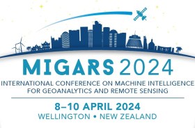
The International Association of the IEEE-Geoscience and Remote Sensing Society (GRSS), the IEEE-Computational Intelligence Society (CIS) and the local organising committee invite geospatial and computing professionals to attend the International Conference on Machine Intelligence for GeoAnalytics and Remote Sensing (MIGARS) to be held in Wellington, Aotearoa New Zealand in April 2024.
MIGARS aims to explore the interface of machine intelligence approaches with geosciences, spatial analytics, and remote sensing. With the tremendous developments in remote sensing technology, data acquisitions and sensing platforms, digital data have grown leaps and bounds to stream and are too big by volume, variety, and veracity. The challenge is handling, processing, and automating geo-data from various sources, such as multi-platform remote sensors and IoT devices, informing decision-making and monitoring our planet.
The conference will focus on connecting researchers from various disciplines, including computation/artificial intelligence, engineering, remote sensing, hydrology, agriculture and geosciences, and look for the potential use of intelligent computational approaches for geo-data-based applications and for serving society at large.


