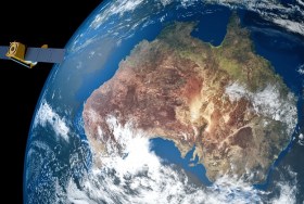
The Space & Geospatial Collaborative Workshop will be jointly hosted by the Andy Thomas Space Foundation and the Surveying and Spatial Sciences Institute in Adelaide the day following the 12th Australian Space Forum and the day before Spatial Information Day.
This inter-disciplinary workshop will provide a unique opportunity for professionals from both space and spatial sectors to:
- Learn about Australia’s renewed commitment to space technology development
- Get updates on the requirements and capabilities of the modern spatial information industry using applications such as PNT (positioning, navigation and timing), EO (Earth Observation) and telecommunications
- Connect and discuss the increasing synergy and collaborative opportunities between the two sectors.

Global Space and Technology Convention (GSTC) is Asia’s Premier Space & Technology event, bringing you the latest technology news, what’s hot in the satellite scene and space technology updates. Over 10 years in the making, GSTC has taken up a crucial role in highlighting how space technology and satellite communications will shape our lives here in Asia. From learning how satellite communication and data can transform urban cities, to its applications in maritime surveillance, security and IoT, GSTC is the go-to platform for your space and satellite business, to connect with the rapidly evolving space industry in Asia.

The Australian Association for Unmanned Systems’ ‘RPAS in Australian Skies 2022’ conference aims to continue discussion on the safe integration of RPAS into Australian airspace. It is supported by key government and industry participants and has established itself as a landmark event in the Australian RPAS calendar.
The 2022 themes will cover:
- Policy and Regulatory updates from the Department of Infrastructure, Transport, Regional Development and Communications, CASA, AirServices Australia and the Australian Defence Force relating to the use of emerging aviation technology in Australia.
- UAS Traffic Management (UTM), low level airspace, integrated airspace systems challenges and opportunities.
- Industry challenges and perspectives
- Continuing development of a professional and safe industry.
- ATSB RPAS data and trends
- Emerging technology and innovative solutions enabling integration or RPAS into Australian airspace.
- Future infrastructure requirements to enable drone delivery and advanced air mobility (AAM).
- Emerging RPAS and AAM applications – benefits, viability and social acceptance.
The conference will be a hybrid event incorporating face to face (live) and online (virtual) choices for participants. It will also include the AAUS Gala Dinner featuring the AAUS Industry Awards.

The presenters for this topical webinar will be Dr Craig Roberts, Senior Lecturer in Surveying/GPS/Geodesy at UNSW and Wayne Patterson Director, Spatial Operations at the NSW Department of Customer Service.
Roberts will give a short update on the revision of the Australian Standard, AS_5488 Classification of subsurface utility information in the context of datum modernisation, low-cost multi-GNSS and recent advances in positioning infrastructure in Australia.
Data storage, data distribution and security are identified as challenges suggesting a reimagined data governance will be needed. Could a spatial digital twin assist? What is a spatial digital twin? Is it a BIM? Where does it come from? What is an open data policy? Who can use it? Can I use it? Which datum? How accurate is the data?
Rather than just another PowerPoint webinar, Roberts will interview Patterson in a free-flowing format. Attendees will be invited to ask their own questions live in the chat as the conversation evolves.
This webinar is targeted at surveyors, geospatial users, students and the wider spatial community.

Commercial UAV Expo, September 6-8 in Las Vegas is the premier event for the commercial drone industry focusing on the integration/operation of commercial UAS.
The event will feature exhibits and demonstrations by UAS solutions providers; keynotes, panel discussions, and presentations with interactive Q&A and chat; AI-powered networking; and more.
Industries covered include Construction; Drone Delivery; Energy & Utilities; Forestry & Agriculture; Infrastructure & Transportation; Mining & Aggregates; Public Safety & Emergency Services; Security; and Surveying & Mapping. It is presented by Commercial UAV News and organised by Diversified Communications.
Use code SAVE100 for a US$100 discount and/or FREE expo admission.

The US National States Geographic Information Council (NSGIC) Annual Conference is the place to enhance geospatial excellence and collaboration for state, local, tribal and federal GIS policymakers and coordinators, private sector partners and other leaders in the geospatial ecosystem.
Providing critical and timely networking opportunities, the conference also offers the chance to connect, collaborate, and share with colleagues and partners.
The agenda will comprise:
Roll Call of States — Where state representatives will share a snapshot of achievements, challenges and upcoming activities.
Plenary Sessions — Presentations by and for the NSGIC community exploring challenges, successes and new approaches for collaboration in the geospatial ecosystem.
State Caucus — A roundtable discussion with state and local government representatives to talk frankly about current pressing issues.
GIO Academy — Leadership sessions and networking for state government GIOs and equivalents only (separate registration is required).
Speed Networking — A fun and fast-paced activity where sponsors, who have allocated points, will rotate to complete the circuit of visiting with state reps.
Annual Business Meeting — Including the election of new board members and leadership transition.
Awards Reception — Recognising exceptional work through the Geospatial Excellence Awards & NSGIC Service Awards.
XPONENTIAL is a leading annual gathering for global leaders and end users of uncrewed technologies. Founded on a belief that cross-pollination drives innovation, it’s the only event designed to advance the entire autonomy ecosystem. Each year, it welcomes thousands of the industry’s top minds to cultivate collaboration, spark new ideas, and in 2023, build the blueprint for autonomy. XPONENTIAL is a catalyst — helping each attendee transform their vision into real opportunities.


The Space & Geospatial Collaborative Workshop is being jointly hosted by the Andy Thomas Space Foundation and SSSI in Adelaide on 10 May 2023, in between the first 2023 Australian Space Forum and the Locate23 Conference.
This inter-disciplinary workshop will provide an opportunity for professionals from both space and spatial sectors to connect and discuss the increasing synergy and collaborative opportunities that have resulted from Australia’s renewed commitment to space technology development and the requirements and capabilities of the modern spatial information industry. The spatial professional has been an enduring end-user of space applications such as PNT (positioning, navigation and timing), EO (Earth observation) and telecommunications.

RPAS in Australia Skies is back for 2023. The conference is the Australian Association for Uncrewed Systems’ (AAUS) main event for the year and has established itself as a landmark event for the Australian drone industry, drawing interest from key government personnel, representatives from the regulatory and safety bodies, defence force, RPAS and UTM representatives, end users and academia.
The hybrid event will take place over two days and will include a combination of presentations and interactive panel discussions.
The conference will cover:
- RPAS related policy and regulatory updates from Australian and international government agencies.
- UAS Traffic Management, low-level airspace and integrated airspace systems
- Industry challenges and perspectives
- Continuing development of a professional and safe industry.
- Emerging technologies and innovative solutions enabling RPAS integration in Australian airspace.
- Emerging applications — benefits, viability and social acceptance
- Case studies of drone use and challenges in emergency services, infrastructure inspection, delivery, mining, and agriculture.

The annual Geo Connect Asia Show & Conferences offers a two day, in-person meeting place for ASEAN’s vibrant geospatial community. Bringing geospatial solutions to the heart of decision-making the event combines with technologies from the digital construction, drone and remote sensing markets.
Geo Connect Asia looks to host its ASEAN neighbours and build on a vibrant community as new technologies add new application tools to enable the Industry 4.0 Revolution. The emergence of AI, blockchain, IoT, robotics and UAVs create a new dynamic and platforms for a region well equipped to take on the challenges ahead.


