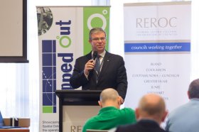
The latest in spatial data applications will be showcased at this year’s Mapped Out Conference to be held at the Rules Club in Wagga Wagga on Wednesday 2 & Thursday 3 March 2022.
Mapped Out will highlight the diversity of applications for spatial data, geographic information systems and their supporting technologies. Guest speakers with local and national experience will be showcasing the use of spatial data to enhance the operation and delivery of government services.
The Conference is a great opportunity for people working in regional NSW in both local government and the private sector to keep abreast of the latest technology and geographical information systems that can be utilised in their day to day work.

Survey and Spatial NZ’s 2022 conference will be held from 1 to 3 August at the Novotel Lakeside, Rotorua. The conference is the biggest continuing professional development event of the year for NZ surveying and spatial professionals. It invites sharing of knowledge amongst peers, bringing together networking opportunities for all delegates and is an essential event for professional development and connectivity within the sector.
The choice of Rotorua as the location is apt, given the conference theme of ‘Turning up the Heat’. The organisers aim to stimulate discussion regarding challenges in regional areas, which include climate change and developments outside of Auckland.

The World of Drones and Robotics Congress New Zealand (WoDaRC NZ) is shaping up as an unmissable event for anyone involved in robotics, drones, AI, AgTech and data-led innovation. WoDaRC is business-led, technology based and will create opportunities for collaboration and growth across the technology ecosystem.
Topics to be covered include:
- Regional capability and strategy
- Humanitarian engineering and disaster response
- Environmental science and agricultural technology
- The new frontiers: oceans, mountains, and space
- Movies, media, community, and social empowerment
- Education

The Local Government Spatial Reference Group (LGSRG) will be holding a webinar on Monday, 4 September, to introduce a series of hands-on workshops it will be holding across Victoria during September 2023.
The webinar will cover the topic of Best Practice Geospatial Intelligence for Climate Impact, and will address important topics on climate impact, community safety and how geospatial intelligence can contribute to better outcomes for local governments.
The LGSRG was formed in 2003 to address the need for a sector wide group representing the strategic interests of the Victorian Local Government sector with respect to spatial information. The LGSRG has been active throughout the COVID pandemic to keep the local government geospatial community connected and engaged via the annual Spatial Capability Workshop series which have grown year on year, and is now diversifying with a quarterly Spatial Hour webinar to share stories of success within the local government geospatial sector.
Image credit: ©stock.adobe.com/au/yutthana

INTERGEO returns for 2023 with the motto, ‘Inspiration for a smarter world,’ with the event this year also incorporating the German Cartography Congress.
The conference and exhibition will cover the topics of geoinformation, geodesy, land management, Earth observation, urban planning, disaster prevention, environmental protection and energy efficiency, while tackling challenges such as the climate crisis, urbanisation and securing resources.
This year, there will be a special emphasis on drone technologies and BIM.

Hosted by the Riverina Eastern Regional Organisation of Councils and the Riverina Spatial Information Group, Mapped Out 2023 will bring together public- and private-sector professionals to learn about the latest geospatial developments.
Mapped Out will highlight the diversity of applications for spatial data, geographic information systems and their supporting technologies. Guest speakers with local and national experience will be showcasing the use of spatial data to enhance the operation and delivery of government services.
The Conference is a great opportunity for people working in regional NSW in both local government and the private sector to keep abreast of the latest technology and geographical information systems that can be utilised in their day-to-day work.

The annual Geo Connect Asia Show & Conferences offers a two day, in-person meeting place for ASEAN’s vibrant geospatial community. Bringing geospatial solutions to the heart of decision-making the event combines with technologies from the digital construction, drone and remote sensing markets.
Geo Connect Asia looks to host its ASEAN neighbours and build on a vibrant community as new technologies add new application tools to enable the Industry 4.0 Revolution. The emergence of AI, blockchain, IoT, robotics and UAVs create a new dynamic and platforms for a region well equipped to take on the challenges ahead.

The 3rd International Land Management Conference, hosted by the University of the West of England, will be held online on 14 and 15 March 2024. The event will bring together experts and professionals in land management to discuss inclusive land tenure, efficient land markets, sector reform and innovations in land research.
The conference will focus on four themes:
- Theme 1: Can we build more inclusive and resilient land tenure systems by understanding social value and climate change?
- Theme 2: How can land administration systems contribute to efficient and equitable land markets?
- Theme 3: What approaches can Development Partners use to help achieve more successful Land Administration sector reform?
- Theme 4: LINK – Early Career Professionals and Junior Researchers – Innovations in Land Research and Practice
The conference is organised by LINK, the Land–International Network for Knowledge — a network of academic organisations, professional practice and development partners, as well as public and private sector country partners — in association with the University of the West of England.

The 2024 edition of the International Conference on Geographical Information Systems Theory, Applications and Management (GISTAM 2024) aims to create a meeting point of researchers and practitioners that address new challenges in geo-spatial data sensing, observation, representation, processing, visualization, sharing and managing, in all aspects concerning both ICT as well as management information systems and knowledge-based systems.
The conference welcomes original papers of either practical or theoretical nature, presenting research or applications, of specialised or interdisciplinary nature, addressing any aspect of geographic information systems and technologies, such as:
- Data acquisition and processing
- Remote sensing
- Interaction with spatial-temporal information
- Spatial data mining
- Managing spatial data
- Modelling, representation and visualisation
- GIS and climate change
- Domain applications


