Discover what’s new and what’s next in HDS technology with immersive sessions and a day dedicated to learning, led by Leica Geosystems experts.
The HDS User Conference is designed to deliver a new experience for all attendees from Australia and New Zealand.
Together with our partners C.R. Kennedy and Global Survey the HDS User Conference will bring together Leica Geosystem HDS users in a community environment where they’ll access training sessions, learn about our latest innovations, listen to best practices from industry and experience live demos of the latest HDS technology and solutions.
The HDS User Conference features insightful keynote addresses, customer success stories and HDS dedicated group training sessions. Discover and test-drive new, innovative hardware and software solutions that will improve the performance, speed, workflows and efficiency across your organisation.
SEE AGENDA
Reasons to attend:
- Experience the latest solutions that will help you compete and win in today’s dynamic environment
- Learn about reality capture hardware and software solutions and how to be more efficient and productive
- Leica Geosystems will unveil several new innovations and attendees will get a first-hand look at the latest technology advancements
- Experience hands-on demonstrations and training to improve your workflows
- Learn from and network with peers across industries
What’s included in your registration:
- Two days filled with informative sessions and networking opportunities plus a dedicated day to learning
- Evening welcome cocktail reception
- Post-conference access to training material and presentations
- Morning tea, lunch and afternoon tea catering
- Delegate bags
NOTE: We ask that you select your preferred training session time when registering. Simply choose from the four session times available, per workshop.
This helps us manage classroom numbers to ensure we provide you with quality training sessions and you will have the opportunity to attend each topic throughout day two of the conference.
Day two- August 15
Workshop sessions and timings
Maximising 3DReshaper
9am – 10:30am I 11am- 12:30pm I 1:30pm-3:00pm I 3:30pm-5:00pm
Advanced data management and registration workflow
9am – 10:30am I 11am- 12:30pm I 1:30pm-3:00pm I 3:30pm-5:00pm
Creating diverse deliverables: optimising the latest Leica HDS software updates to transform point cloud data into value- added deliverables
9am – 10:30am I 11am- 12:30pm I 1:30pm-3:00pm I 3:30pm-5:00pm
BIM workflow
9am – 10:30am I 11am- 12:30pm I 1:30pm-3:00pm I 3:30pm-5:00pm
Visit the event page for more information
If you have any questions about the HDS User Conference, training sessions, or assistance regarding registration, please contact:
Tamara Stakic
Marketing Manager
info.anz.geo@leica-geosystems.com
T: +61 3 9914 2262

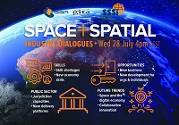
During 2020 an expert group drafted the SPACE+SPATIAL Industry Growth Roadmap 2030 – a national snapshot for Australian professionals to better understand the bold new future that’s rapidly approaching and what it means for them, their careers, their organisations and all of Australia.
The National Steering Committee is seeking feedback on the Roadmap from spatial professionals of all levels across the country. There are a number of ways to get involved, one of which is to participate in this SSSI and SIBA|GITA SPACE+SPATIAL Roadmap Online Session.
You will hear about the key plans, activities and issues and have the opportunity to have a meaningful discussion with colleagues about your thoughts on the Roadmap Consultation Paper and the topic in general.

Organised by OSGeo, this international annual gathering of location enthusiasts is the largest global gathering for geospatial software. Now in its 15th year, FOSS4G (ie. Free and Open Source Software for Geospatial) brings together developers, users, decision-makers and observers from a broad spectrum of organisations and fields of operation.
Through six days of workshops, presentations, discussions, and cooperation, FOSS4G participants create effective and relevant geospatial products, standards, and protocols. The 2021 event will be focused for the first time on South America and will be held with the close collaboration of the GeoLibres Association in Buenos Aires, Argentina.

As Australasia’s premier annual industry event, the Disaster & Emergency Management Conference attracts a passionate crowd of leaders and change-makers from government, private, and volunteer agencies working in disaster and emergency management.
Over two days, you will connect with emergency management professionals and subject matter experts offering insight, reflection, understanding and motivation across a wide range of topics and emergency management incidents.
Enjoy an impressive line-up of keynote speakers, presenters, and panel discussions, and leave with practical tools and techniques to ensure your team is best supported to better plan, prepare, and respond to emergencies, disasters, and rescue operations.
- Connect with emergency management personnel from state and local government, NGOs, and other recovery agencies.
- Explore and engage with exhibitor displays featuring the latest equipment, technologies, and agency services.
- Discover what is happening across multi-sectors via a program of renowned keynote speakers, sector representatives and lived-experience presenters.
- Gain practical tips, techniques, and strategies to incorporate into your organisation to improve the way you approach disaster and emergency planning, response & prevention.

The 16th annual congress of the Open Source Geospatial Foundation, the non-profit organisation that supports and promotes the collaborative development of free and open source geographic technologies and open geospatial data, will be held in Florence, Italy, at the Palazzo dei Congressi, Palazzo degli Affari and the University of Florence.
FOSS4G (ie. Free and Open Source Software for Geospatial) brings together developers, users, decision-makers and observers from a broad spectrum of organisations and fields of operation.

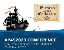
The Association of Public Authority Surveyors, NSW (APAS) annual conference for 2023 will be held at Opal Cove Resort in Coffs Harbour, from 20 to 22 March 2023.
The theme for the event will the ‘Pirates of the Cadastre’. The program is being developed, with a call for abstracts currently in place (as of June 2022).
Important dates and deadlines to note, are:
- Abstract submission deadline: Friday, 23 September 2022
- Draft paper deadline: Friday, 18 November 2022
- Final paper deadline: Friday, 20 January 2023


