

Blue Marble is pleased to offer both new and experienced users of Global Mapper the opportunity to expand their knowledge of the software and the LiDAR Module by attending an instructor-led, web-based training program.
Due to the ongoing COVID-19 pandemic, Blue Marble has made the difficult decision to indefinitely postpone all face-to-face classroom-based training classes. The health and safety of our clients and staff remain our top priority.
For this reason, we are very excited to be able to offer these training sessions online, so everyone can participate from a safe distance. Blue Marble instructors have been effectively using the GoToWebinar platform to deliver online training for many years. The online approach to training allows you to learn the software from the comfort of your home or office and provides an opportunity for us to leverage multiple instructors so real-time help will be readily available during and after the class.
The course content will be delivered over several days, during which attendees will have an opportunity to see the instructor’s screen, follow written workflows in the accompanying training manual, and ask questions as needed.
The intensive twelve hour Global Mapper portion of the program introduces all of the major components of Global Mapper using simulated real-world scenarios and workflows. The agenda includes digitizing and vector editing, advanced attribute management, thematic mapping, raster processing, terrain analysis, and much more. To make best use of the available time, the core functionality of the software, such as file management, interface navigation, tool selection, etc., will not be covered in detail however introductory educational materials will be distributed to all attendees before the class.
The six hour LiDAR Module training will explore all aspects of LiDAR processing from initial data quality assurance to 3D analysis. The class will introduce the structure and characteristics of LiDAR data before following a series of workflows that demonstrates the point cloud visualization, editing, and analysis capabilities of the software.
All attendees who successfully complete both the Global Mapper and LiDAR Module training classes (18 hours of training) will be issued an official certificate of completion and will be recognized as Certified Global Mapper users.
Training Agendas
Requirements for Training
The instruction technique is hands-on so each attendee must have a Windows-based laptop computer with the latest build of Global Mapper installed. If necessary, a temporary license file will be provided to enable all of the functionality of the software for the duration of the classes. All data used during the program will be provided via FTP prior to the classes.
As a prerequisite for attending the LiDAR Module class, attendees must have an understanding of the basic principles of GIS and preferably experience with Global Mapper. Attendees who are new to Global Mapper are strongly encouraged to sign up for the Global Mapper portion of the program.
Multiple Attendee Registrations
If you intend to register five or more attendees from your company or organization for the class, please email training@bluemarblegeo.com to confirm that enough seats are available.
This presentation will detail the technical specs and applications of Teledyne Optech’s new Galaxy CM2000. A new innovative sensor designed for corridor mapping, that will allow for flexible and efficient low altitude surveys. The Galaxy CM2000 offers an effective rate of 2 million measurements per second, and the tightest laser footprint on the airborne market. Join us, as we showcase the CM2000 and it’s ability to deliver high resolution products for road, rail, utility, and telecom applications.
Join us during National Science Week at our FREE Virtual Launch Party.
Each day at 9.30am AEST (17 – 21 Aug) we have an author reading, visits from the Drone Squad team featured in the book, and a challenge from the book illustrator!
Perfect for classroom or home-based learning.
MaaS offers the potential to drastically improve customer choices, reduce travel costs, increase network capacity and transport sustainability while improving social and environmental outcomes.
From a concept that excited the industry to consider how we might rethink transport to a real world offering that is providing a new way to plan, book and pay for transport.
Mobility 2020 will be a VIRTUAL CONFERENCE.
Australia’s leaders in ITS Mobility and MaaS will bring together experts from industry, government and academia to learn and share ideas about the impact of COVID-19 on our industry and communities. Transportation, freight and logistics, and the transport and technology sector widely have been both massively impacted and deliver essential services. How are organisations and individuals adapting and learning through this crisis?
We will also look at behavioural change, how people are likely to work and study post the covid pandemic, what will be the impact on fare revenue and fare sharing, what are the new sets of challenges MaaS is trying to solve. Join online as key organisations will share covid success stories and how they are pivoting from the pandemic experience.
Now more than ever it is important to stay connected with industry, government and academia to maintain vital connections during a time where our industry is both working at the front lines and continuing to deliver on their existing important roles. Sharing information about what industry is doing and how we are preparing for the future has never been more important.
Key Dates
Wednesday 2 – Thursday 3 September 2020: Virtual sessions, keynote speaker interviews, presentations and panel discussions, live interactive Q&A sessions, polls and surveys.
Program
Full program and speaker line-up to be announced.
Sessions will be broken down and spread over 2 days – allowing you time to connect interact with attendees and presenters via the event platform.
Speakers
We are working with a group of industry experts to design a program that is both substantive and exciting, if you are interested to be a speaker or contribute to an interactive panel discussion, you are encouraged to email your expression of interest to ITS Australia and include:
- Proposed Speaker: Name, Job Title, Organisation
- Proposed presentation title
- Brief paragraph of presentation focus (max 200 words)
Email to: admin@its-australia.com.au
The 27th ITS World Congress in Los Angeles, CA, October 4-8, 2020 will explore “The New Age of Mobility”.
The recent explosion of new technologies and new forms of mobility are transforming the future of transportation. At a time in which we are focused on moving people, data and freight, how will we prepare for a future that is increasingly more connected, automated, shared and electric? The technologies that make our roads safer will also reduce congestion and greenhouse gas emissions, and move us closer to a future of seamless mobility — one that is safer, greener and smarter.
10,000+ Participants | 300+ Exhibitors | 20+ Technical Tours and Demonstrations
ITS Australia are major exhibitors in Los Angeles!
Co-Exhibit on the ITS Australia Pavilion and secure your spot at the World Congress
Co-Exhibitor and Sponsorship Opportunities Now Available with ITS Australia in Los Angeles
Pavilion Early Bird ‘Design-Phase’ rates available
ITS Australia Stand #1027
More info: Janette Sofronidis, Event Manager ITS Australia
Email your expression of interest: admin@its-australia.com.au
Being a co-exhibitor on a major pavilion is the best way to get noticed at this major global event – providing high visibility in the exhibition for your transport technology solutions. Leverage this opportunity to be part of the ITS Australia Pavilion and generate new business leads across Europe, Americas and Asia Pacific. Alternatively, consider sponsorship of ITS Australia hosted social networking functions – a great way to associate a positive and socially engaging experience with your brand.
Exhibitor List and Expo Floor Plan
- 10,000+ visitors through the Expo Hall
- On the ITS Australia Pavilion you get: your own display space, logo branding, monitor display, own lockable storage, ample bench-top space for equipment displays, and meeting spaces
- Complimentary exhibitor registration
- Access to official World Congress Media Partners
- Multiple website listings
- Official World Congress online Exhibitor Profile
- Global brand and media engagement
- ITS Australia VIP Reception guest invitations
- Professional Project Management done for you by ITS Australia!
ITS Australia is working to provide opportunities for you in Los Angeles:
- A large contingent of Australian transport technology professionals expected to attend, present in the program, network and do business.
- Large Australian Pavilion hosted by ITS Australia stand #1027 – featuring leading industry co-exhibitors showcasing new technologies.
- VIP Reception hosted by ITS Australia at a premium venue in Downtown LA with stunning views over the famous city skyline – invitation only.
- On-Stand Drinks Networking Function – casual drinks and canapes on the ITS Australia Pavilion to network and socialise.
- ITS Australia hosted webinars before and after the congress.
- All ITS Australia member logos on full display in the Expo Hall.
- Leading Australian transport technology innovations being presented in the scientific program across multiple sessions.
- ITS Australia hold several positions on both the ITS World Congress and the ITS Asia Pacific Boards of Directors providing opportunity to influence discussion and decision-making to support the particular needs of the Australian industry.

Check out our upcoming Webinar which talks more about the Growing Data Foundation’s FireWater App and the SSSI FireWater Map-a-thon. Details are as follows:
Date: Wed, 7th October, 2020
Time: 12PM AEDT
RSVP: Further details click here
And don’t forget to register for the SSSI FireWater Map-a-thon here
Google Maps. Everyone uses it, but do you know that Google Maps is also a powerful tool for transforming your business in the time of COVID-19? With Google Maps Platform, you can leverage the strengths of Maps, Routes, and Places to benefit your customers and operations despite challenges. For example:
- Your hours of operation may fluctuate, but you can keep customers well informed of changes, with the latest updates visible to anyone searching Google.
- You can help customers easily navigate e-commerce, from finding information about your business to reducing the number of steps required to complete transactions to confirming that delivery addresses are accurate.
- Bringing this data online to make it accessible and usable to all project stakeholders
- You can ensure that deliveries are efficient and arrive on time, from tracking assets to routing shipments to optimizing performance and fuel usage.
Join us for this webinar to learn more about these and other applications, including how you can easily deploy and optimize Google Maps for your business. Google Maps Platform can provide the foundational content and capabilities to navigate your business to success despite any challenges.
2020 is the year of the unexpected, of surprises and the occurrence of events nobody thought possible. Worldwide we are required to deal with this challenge, to understand it and learn from it. Personal contact is currently reduced to a minimum. Through these experiences, we are reminded of how important and irreplaceable it is to be able to face each other and look each other in the eyes. This is what dialogue engaged at eye level and personal interaction are all about, as has been possible at INTERGEO EXPO and CONFERENCE for the past 25 years.
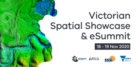
| You’re invited to the 2020 Victorian Spatial Showcase and eSummit: 18 and 19 November 2020
You’re invited to attend this year’s 2020 Victorian Spatial Showcase and eSummit, hosted by the Surveying & Spatial Sciences Institute (SSSI), Spatial Industries Business Association (SIBA) and the Department of Environment, Land, Water and Planning (DELWP)! This new partnership brings together two well known annual events into one festival for the Victorian spatial and surveying sectors. Join us as we bring together government agencies, industry academics and community spatial enthusiasts to connect and learn more about the innovative spatial data, technology and services that Victoria has to offer. On the agenda is a mix of lightning talks and presentations by a diverse range of industry professionals, interactive sessions, networking opportunities and more. Spatially enabling the Sustainable Development Goals This year, we’re going to tackle some of the world’s most complex problems – our 2020 theme is exploring how the spatial industry is enabling the United Nations Sustainable Development Goals (SDGs) through innovation. But what are the SDGs you might ask? The 2030 agenda for Sustainable Development, adopted by all UN Member States in 2015. provides a shared blueprint for peace and prosperity for people and the planet, now and into the future. At its heart are the 17 Sustainable Development Goals (SDGs), which are an urgent call to action by developed and developing countries across the globe. During the eSummit, the Victorian spatial community will draw on its collective experience to identify opportunities and challenges for us all to achieve these goals. Call for abstracts We welcome presentations from spatial and surveying professionals all over the world that align with our theme. Please submit an abstract of the presentation for the eSummit and take note that we encourage audience interaction presentations, e.g. polls and Slido. The deadline for submission is midday Monday 12 October 2020. Register for the event When: The event will be held over two days, on Wednesday 18 November and Thursday 19 November 2020 from 9.00am-12.30pm. Where: It’s online. You’ll receive a link to the sessions when registering – simply click the link you receive when you sign up and add it to your calendars. The event is free for all to attend, and by registering early you’ll secure your spot and receive upcoming event information. |

At 1Spatial we use validation, integration, automation and our rules-based approach to build strong data infrastructures, leading to better outcomes and making your data smarter.
1Data Gateway provides a web-based portal to a smart, simple and controlled way to deliver validation rules, corrections and data enhancement processes for your users with no training required. 1Data Gateway can be deployed on the cloud or on-premise.
1Data Gateway offers internal, external and supply chain users a secure, fully scalable and customisable product to handle both spatial and non-spatial data files. Improve data accuracy and integration across your organisation with 1Data Gateway. Its intuitive interface provides easy and secure access, enabling users to securely upload data and download the results generated.
Join us for a free webinar on Thursday 29th October to hear about 1Data Gateway’s latest NEW features and how it can enhance Esri and FME to automate validation and updating of your data.
We welcome Ricardo Cifres, Product Manager of 1Data Gateway, who will detail some of the many new features that have been added since the initial release of 1Datagateway 2.0 earlier this year. Some of the new features include SQL & Oracle Database support, Scheme mapping, Support of Custom datastore, Authentication enhancements for SAML & OAuth2 and email Server configuration through a UI to name a few.
In addition, Phillip Ridley Senior Business Development Consultant will be demonstrating current case studies showing how 1Datagateway can update large complicated datasets from spatial boundary updates, including integration with Esri file formats and feature services.
We hope you can join us!