Each week Spatial Source highlights the best that the internet has to offer.

One teaspoon of soil contains thousands of microorganisms. Now, scientists have begun mapping every single one of them – on a global scale. Or, at least, they have begun estimating their distribution. National Geographic unearthed how this is possible and why it’s important.

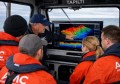
Building information modelling (BIM) and augmented reality (AR) have both undergone huge advancements in recent years. Engineering.com showed how one architect is using it to create the buildings of the future in the fraction of a time it would otherwise.

You may not have heard of Null Island, but if you work with GIS there’s a good chance you’ve visited it. That’s because Null Island doesn’t actually exist and is located at 0°N 0°E– in the middle of the Atlantic Ocean. Due to its coordinates, this is where many digital maps originate- leading GIS enthusiasts to create a ‘national’ flag, create fantasy maps and document the Island’s rich history- as reported by Science Alert.

During the nuclear age, explosions of all types and scales were detonated around the Earth. The Blast Map charts all of these through time. Adventures in Mapping discusses how you might be surprised how many parts of the world have been exposed to deadly radiation. Above shows the detonation sites at the bomb testing facility in Nevada, USA. What is doesn’t show is the fallout.

Facebook launched live video streaming this year so anybody can effectively have their own live Television show. Now you can also see a map o f the world locating every current live stream. Be warned: you might get stuck on this for while…