

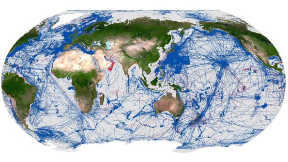
A total of 28.7% of the world’s ocean floor has now been mapped.
Close to five million square kilometres of ocean floor data were added over the past year alone.
These figures were announced on behalf of the Nippon Foundation-GEBCO Seabed 2030 Project by Mitsuyuki Unno, Executive Director of The Nippon Foundation, at the Assembly of the International Hydrographic Organization (IHO), currently underway in Monaco.
The latest update represents approximately 104 million square kilometres of mapped seabed, an area equivalent to more than two-thirds of the Earth’s land surface.
A total of 220 organisations have now contributed data to the project, including 15 new contributors over the past year, with first-time data contributions coming from countries including Malaysia, Morocco, Papua New Guinea and Saudi Arabia.
Substantial increases
The 2026 update includes significant regional increases in mapped coverage. For instance, the Regional Organization for the Protection of the Marine Environment Sea Area more than tripled in coverage, increasing from approximately 6.4% to 20.5%.
Coverage also increased across the Eastern Atlantic, North Indian Ocean, Meso American and Caribbean Sea, and North Sea regions. At the national level, substantial increases were recorded within several exclusive economic zones.
The past year has seen the incorporation of a wide range of new and previously unshared datasets, such as:
- Significant contributions from major data repositories, including NOAA-NCEI and PANGAEA;
- Expanded coastal mapping through datasets such as the Global Coastal SDB Dataset from Copernicus/EOMAP, adding new coverage in areas not represented in previous GEBCO Grid releases;
- Notable satellite-derived bathymetry from the Greenwater Foundation, in partnership with TCarta and Caladan Oceanic;
- Additional bathymetric data from the Japan Agency for Marine-Earth Science and Technology (JAMSTEC), expanding coverage in the North Pacific;
- Deep-water mapping data from NOAA-led Seascape Alaska campaigns;
- Multibeam survey data contributed by the Directorate of Hydrography and Navigation of the Brazilian Navy; and
- Multibeam data around the Comoros, contributed by the Bureau de Recherches Géologiques et Minières (BRGM), marking a new contributing organisation.
All data collected and shared with the Seabed 2030 project is included in the free, publicly available GEBCO Global Grid.
Global effort
According to Seabed 2030 Director Jamie McMichael-Phillip, “This update reflects what the global community can achieve when data is shared openly and collaboratively”.
“Seabed 2030 exists to help bring those contributions together, and we are seeing that collective effort translate into meaningful results,” he said.
“We are grateful to The Nippon Foundation and GEBCO for their ongoing support, which enables us to accelerate progress towards a complete map of the ocean floor.”
Established in 2017, Seabed 2030 is a collaborative project between The Nippon Foundation and GEBCO, which seeks to accelerate the complete mapping of the world’s oceans and to compile all the data into the freely available GEBCO Ocean Map.
The Project is also formally endorsed as a Decade Action of the UN Ocean Decade.
GEBCO is a joint program of the IHO and the Intergovernmental Oceanographic Commission of UNESCO, and it is the only organisation with a mandate to map the entire ocean floor.
See also:
Deakin University partners with Seabed 2030
Seabed 2030, Greenroom Robotics sign deal


