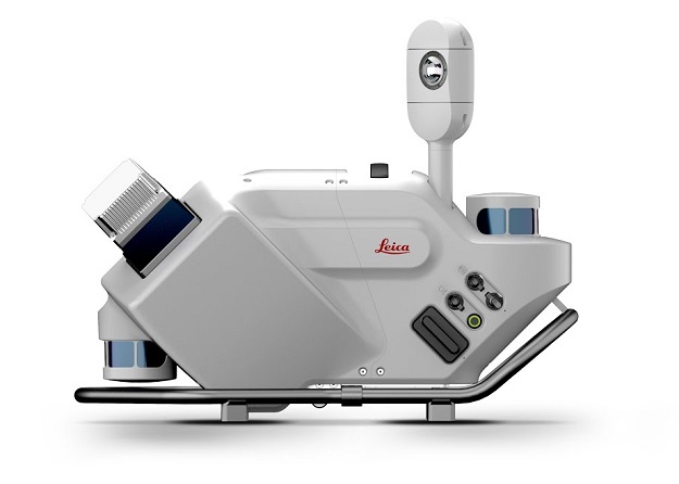
Leica Geosystems has announced the Leica Pegasus TRK500/700 Neo Mobile Mapping solution, which, it says, brings autonomy, intelligence and simplicity to mobile mapping and has what the company describes as next-generation AI-enhanced capabilities.
The dynamic laser scanning and expandable imagery system for recording, measuring and visualising environments is adaptable to a multitude of applications, increasing productivity with automated, intelligent workflows.
The unit represents Leica Geosystems’ first artificial intelligence enhanced camera in a vehicle-based mobile mapping system (MMS) with built-in automatic camera calibration.
For privacy compliance, its AI can identify and optionally blur objects, people and vehicles in real-time as data is collected.
The Pegasus TRK Neo can be operated by one person and is suitable for users that are new to the technology as well as those with advanced technical expertise in various industries, including surveying, transportation and utilities.